Tehuano wind event
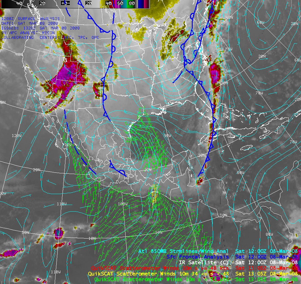
As a powerful winter storm intensified and produced heavy snowfall and blizzard conditions across much of the Ohio River Valley region of the US during the 07 March – 08 March 2008 period (Columbus, Ohio set new all-time records with a 20.4 inch storm total snowfall and 15.5 inches in 24 hours), a strong surge of cold air plunged southward across the Gulf of Mexico. This cold surge continued equatorward, crossed the terrain of southern Mexico, and emerged as a well-defined “Tehuano wind event“ over the Gulf of Tehuantepec along the Pacific coast (hence the name “Tehuantepecer“ given to this type of strong wind event). An AWIPS image of the GOES-12 10.7µm IR channel (above) includes plots of the surface frontal positions, the 850mb wind streamlines, and polar-orbiting microwave scatterometer winds from the QuikSCAT instrument on the morning of 08 March.
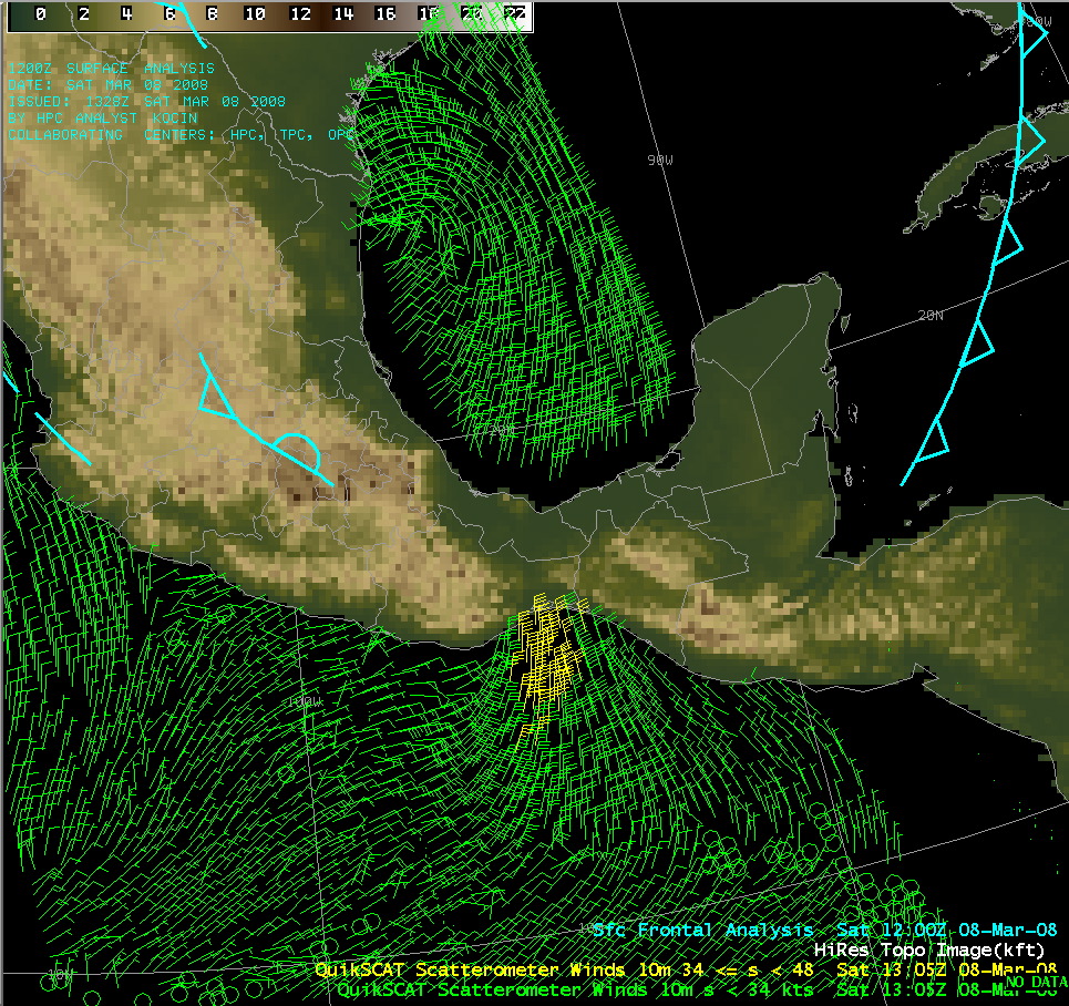
An AWIPS image of wind data from the QuikSCAT SeaWinds scatterometer instrument overlaid on the topography of the region (below) reveals the break in the higher terrain of the Sierra Madres mountain chain (known as the Chivela Pass), through which the northerly winds of a strong cold surge are able to pass from the Gulf of Mexico to the Pacific Ocean.
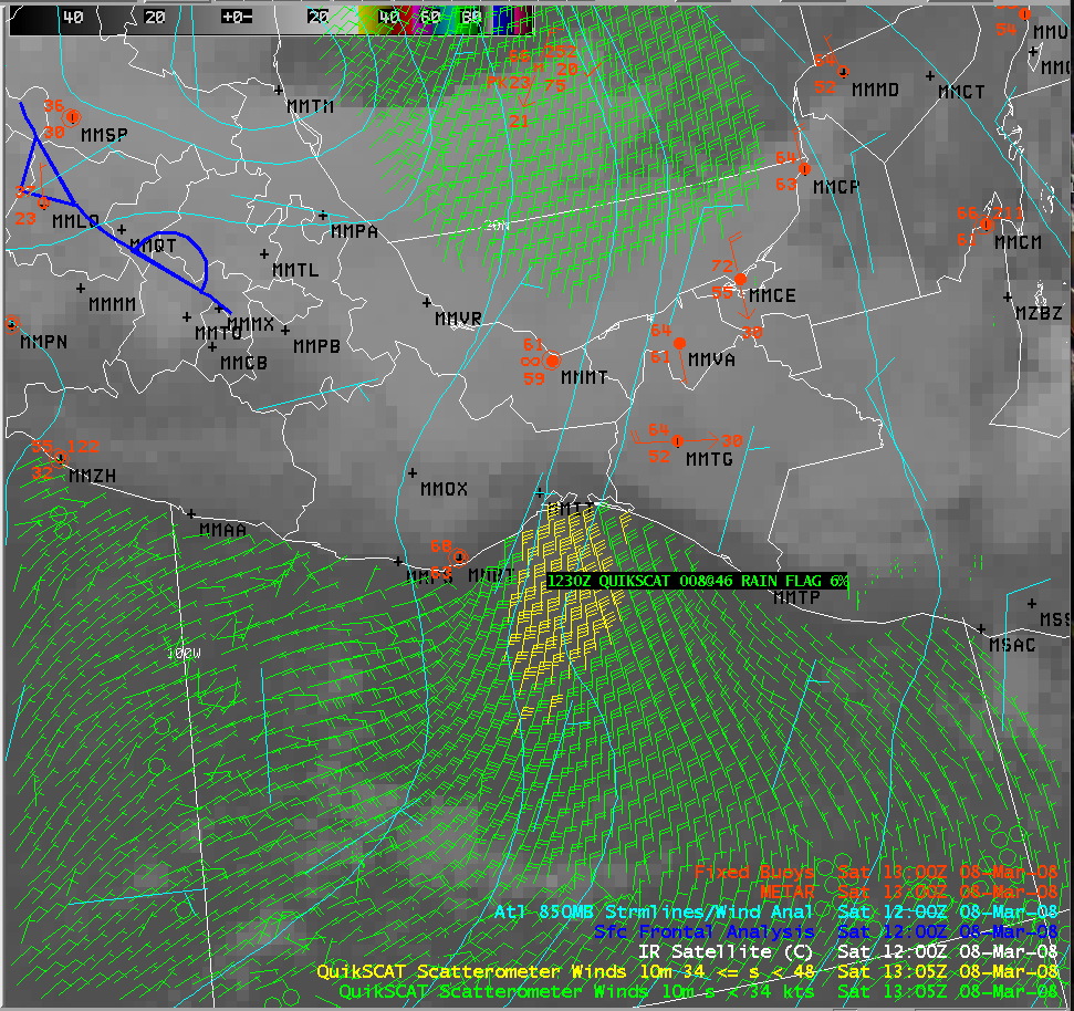
A closer view of the QuikSCAT wind data (below) shows that wind speeds at the 10-meter height were as strong as 46 knots (24 meters per second) as the cold “mountain gap winds” emerged over the Gulf of Tehuantepec. The accuracy of the QuikSCAT retrieved winds is probably very good in this case, since there is a very low rain contamination as noted by the Rain Falg value of only 6% (high rain contamination often leads to increased errors in QuikSCAT wind direction and speed magnitude).
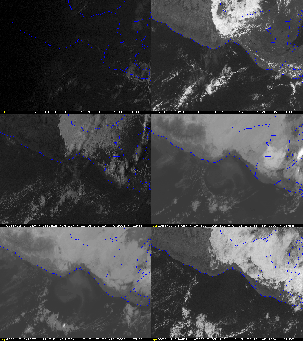
An animation of GOES-12 visible images during the daylight hours on 07 March, followed by 3.9µm IR images during the overnight hours, and then visible images during the daylight hours on 08 March (below) shows the southward progression of a well-defined cloud arc (or “rope cloud”) that marked the leading edge of the cold surge.
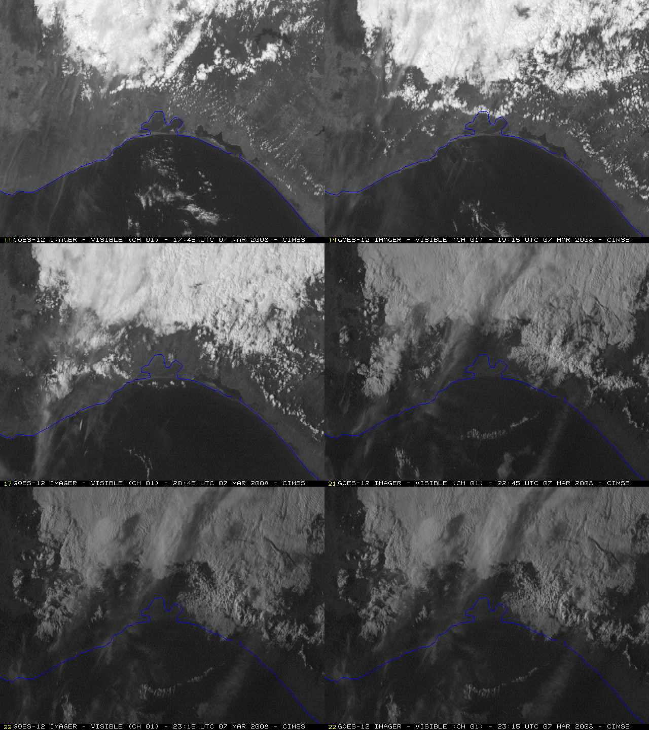
A close-up animation of GOES-12 visible images (below) shows the period where the Tehuano wind event was moving through the Ixtepec, Mexico area (located just north of the Gulf of Tehuantepec) and flowing southward into the Gulf of Tehuantepec on 07 March. Note that the turbidity of the water in the small bay along the coast increased (as seen by the lighter gray, “muddy appearance” of the water).
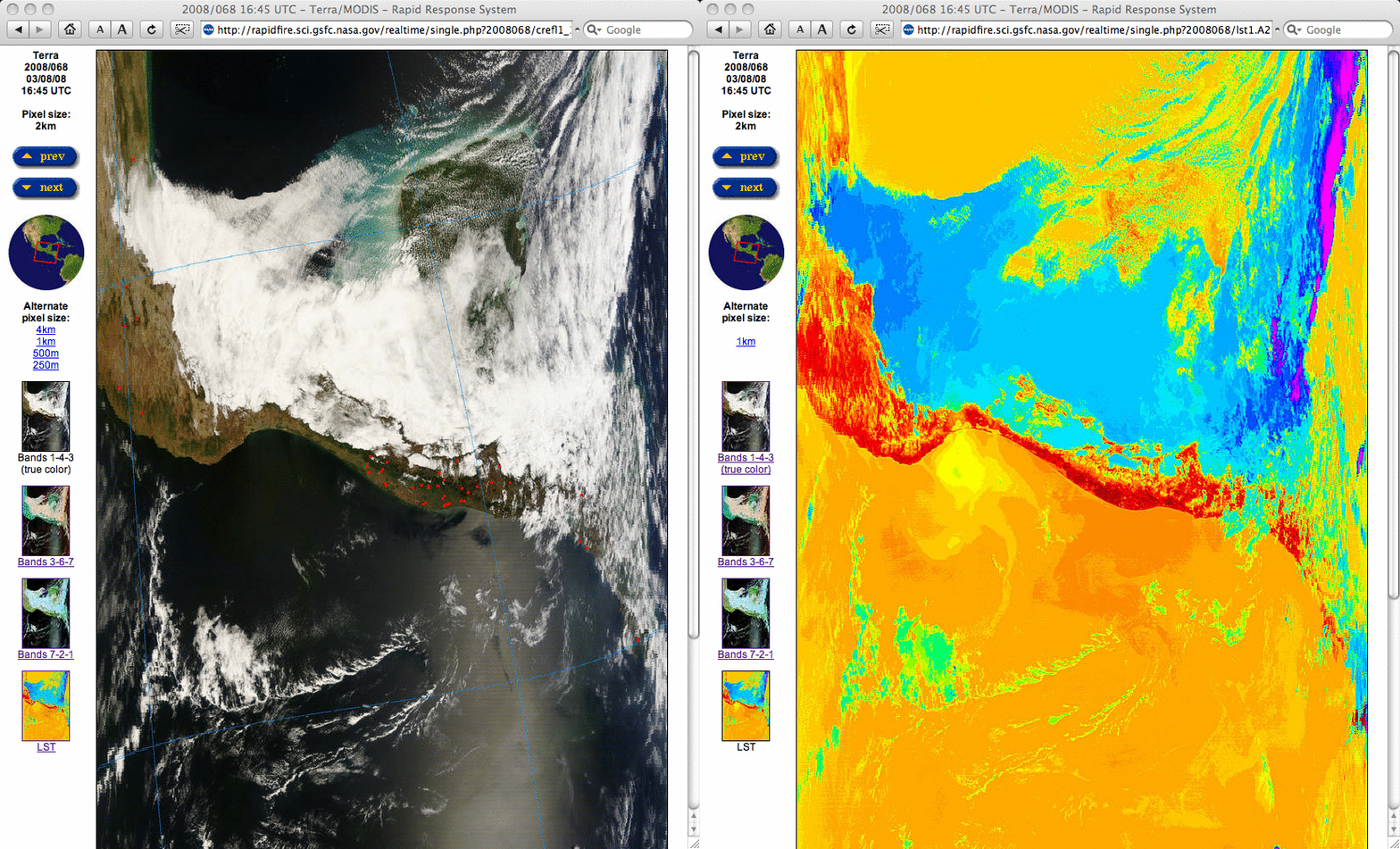
The strong winds associated with a Tehuano wind event often cause upwelling of the coastal waters, which brings cooler and more nutrient-rich water to the surface. A comparison of MODIS true color and Land Surface Temperature images (below) from the MODIS Rapid Response System site indicated that a pool of colder offshore water temperatures (15º – 19º C, green to yellow colors) was in place in the Gulf of Tehuantepec, surrounded by warmer water temperatures in the 23º – 27º C range (orange colors). A closer view using 250-meter resolution MODIS true color imagery better shows the turbidity of the water in the bay just south of Ixtepec, as well as a plume of blowing dust being advected southward over the water.
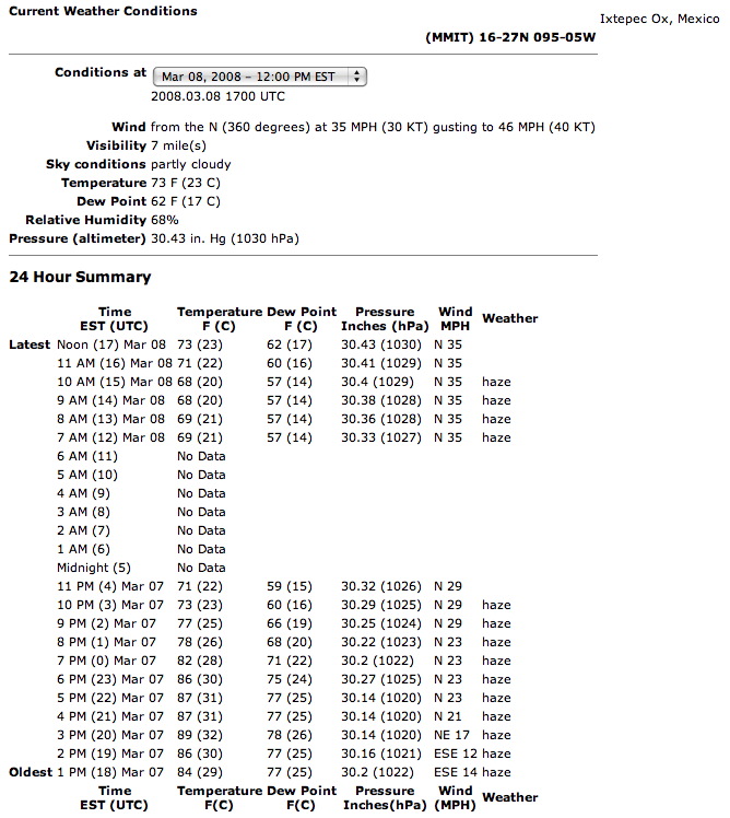
Surface weather observations at Ixtepec, Mexico showed that winds changed to northerly and increased to 35 mph (16 meters per second) with the arrival of the Tehuano event (below). There was a ship report of winds as high as 50 knots (26 meters per second) over the Gulf of Tehuantepec at 18:00 UTC on 08 March; surface winds a day earlier were as high as 46 knots (24 meters per second) at Minatitlan, Mexico farther to the north (along the Gulf of Mexico coast).


