NUCAPS and microwave snow estimates over Alaska
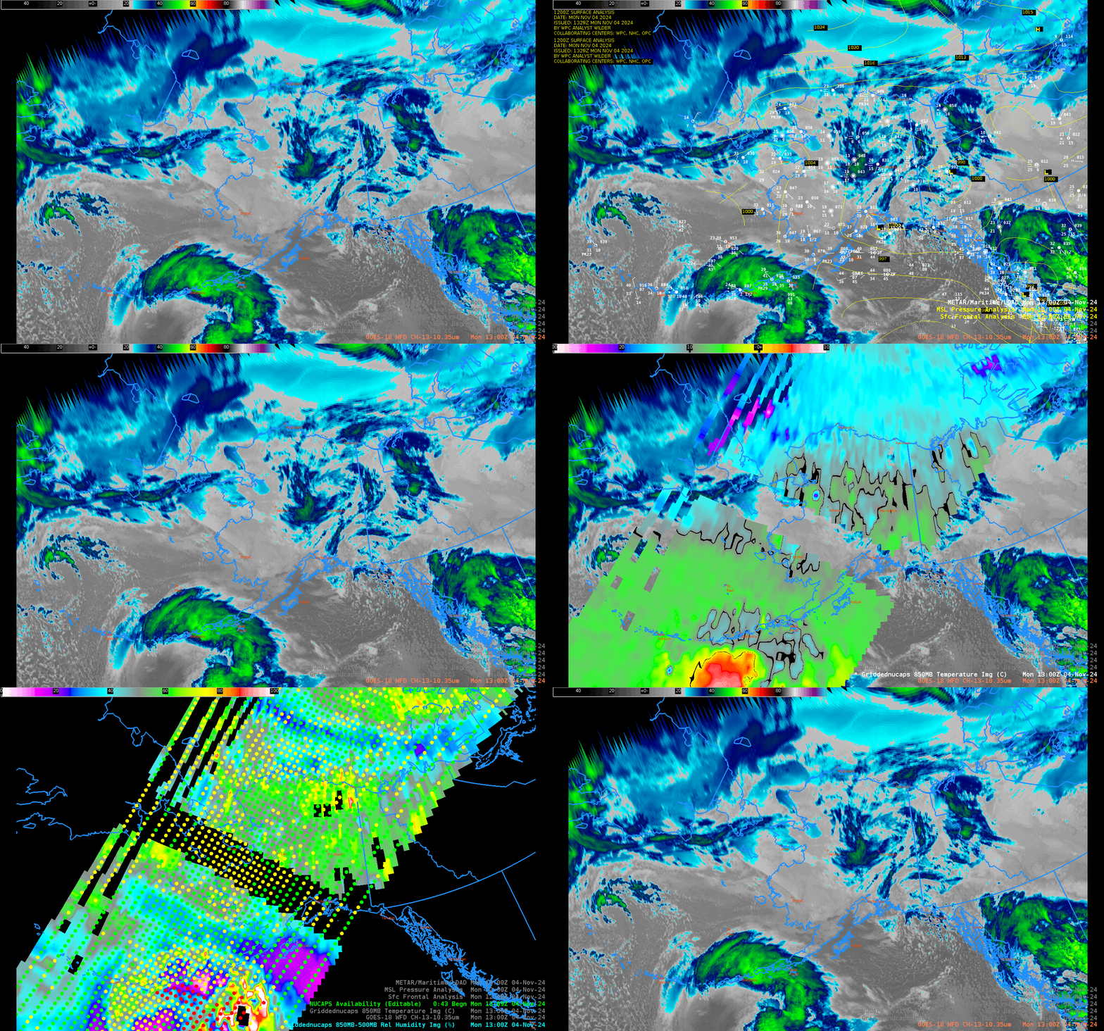
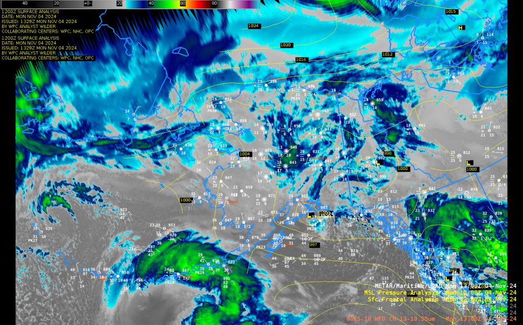
NUCAPS estimates of temperature and dewpoint give swaths of information over the Arctic — a region where conventional observations are uncommon and widely spaced. The toggle above shows a disorganized low pressure system over central Alaska — light snow is widespread as shown by the surface observations, below (and in the toggle above).
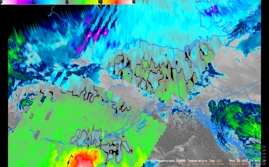
The toggle above includes swaths of temperature and of relative humidity (derived from all NUCAPS profiles at that time) that are shown individually below. The color bar for 850-mb temperature has been modified so that temperatures of 0oC and -10oC are contoured in solid black. The >0oC warmer region (yellow and red in the color curve) is south of the Aleutians. There is a relatively cold patch just northeast of the warm patch, and a stronger boundary between warmer and -10oC and colder than -10oC across central Alaska. There is good agreement between the NUCAPS analysis and the GFS analysis of 850-mb temperature at that time (here, from the TropicalTidbit website)
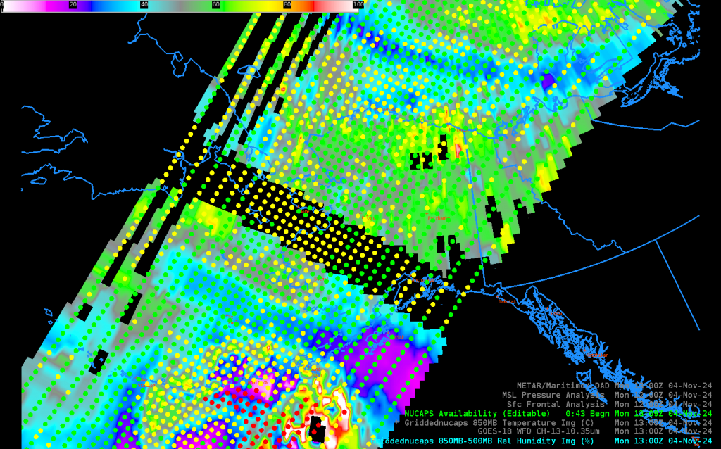
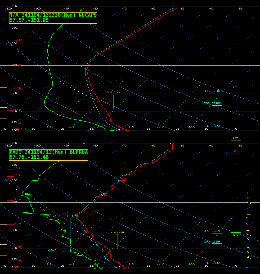
Kodiak Island is very near a region of dry air as indicated by the NUCAPS profiles; relative humidity in the 850-500 mb layer is <20% per the gridded NUCAPS analysis. The toggle below compares the NUCAPS profiles near Kodiak Island (a green profile, at 1323 UTC) with the 1200 UTC sounding at Kodiak. In this case the soundings tell similar stories: a largely dry atmopshere, and the diagnosed levels (FZL, -20oC and -30oC) are similar.
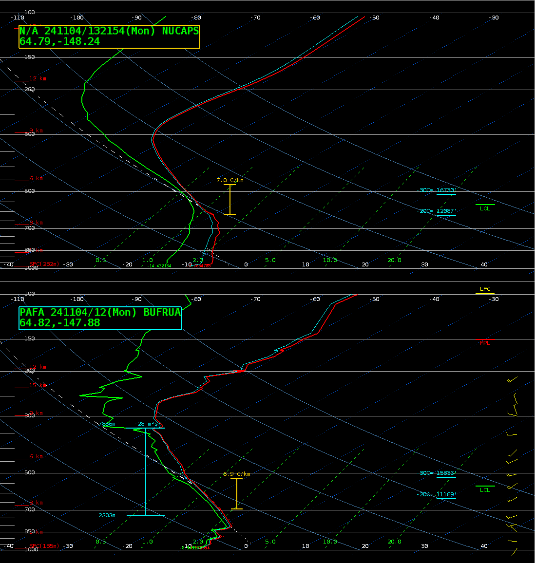
The NUCAPS swath also includes Fairbanks and Utqiagvik, both with 1200 UTC soundings. Comparisons at those two sites are shown below. NUCAPS near Fairbanks does capture the near-saturation in the snow-growth region of the atmosphere, and the tropopause height is in agreement; however, the low-level saturation and low-level inversion in the rawinsonde is not in the NUCAPS profile. If a forecaster had access to AMDAR/MADIS profiles from aircraft at the same time, that near-surface NUCAPS deficiency could be mitigated.
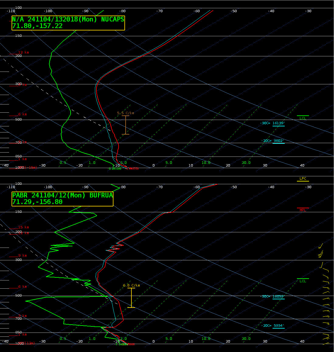
The comparison at Barrow/Utqiagvik, below, shows some similarities: the dry slot at mid-levels with relatively moist regions near the surface and below the tropopause. As you make the comparison between NUCAPS and rawinsondes, always recall the very coarse vertical resolution in NUCAPS profiles.
Gridded NUCAPS fields are also available at this SPoRT site, supplying views as shown below.

The SPoRT site above also contains microwave estimates of snowfall rate, derived using MIRS algorithms and (for the time shown) ATMS data from NOAA-20. Widespread light snow is indicated, as might be expected by the saturation in the snow growth region within the Fairbanks sounding.
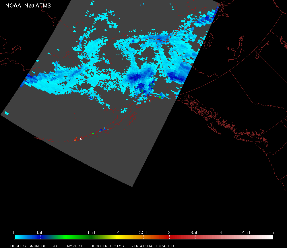
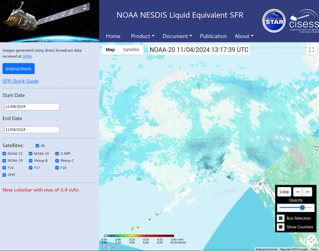
Snowfall rate is also available at this UMD site where data from more satellites are available. Note the similarities in the two fields of snowfall rate from the two sites for the same overpass.
