NGFS detection of lightning-induced fires over Wyoming
GOES-18 True-Color imagery, above, from the CSPP Geosphere website (link to animation above), shows convection moving over northeastern Wyoming, leaving in its wake a series of smoke plumes: wildfires caused by lightning. The screenshots below were captured from the Real Earth instance of NGFS imagery (link), and they show LightningCast probability and Flash Extent Density as well as NGFS Fire Detections.
The image below, for 1550 UTC, includes large LightningCast probabilities (and observed Flash Extent Density) from GOES-East. These features are moving northeastward through Wyoming as shown in the animation above.

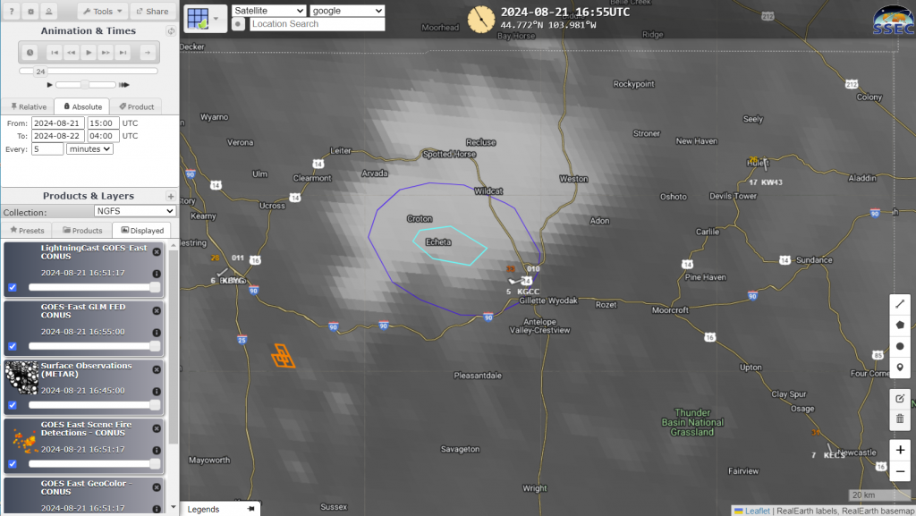
At 1655 UTC, below, the convection has moved into extreme northeast Wyoming. NGFS fire pixels are shown in the wake of the departing convection: dry thunderstorms appear to have initiated a fire (this is the House Draw fire). Lightning Probabilities continue to be enhanced with the convection.

Convection continues later in the day on the 21st, as shown in the series of images below: 1935 UTC and 2225 UTC on 21 August, and 0000 and 0400 UTC on 22 August. By 0400 UTC on 22 August, most of the convection has moved northeast of Wyoming, leaving behind a series of wildfires as indicated by the NGFS detections. The largest of these was the House Draw fire. Notice how quickly the area consumed by the House Draw fire is expanding.


This example of convection-induced fires shows why LightningCast probabilities are included in the NGFS RealEarth displays!
This fire was also discussed on the Satellite Liaison Blog here. Note that this fire also included a Fire Weather Warning issuance from WFO Riverton in collaboration with local Emergency Managers.

