Hot and hazy in the Northeast and Mid-Atlantic regions (but cool in southern California)
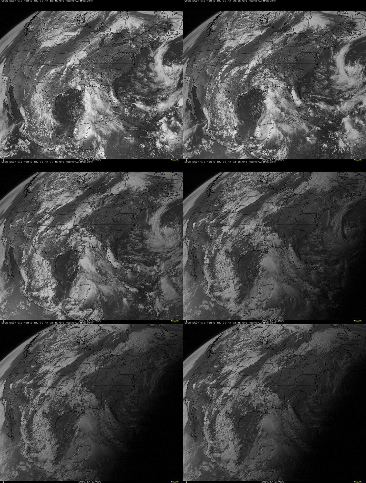
A stagnant area of high pressure situated over the Northeast and Mid-Atlantic states contributed to a prolonged heatwave over that part of the US, with widespread temperatures over 100º F (38º C) for several days — including 106º F (41º C) at Williamsburg, Virginia and Frederick, Maryland on 06 July 2010. McIDAS images of GOES-13 0.63 µm visible channel data (above) showed a large area of very hazy sky conditions covering much of the Northeast and Mid-Atlantic regions on that particular day — and corresponding MODIS Aerosol Optical Depth values were also quite high within the hazy areas seen on visible imagery, with surface Air Quality Index values deteriorating into the “Moderate” to “Unhealthy for Sensitive Groups” categories.
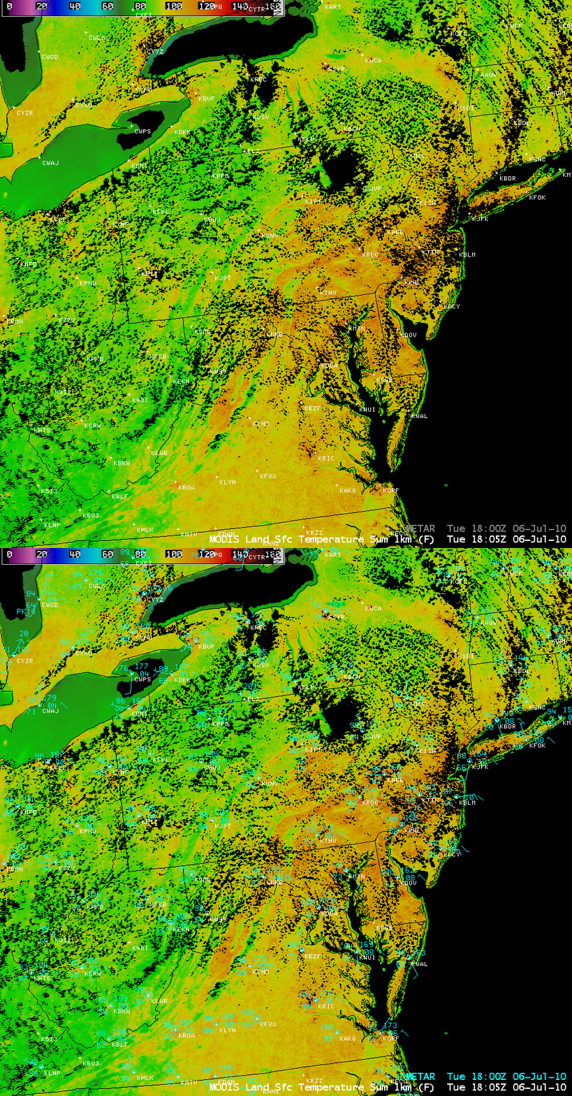
An AWIPS image of the MODIS Land Surface Temperature (LST) product (below) revealed that while many air temperatures (measured in an instrument shelter about 5 feet above the surface) were only as warm as about 100º F at 18:05 UTC (2:05 pm local time), the “skin temperature” of the ground surface was much warmer — with many areas exhibiting LST values in the 120-130º F range (darker orange to red color enhancement). The warmest LST value seen at that time was 136º F in southeastern Pennsylvania. As an aside, MODIS Sea Surface Temperature values were as warm as 87º F in the southern portion of Chesapeake Bay.
Other notable features seen on the GOES-13 visible imagery above included (1) the development of a line of severe thunderstorms along a frontal boundary from Nebraska and South Dakota, which produced a number of tornadoes and large hail up to 2.75 inches in diameter, (2) a extensive area of cloudiness over the Yucatan Peninsula of Mexico, which eventually developed into Tropical Depression #2 over the Gulf of Mexico on the following day, and (3) the dissipation of fog and stratus along the California coast during the late morning and afternoon hours (with convection developing further inland over the Sierra Nevada mountain range).
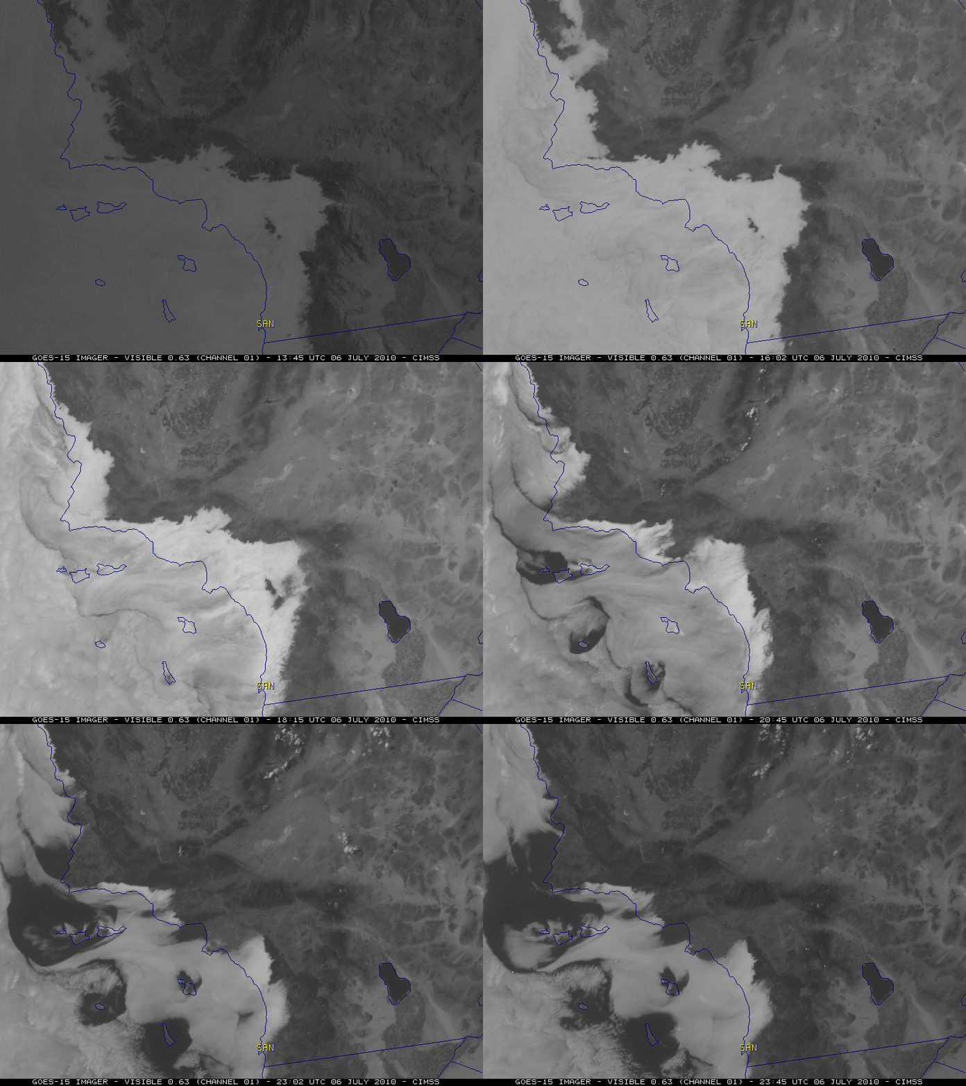
In terms of the coastal fog and stratus in southern California, GOES-15 0.63 µm visible channel images (below) showed how slow these features were to burn off in some areas. In fact, a number of locations in the San Diego, California area experienced record low maximum temperatures for the date — including a daily high temperature of only 65º F at San Diego International Airport (labeled SAN on the images), which was 10 degrees below the normal high temperature (75º F) for San Diego on 06 July. It is also interesting to note that heating of the higher terrain of some of the offshore islands appeared to help initiate the earlier clearing of the marine layer stratus cloud deck.
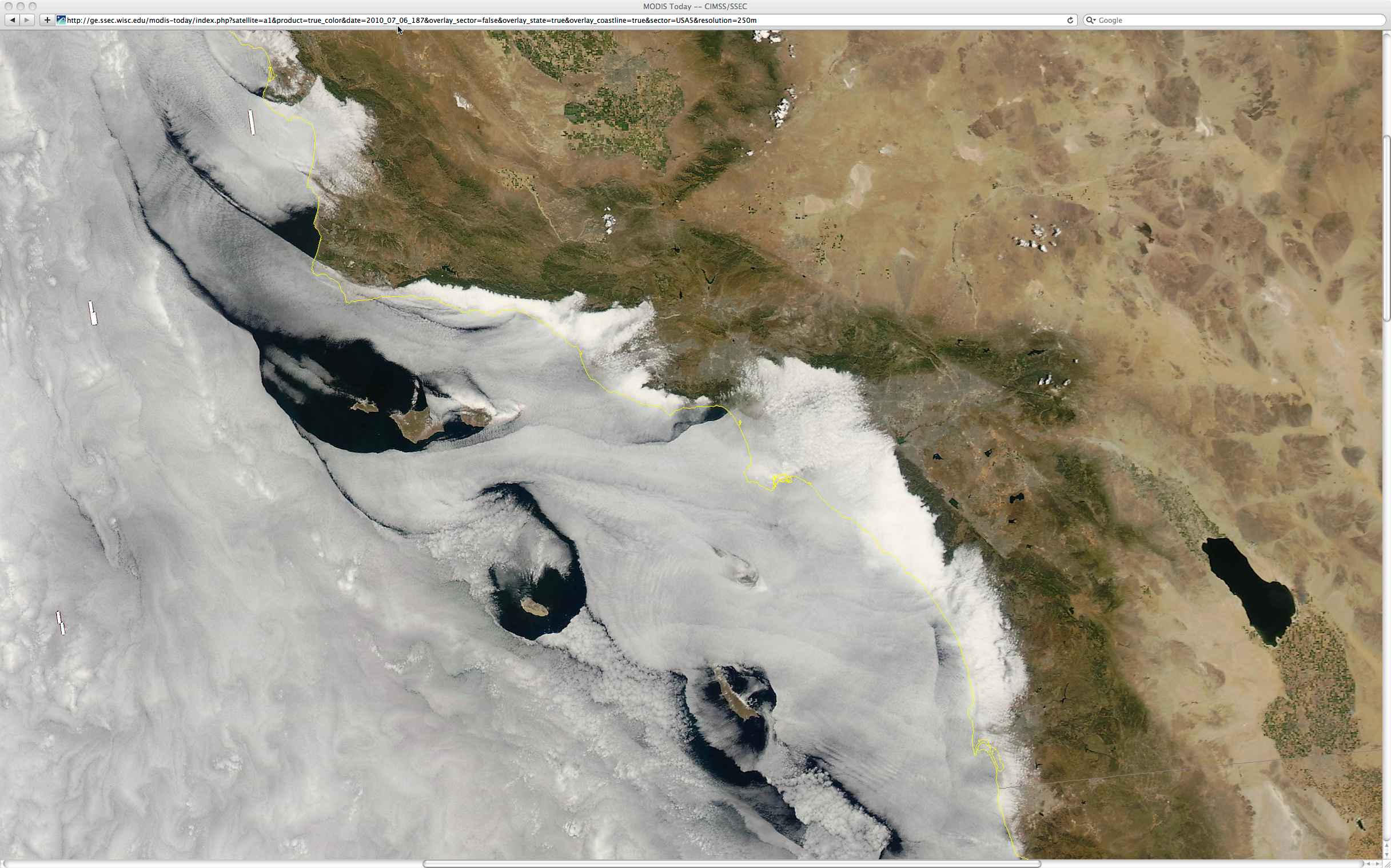
A 250-meter resolution MODIS true color Red/Green/Blue (RGB) image (created using Bands 1/4/3) from the SSEC MODIS Today site (below) shows even greater detail in the structure of the coastal fog/stratus features at 21:23 UTC (2:23 pm local time).
===== 10 JULY UPDATE =====
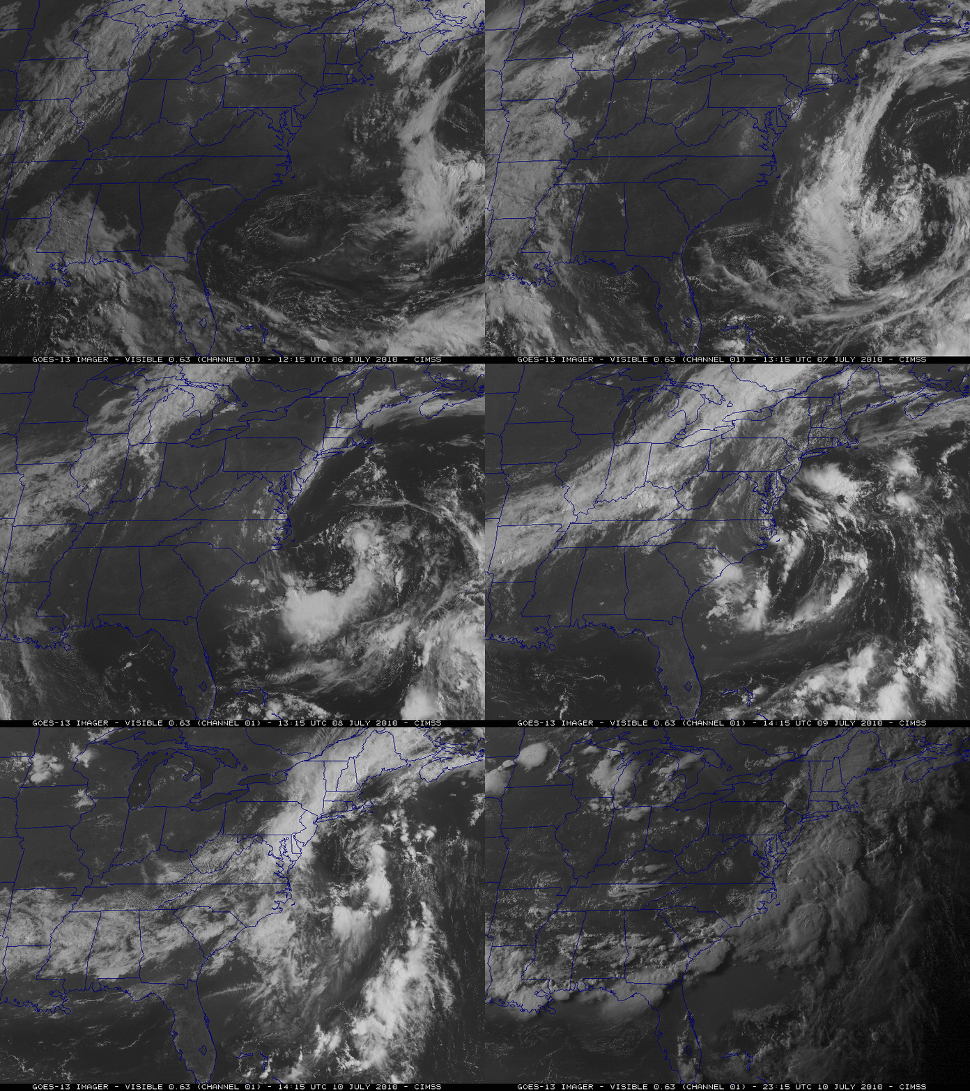
The large pocket of haze seen on the GOES-13 visible imagery over the Northeast US on 06 July slowly migrated southward along the East Coast during the next several days. An animation of hourly GOES-13 visible images (below) showed that the haze was concentrated over the Mid-Atlantic states on 07 July, but then moved further south to settle along and off the coast of the North and South Carolina, Georgia, and Florida during the 08/09/10 July period. A large cyclonic circulation over the far western Atlantic Ocean was largely responsible for helping to draw the hazy air mass southward.


