Lee cirrus clouds in Colorado
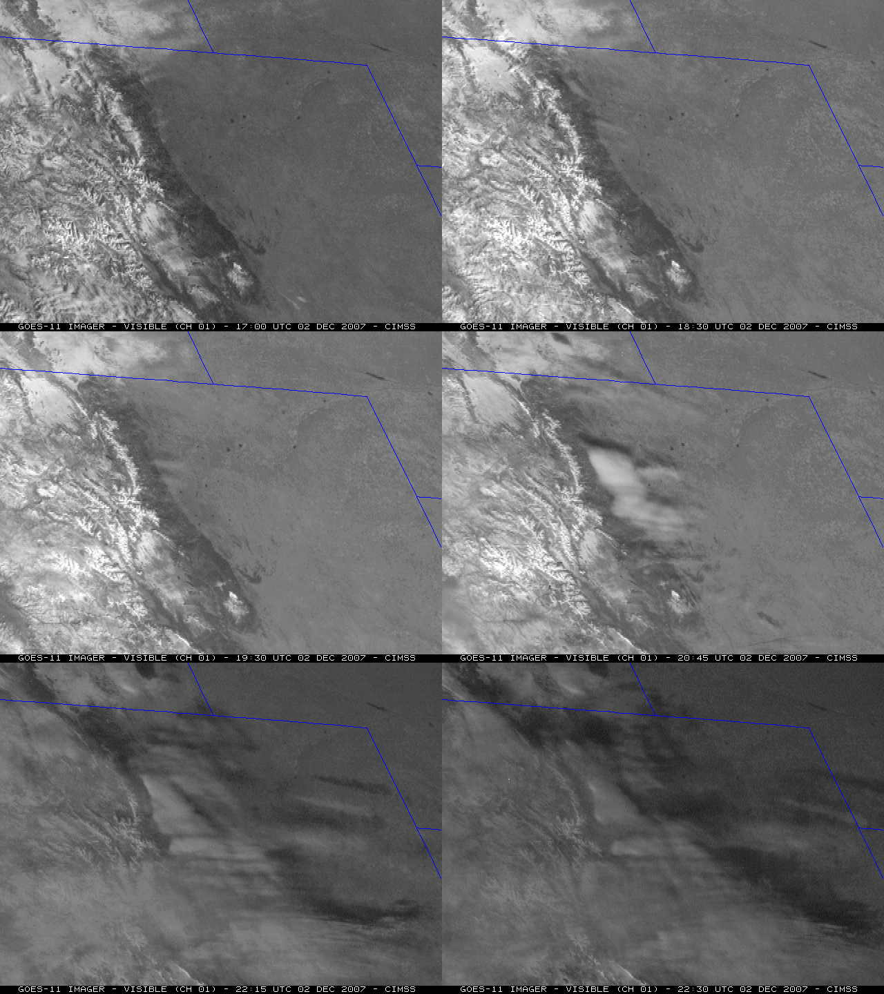
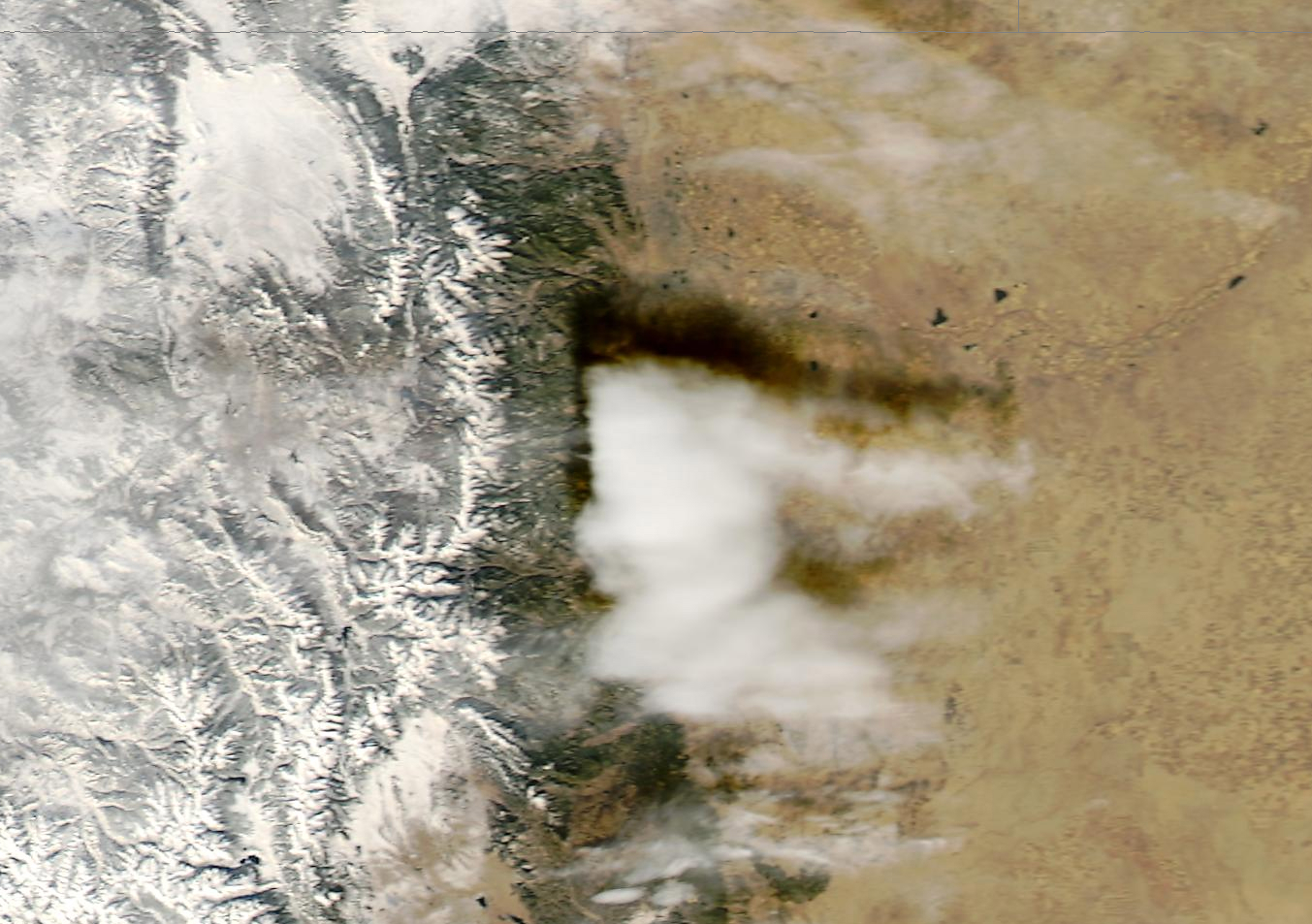
A patch of dense cirrus clouds developed to the lee (downwind) of the mountains of the Colorado “Front Range” on 02 December 2007 — this cloud feature marked the crest of a standing wave that had formed as stable air flowed from west to east across the Rocky Mountains. GOES-11 visible images (above) showed that these cirrus clouds quickly increased in areal coverage during the afternoon hours. A closer view using 250-m resolution MODIS true imagery from the SSEC MODIS Today site (below) revealed the shadow cast on the ground by the dense cloud patch that was located near Denver; deep snow cover in the higher elevations of the Rocky Mountains to the west of Denver was also clearly evident.
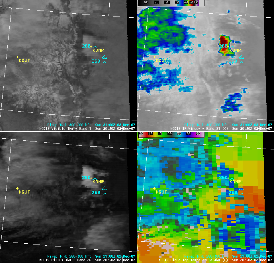
One isolated pilot report of moderate turbulence was noted by an aircraft in the area of the dense cirrus patch near Denver (KDNR), as seen on a AWIPS 4-panel of MODIS images (below); while the turbulence report was plotted on AWIPS at the default altitude of 26,000 feet (“260”), the actual pilot report indicated “FLUNKN” (Flight Level Unknown). As expected, the lee cloud features exhibited a bright appearance on the MODIS “cirrus detection channel” (lower left panel), with fairly cold pixels on the MODIS 11.0 µm IR channel image (-67º C, upper right panel) and the MODIS Cloud Top Temperature product (-63º C, lower right panel).
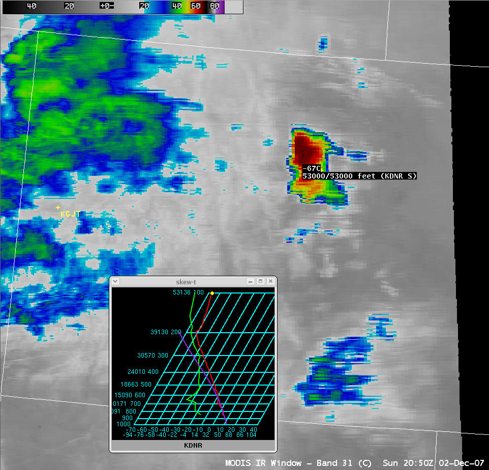
The coldest MODIS 11.0 µm IR brightness temperature (below) of -67ºC corresponded to an altitude of about 53,000 feet above ground level according to the most recent Denver (KDNR) rawinsonde data.
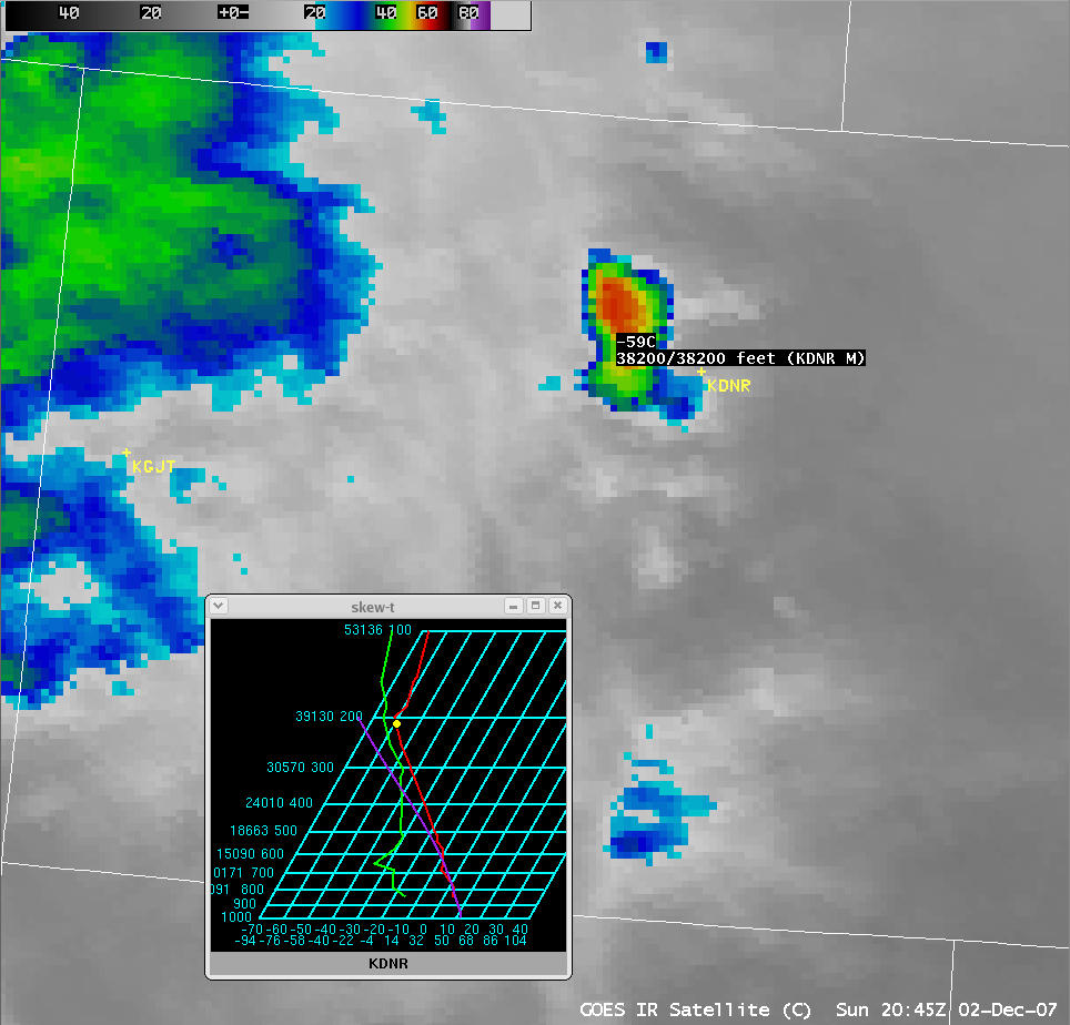
In contrast, the coldest GOES-12 10.7 µm IR brightness temperature (below) from around that same time was -59º C, which corresponded to a lower altitude of about 38,200 feet above ground level.


