Wave structure on top of a stratus cloud deck
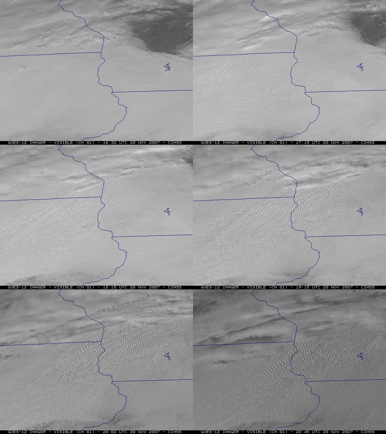
GOES-12 visible channel images (above) revealed
an interesting wave structure along the top of an extensive stratus cloud deck
that covered much of Iowa, southern Wisconsin, and northern Illinois on 20
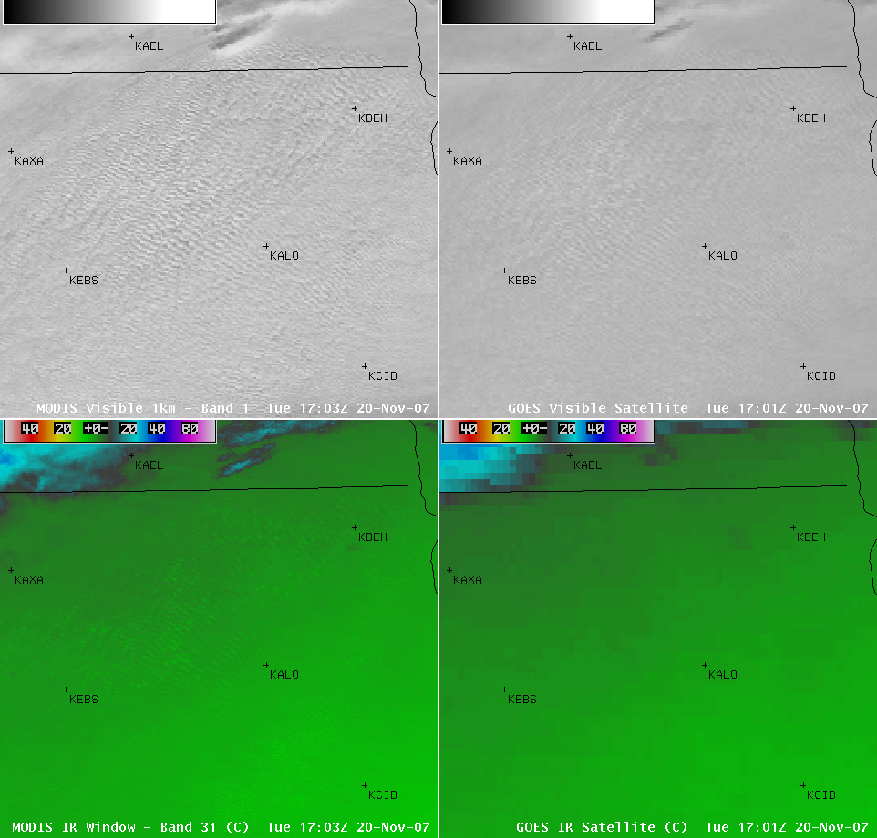
November 2007. An AWIPS 4-panel image showing the MODIS and GOES-12
visible and IR window channels (below) demonstrated
the better wave detection capabilities of the higher spatial resolution MODIS
data. The GOES-12 and MODIS IR brightness temperatures in the region of the
wave signatures were generally in the +1ºC to +5ºC range, with the GOES
Sounder Cloud Top Height indicating tops around 4700 feet in that
area (tan enhancement); the MODIS
Cloud Phase product confirmed that the cloud in that region was
likely composed of supercooled water droplets (blue enhancement).
=============================================
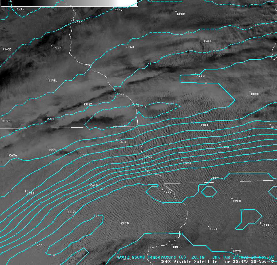
Much of the wave structure on satellite imagery seemed to be located along
a southwest-to-northeast oriented baroclinic zone (indicated
by a tighter packing of the 850 mb isotherms), with the individual banding
elements oriented generally perpendicular to the axis of the baroclinic
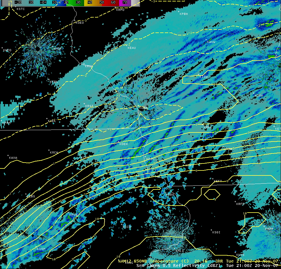
zone (above); however, radar echoes that developed
a few hours later were generally aligned closer with the axis of the baroclinic
zone (below). A northwest-to-southeast cross section
of NAM12 model output (along
line D-D’ orthogonal to the baroclinic zone axis) revealed elevated
pockets of frontogenesis and omega (within
the 600-850 mb layer) which may have played a role in the formation of
the regions of banding seen on both satellite imagery and radar reflectivity.
=============================================
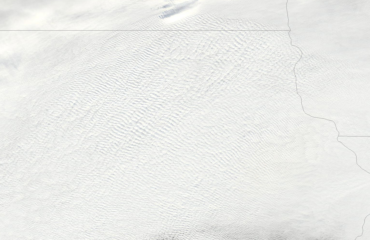
A 250-m resolution MODIS true color image (above) from
the SSEC
MODIS Today site shows the cloud top waves in great detail over
northeastern Iowa. Note that some of the wave structure and orientation (just
south of the Iowa/Minnesota border) was similar to that seen on the radar images.


