Large waves approaching Hawai’i

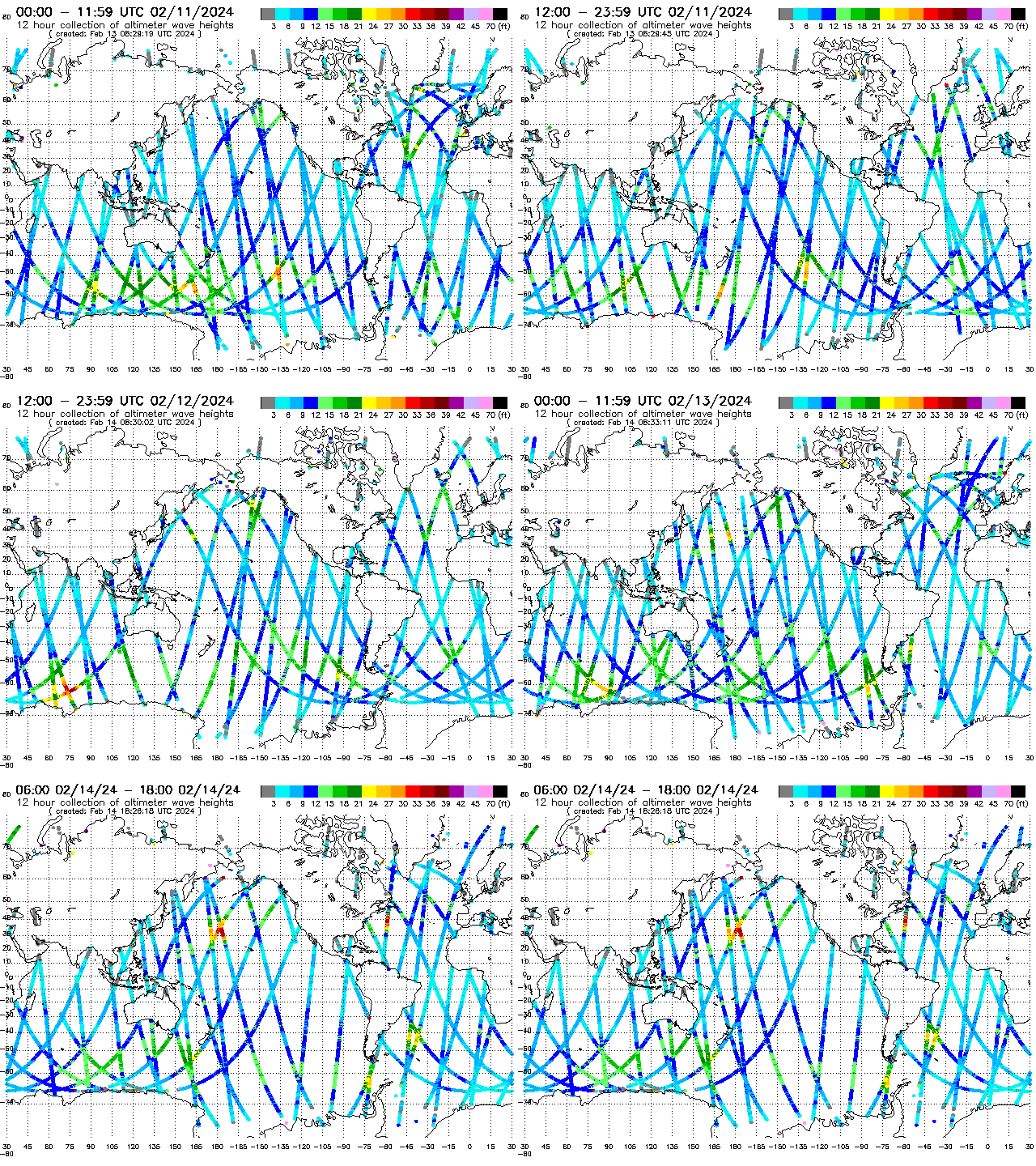
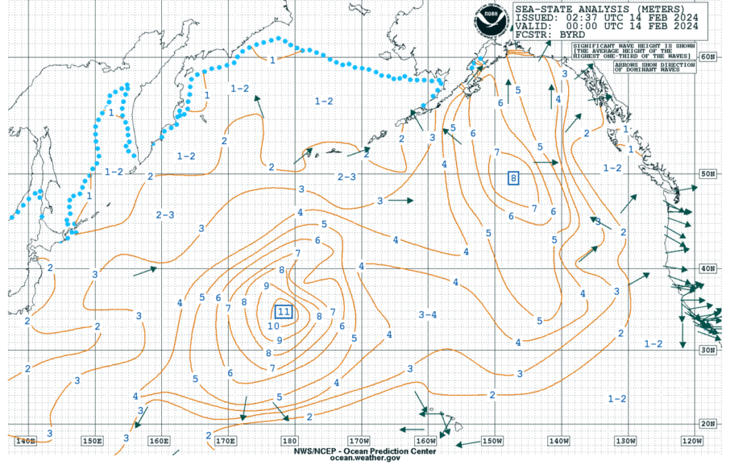
Altimetric measurements of the sea surface (from this site), above, show a region of very tall waves early on 14 February, with Significant Wave Heights exceeding 30 feet. Those waves are also show below in an analysis from OPC (link); they are southwest of a hurricane-force low (surface analysis; here is a toggle between the Significant Wave heights and the surface analysis).

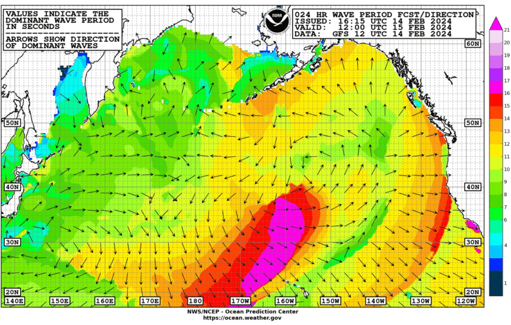
Forecast Waves, below, show the long wave period associated with the large waves starting to affect the Hawai’ian Islands by 1200 UTC 15 February. The north-facing shores of the Hawai-ian islands are under a High Surf Warning.

What does the satellite imagery show for the storm that supported such strong waves? Airmass RGB imagery from Himawari-9, below, (from 0000 UTC 9 February through 2300 UTC 12 February) show the development of the system and a long fetch of strong winds (by 2300 UTC 12 February). The strong storm exits the eastern edge of the domain by the end of the animation

GOES-West imagery (from the CSPP Geosphere site), hourly below from 1500 UTC on 12 February through 1900 UTC on 14 February shows the strong storm moving eastward across the Pacific, with strong nortwest winds inferred behind a propagating cold front.
For more information on this wave event, refer to the forecast office of the National Weather Service in Honolulu.

