Saharan dust outbreak
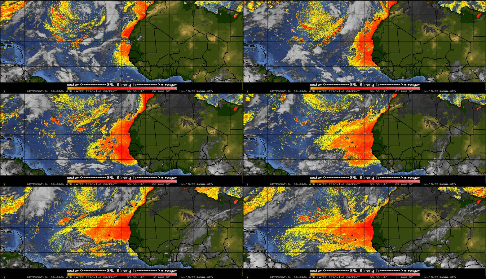
A major outbreak of Saharan dust was noted during the 06-11 November 2007 period — the Meteosat-9 Saharan Air Layer (SAL) tracking product (above) revealed an extensive signal of thick dust (orange to red enhancement) that was being transported westward across the tropical Atlantic.
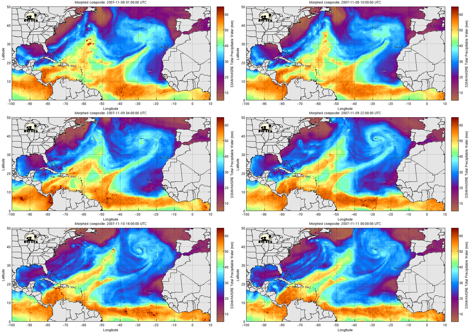
The MIMIC Total Precipitable Water (TPW) product (below) showed the dry character of this large Saharan dust plume — TPW values as low as 10-20 mm (brown to violet enhancement) were seen over eastern and central portions of the tropical Atlantic basin as the dust and dry air layer streamed westward off the African continent.
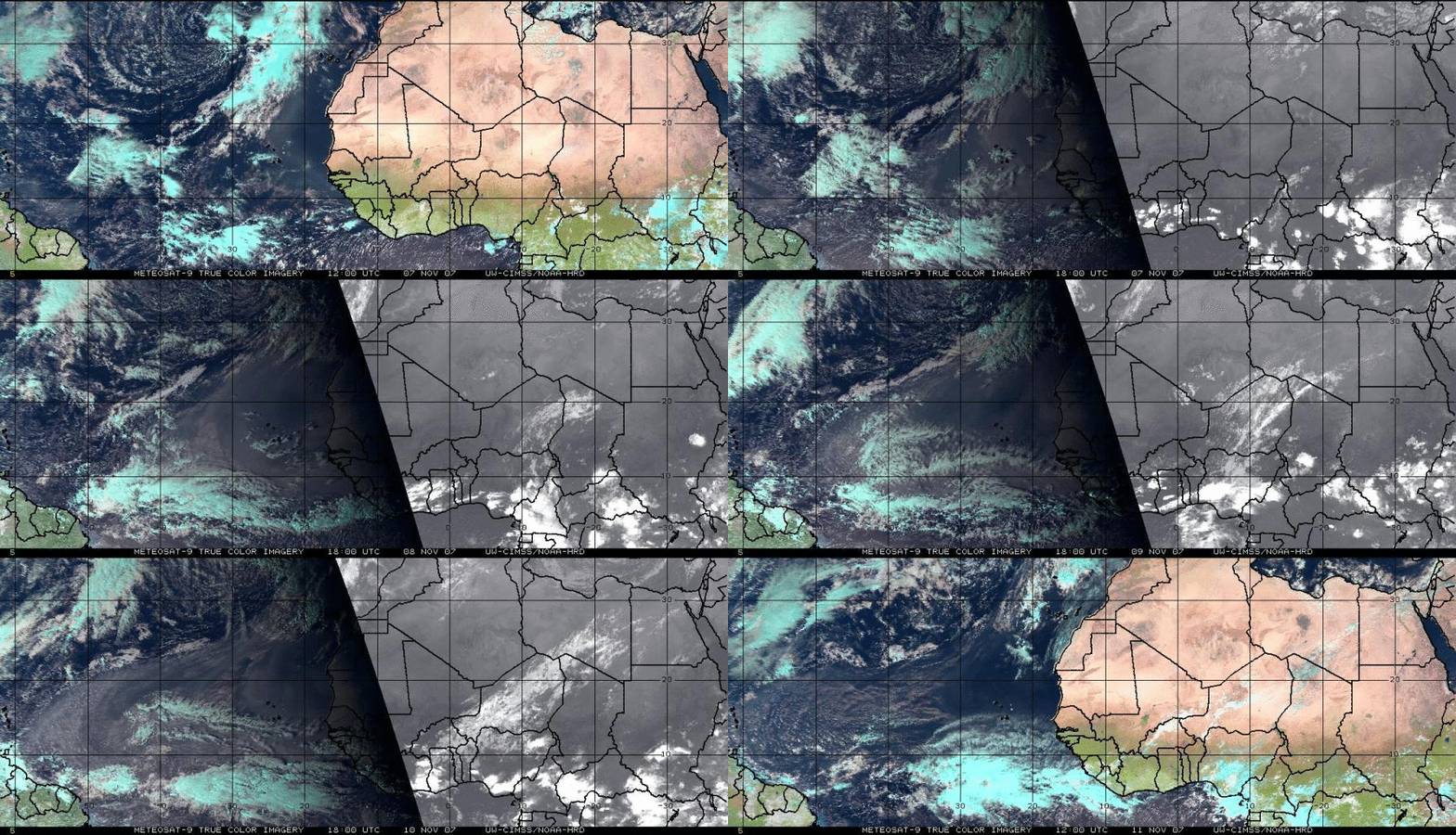
An animation of daytime Meteosat-9 “true color” image composites at 12 UTC and/or 18 UTC (below) shows the hazy appearance of the large Saharan dust plume. The appearance of such a strong Saharan dust event in November is curious in light of two recent studies by Evan et al.: (1) November appears to be the minimum of the seasonal Saharan dust cycle, and (2) August-September 2007 showed little to no dust storm activity over the tropical North Atlantic basin.


