|
|
Meteosat-8 Pseudo-Natural Color Imagery:
Background:
This product is created by combining the 0.6, 0.8, 1.6, and 3.9 µm channels on
the Meteosat Second Generation satellite. The 0.6, 0.8, and 1.6 µm channels are
used as a proxy for the blue, green, and red regions of the visible spectrum and
are combined into a single image. The 3.9 µm channel is used to supplement these
visible and near-IR channels by providing continuous coverage through the nighttime
hours.
Uses:
The resulting merged "color" image closely mimics what an actual color photo of
the Earth would look like from space. This imagery is useful for highlighting ocean,
land, aerosol (e.g. Saharan dust, pollution and biomass burning emissions), and cloud
features in colors that are qualitatively similar to those of a true color image.
Animations of the imagery are useful for tracking features and can help identify
the source of aerosols that are indicated in the imagery.
Notes:
• The visible portion of the pseudo natural color image is subject to
sun glint (solar reflectance off the ocean surface). This effect can make it
look "dusty", when in fact, it may not be. This area of sun glint is easily
identifiable as it rapidly moves across the basin in successive images;
• Low sun angles (relative to the position of the satellite) can make
it easier to see suspended mineral dust and other aerosols because scattering by
these particles is greater;
• Saharan mineral dust can often be seen as far west as the Windward
Islands in this imagery and appears as a brown haze;
• Biomass burning emissions appear as a deep aqua blue;
• Shallow stratocumulus and cumulus clouds appear white;
• Higher (colder) clouds appear as a light blue. This is because the
three visible channels being used to create the pseudo natural imagery are only
proxies for the blue, green, and red portions of the visible spectrum;
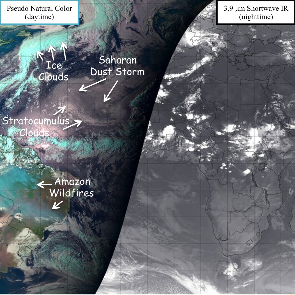
Example of a pseudo natural color image.
For more SAL information, please visit the
SAL Background Information
page.
|
|
|