Classic “Enhanced-V” IR storm top signature in Texas
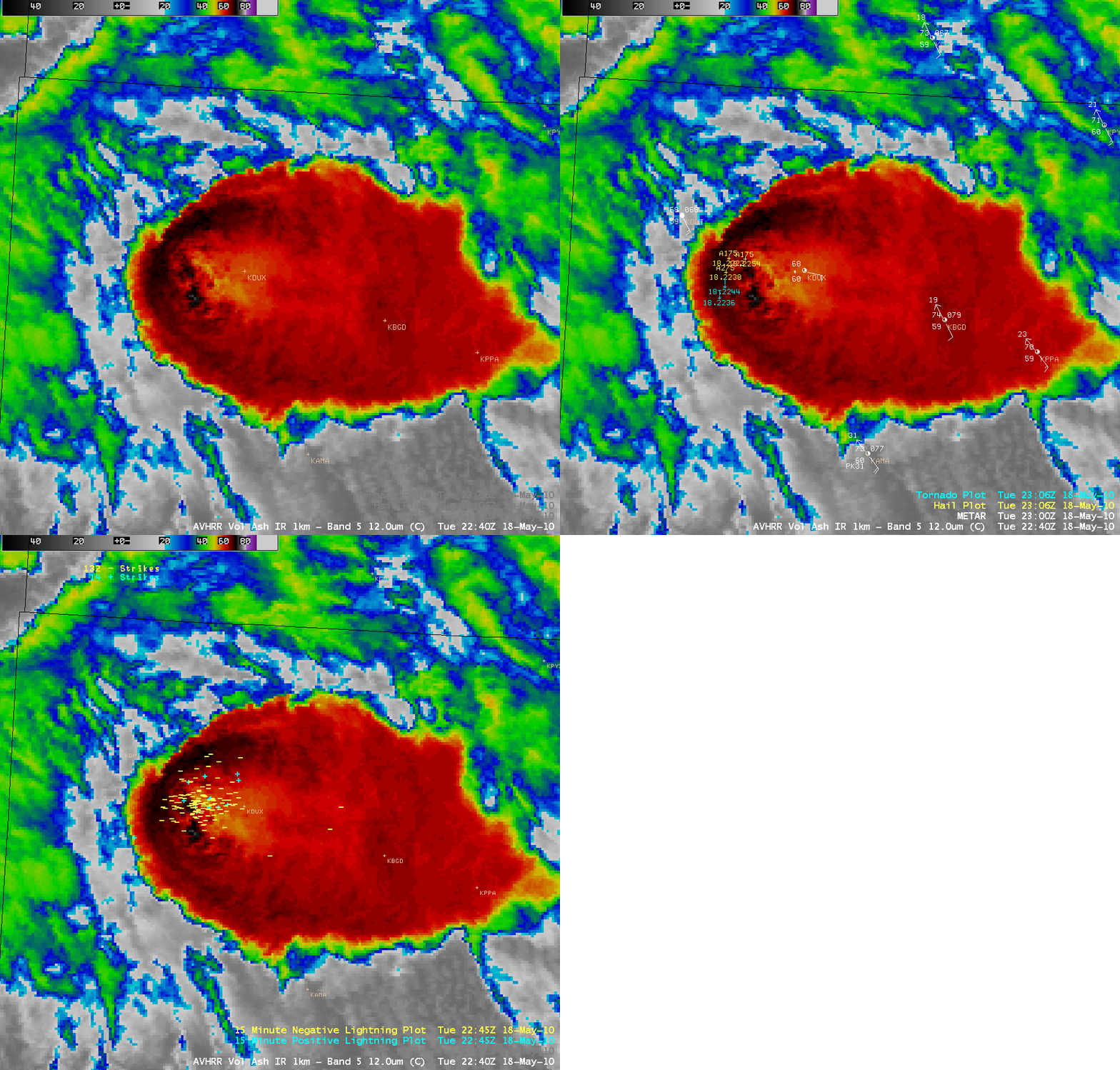
An AWIPS image of the 1-km resolution POES AVHRR 12.0 µm IR channel data (above) displayed a classic and well-defined example of an “Enhanced-V” storm top signature over the northern Texas Panhandle region on 18 May 2010. Overlays of SPC storm reports and cloud-to-ground (CG) lightning strikes near the time of the image showed that this severe thunderstorm was producing hail as large as 2.75 inch in diameter, as well as a couple of tornadoes — and there were a large number of CG strikes within the Enhanced-V signature. The coldest cloud top IR brightness temperature was -74º C.
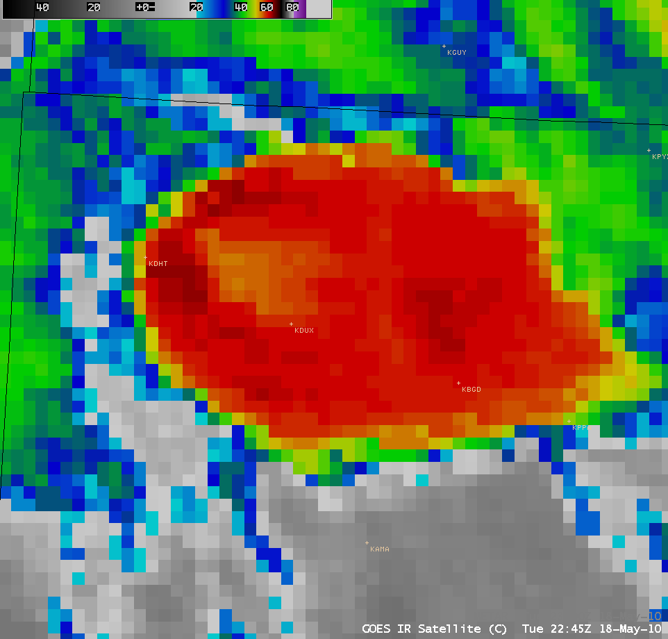
The corresponding 4-km resolution GOES-13 10.7 µm IR image (below) did exhibit an Enhanced-V signature, but the details were not as well-defined at the coarser spatial resolution. The coldest cloud top IR brightness temperatures were also about 10º C warmer on the GOES-13 image.
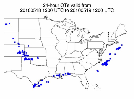
As part of the GOES-R Proving Ground activities to support the SPC Hazardous Weather Testbed, an Overshooting Top product is being generated by CIMSS. A 24-hour composite of the Overshooting Top (OT) hits is shown below, with a number of OT hits seen across the northern Texas panhandle.


