Update on the Deepwater Horizon oil slick in the Gulf of Mexico
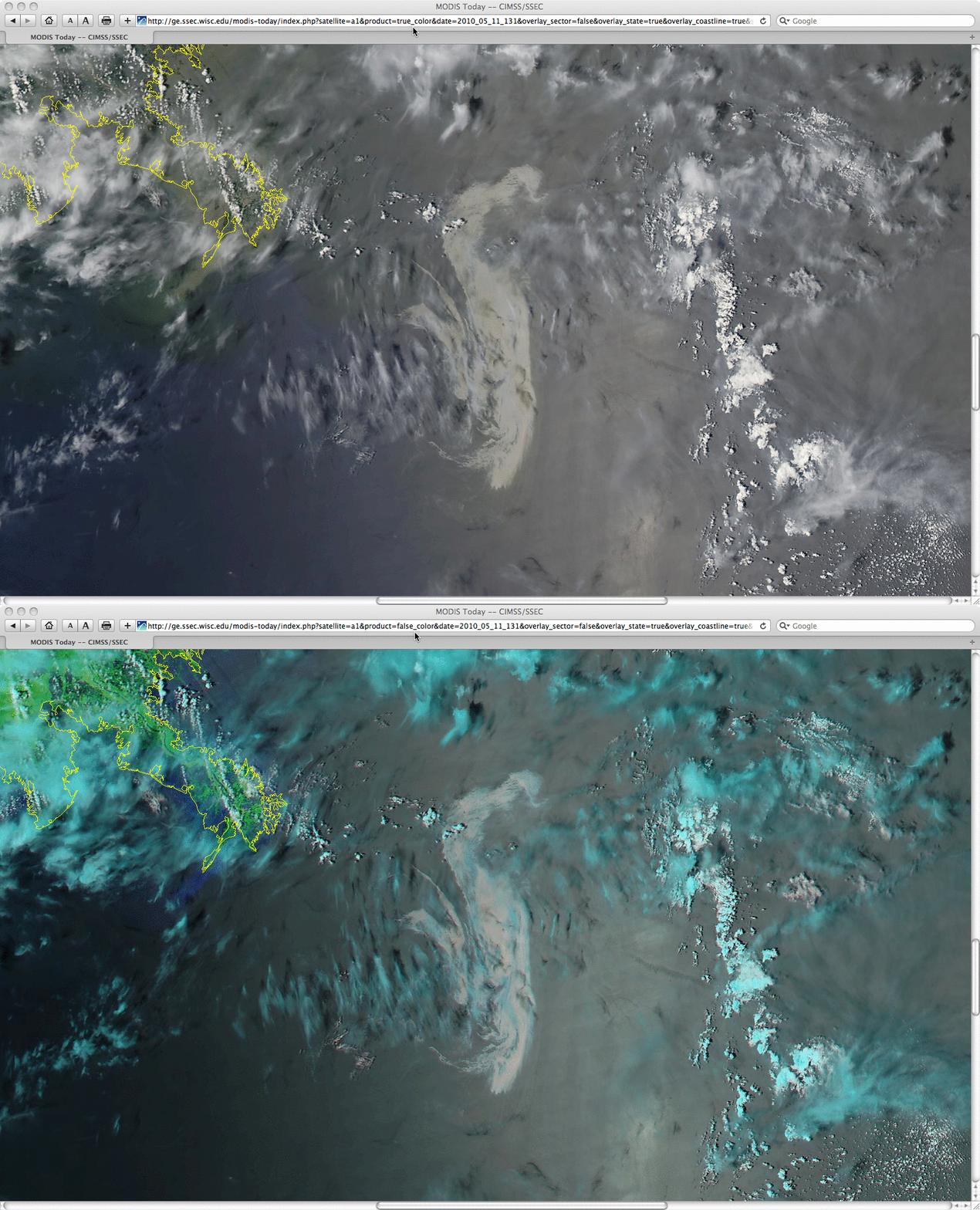
A comparison of MODIS true color (using bands 1/4/3) and false color (using bands 7/2/1) Red/Green/Blue (RGB) images from the SSEC MODIS Today site (above) again revealed the areal extent of the surface portion of the oil slick just off the Louisiana coast in the northern Gulf of Mexico on 11 May 2010.
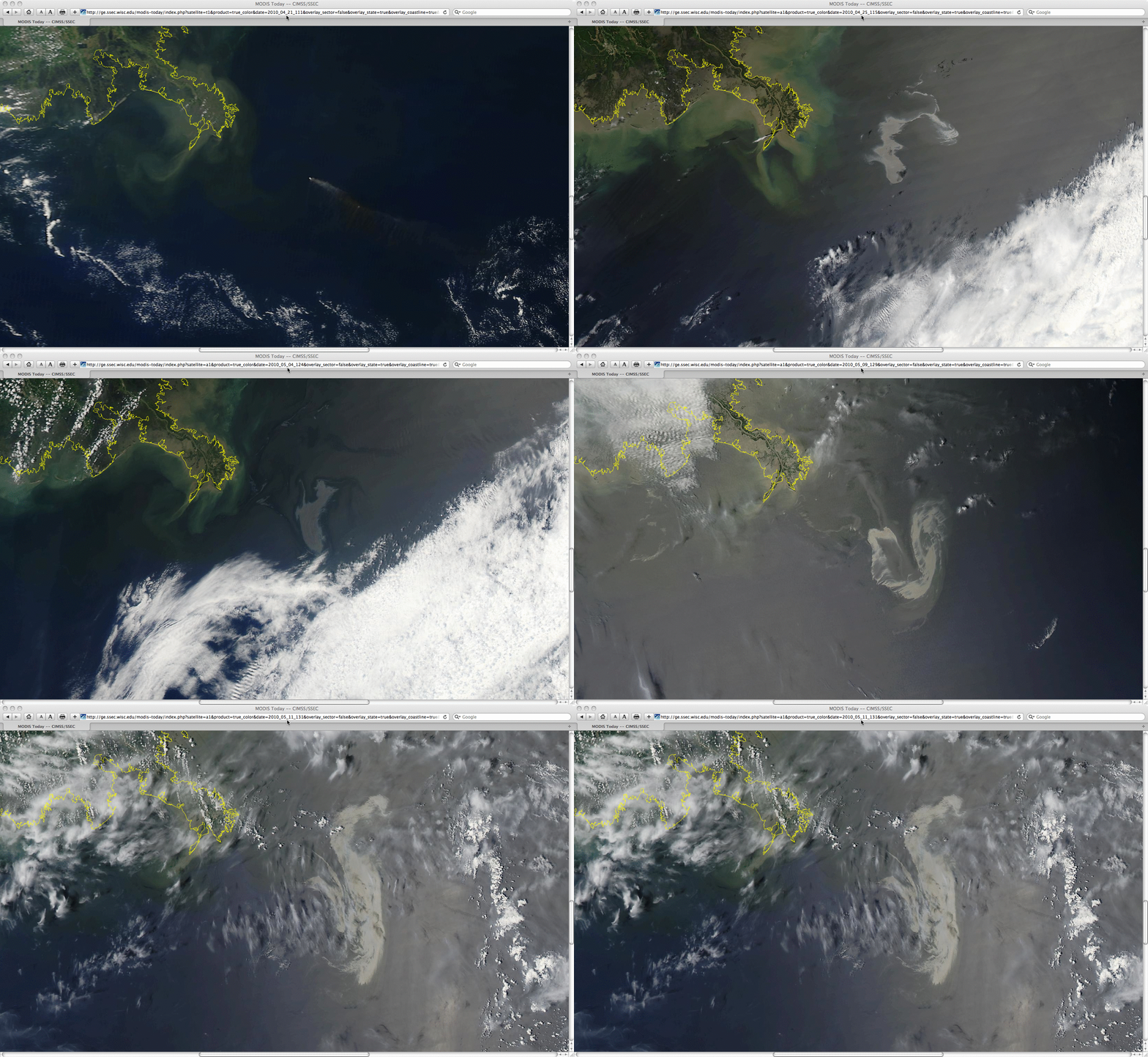
An animation of MODIS true color RGB images (created using bands 1/4/3) from days when the geometry of the sun glint was favorable (below) showed the changes in areal coverage and shape of the surface oil slick feature during the 21 days following the Deepwater Horizon offshore oil rig explosion (which occurred late in the evening on 20 April: CIMSS Satellite Blog | VISIT Meteorological Interpretation Blog). The first image on 21 April shows the smoke plume drifting southeastward from the oil rig site (before it eventually collapsed).
With the use of the 16-channel ABI instrument on the upcoming GOES-R satellite, the capability to generate and display these types of RGB images will be possible at high temporal resolution (every 5 minutes on a routine basis).
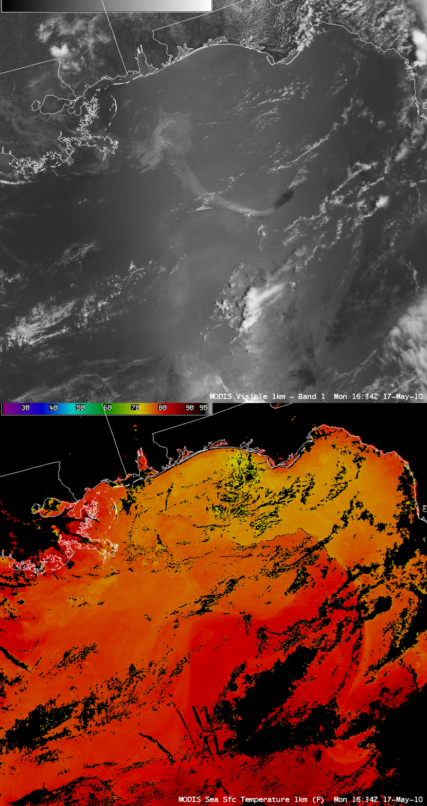
AWIPS images of MODIS 0.65 µm visible channel data and the MODIS Sea Surface Temperature (SST) product on 17 May 2010 (above) revealed that a long, thin portion of the oil slick had been drawn southward and southeastward, possibly becoming entrained into the far northern circulation of the Gulf of Mexico Loop Current. The MODIS SST values within the Loop Current were very warm — as high as 82º F (darker red color enhancement).
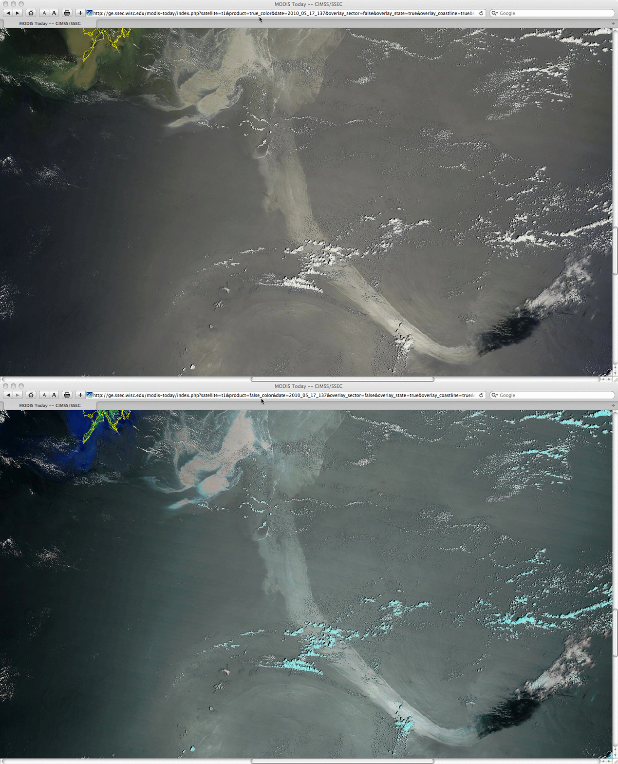
A closer view using 250-meter resolution MODIS true color (using bands 1/4/3) and false color (using bands 7/2/1) RGB images from the SSEC MODIS Today site (below) showed better detail of the long oil slick plume that was moving southward.
It is unclear why the far eastern end of the oil slick plume appears so dark on the MODIS images; one idea is that a great deal of oil dispersant had been spread over the leading edge of the plume, which then greatly reduced the amount of solar energy being reflected back up toward the satellite. Or, perhaps the darker area is oil along the leading edge of the plume that is still sub-surface?
For addition details, see the Weather Underground blog.


