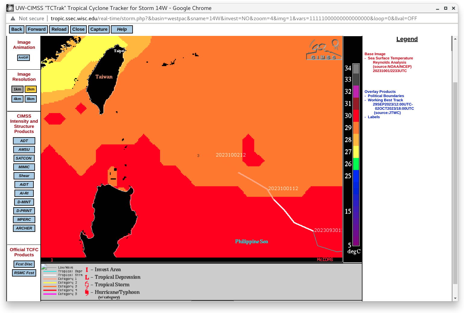
Typhoon Koinu in the Philippine Sea
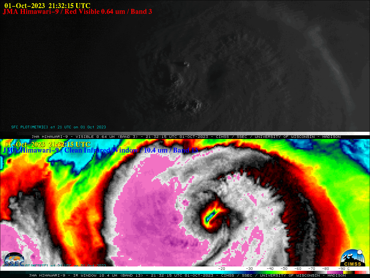
JMA Himawari-9 “Red” Visible (0.64 µm, top) and “Clean” Infrared Window (10.4 µm, bottom) images, from 2132 UTC on 01 October to 0902 UTC on 02 October [click to play animated GIF | MP4]
Just prior to the start of the Himawari-9 animation, an image of RCM-3 Synthetic Aperture Radar (SAR) winds at 2122 UTC on 01 October (source) is shown below — which depicted a narrow but fully closed eyewall.
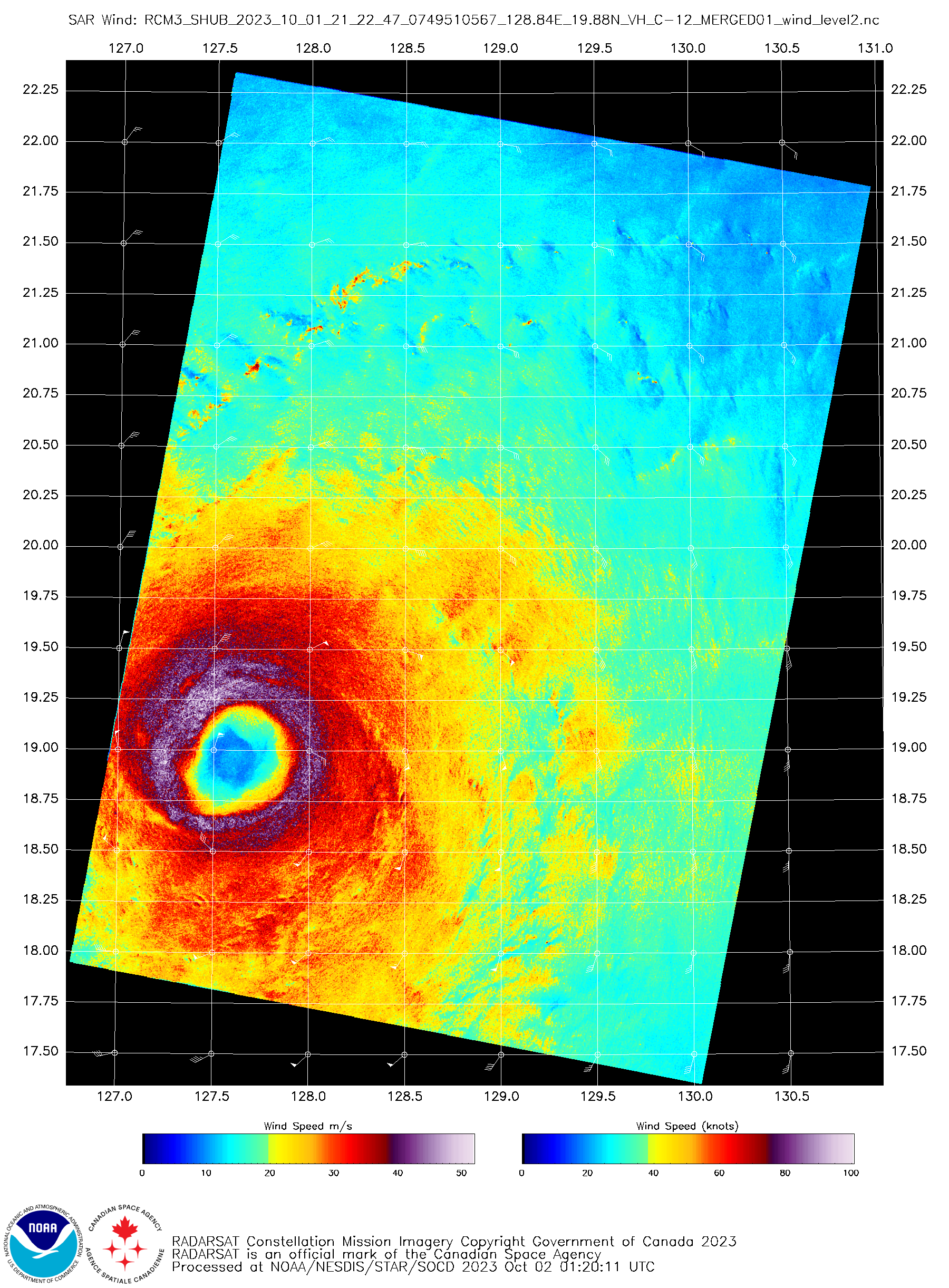
RCM-3 Synthetic Aperture Radar image at 2122 UTC on 01 October [click to enlarge]
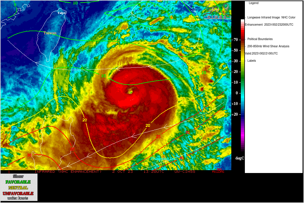
Himawari-9 Infrared Window (11.2 µm) images, with an overlay of deep-layer wind shear at 2100 UTC [click to enlarge]