Explosive eruption of Mount Shishaldin in Alaska
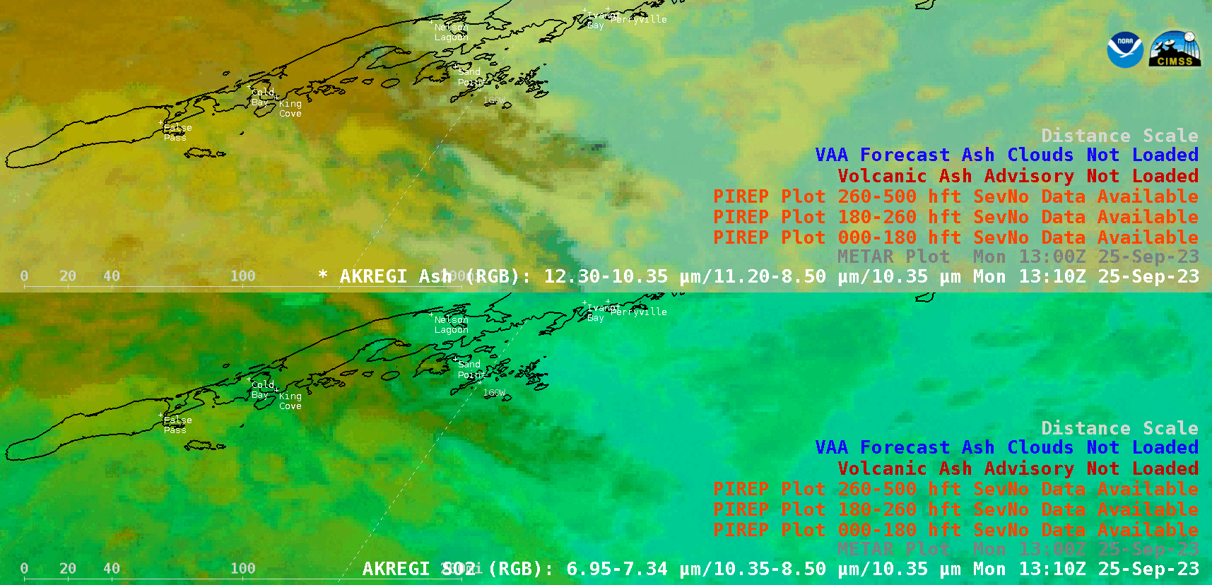
GOES-18 Ash RGB images (top) and SO2 RGB images (bottom), with plots of Pilot Reports and Volcanic Ash Advisory/Forecast polygons, from 1320-2200 UTC on 25 September [click to play animated GIF | MP4]
There were trace to minor amounts of volcanic ashfall reported in False Pass, King Cove, Cold Bay and Sand Point, occurring in conjunction with light rainfall. A 1912 UTC Pilot Report (PIREP) issued at Sand Point (below) mentioned that volcanic ash (VA) was falling in light rain (-RA), covering surfaces.
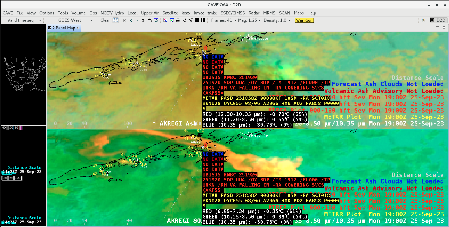
Cursor sampling of a PIREP issued at 1912 UTC (red text) [click to enlarge]
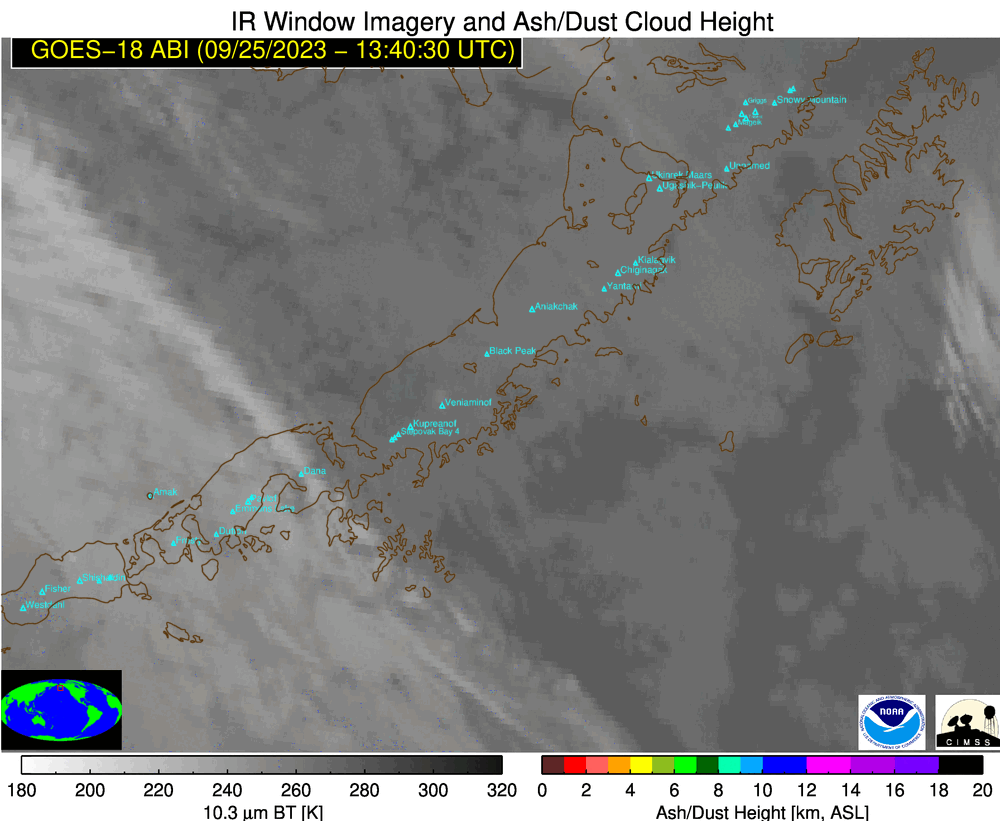
Volcanic Ash Height derived product [click to play animated GIF | MP4]
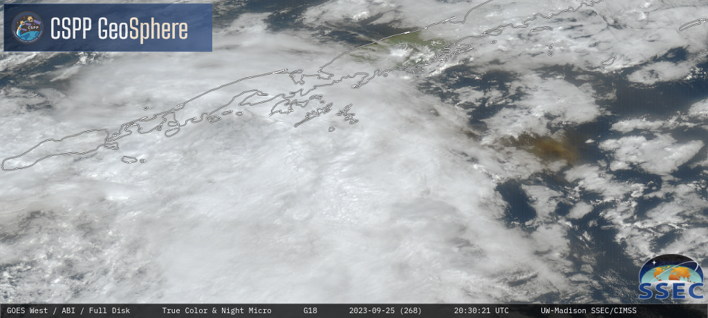
GOES-18 Nighttime Microphysics RGB + daytime True Color RGB images [click to play MP4 animation]