Swaths of wet ground in the Plains
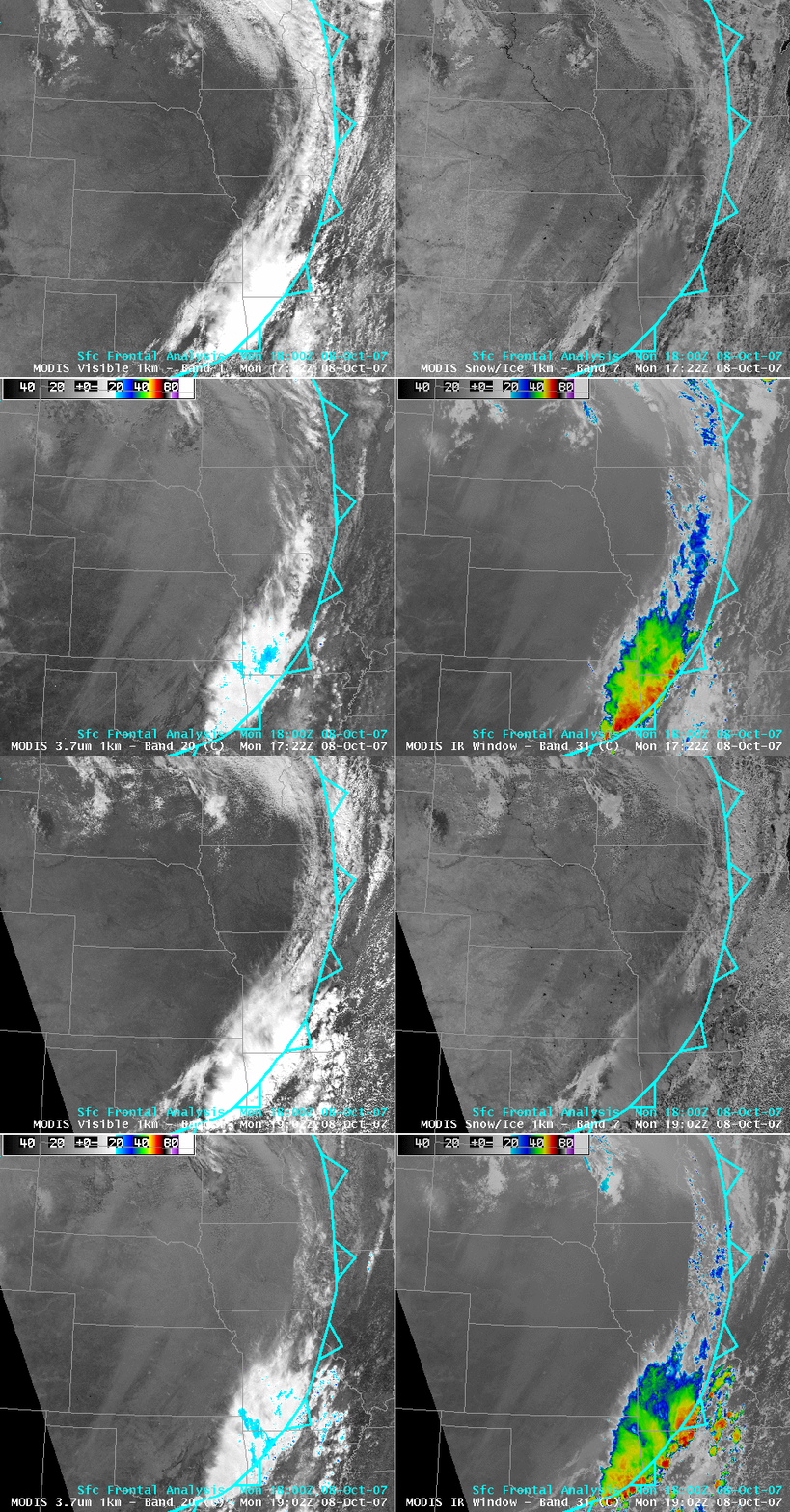
Clearing skies in the wake of a cold frontal passage on 08 October 2007 allowed AWIPS 4-panel images of the MODIS visible, snow/ice, 3.7µm, and 11.0µm IR window channels (above) to reveal extensive swaths of slightly darker (and slightly cooler) wet ground which were oriented southwest-to-northeast across parts of Texas, Oklahoma, Kansas, Nebraska, and Iowa. One-day precipitation amounts within these swaths were as high as 1.0-2.5 inches in Kansas, with similar amounts falling across western Nebraska a day earlier.
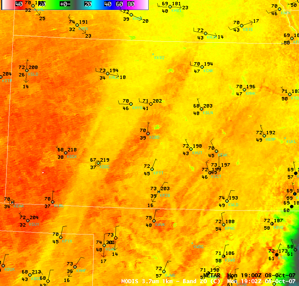
A closer view of western and central Kansas using the MODIS 3.7µm shortwave IR channel (above) shows that the IR brightness temperatures were several degrees cooler within the rain swaths (23-26º C or 73-79ºF, yellow enhancement), versus 28-33ºC or 82-91ºF (red enhancement) outside of the rain swaths — surface METAR data also depicted early afternoon (2:00 PM local time) surface temperatures a few degrees F cooler in the swaths where significant rain had fallen. The dew point temperatures were also generally a few degrees F higher at stations located within the rain swaths.
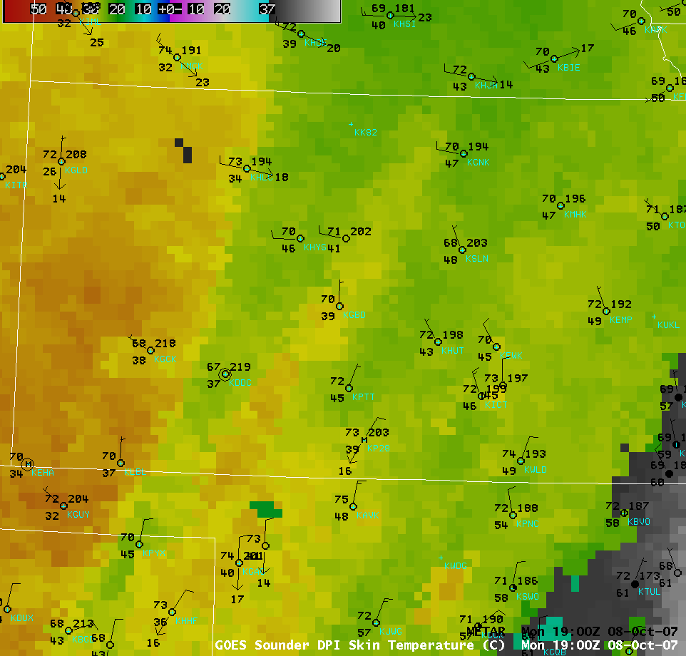
The GOES sounder Skin Temperature derived product image (below) showed a similar temperature difference between the areas that received heavy rain (skin temperature values of 25-27º C, or 77-81º F, green enhancement) and those areas that received little to no rain (skin temperature values of 31-37º C, or 88-99º F, yellow to orange enhancement).
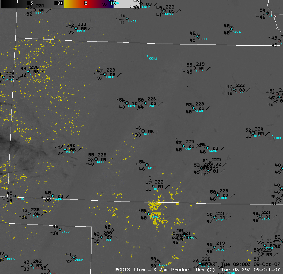
UPDATE: From an operational forecasting standpoint, there was some concern that the areas in Kansas having higher soil moisture might be more prone to fog formation during the upcoming nighttime hours. An AWIPS image of the 1-km resolution MODIS fog/stratus prodcut (below) did not exhibit a fog signal (yellow enhancement) in the Kansas rain swaths at 08:39 UTC (03:39 AM local time) on 09 October. However, it was interesting to note that a few of the stations located within the primary rain swaths — most notably, Hayes (KHYS) and Dodge City (KDDC) in western Kansas, as well as Salina (KSLN) and Pratt (KPTT) in central Kansas — apparently remained a few degrees warmer than adjacent sites just outside of the rain swaths, thereby not cooling close enough to their dew points for widespread radiation fog to form.


