Isolated ASCAT wind maxima and Himawari-9 imagery

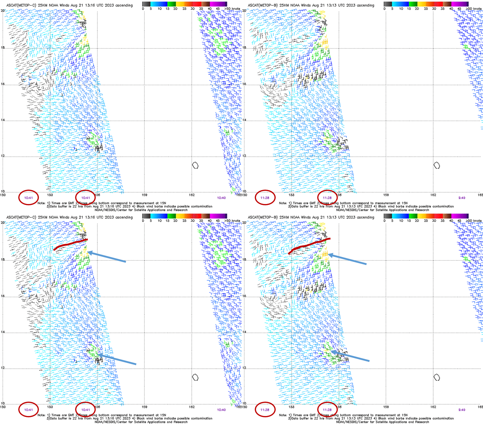
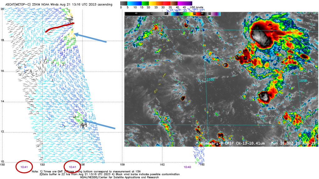
Metop-B and Merop-C overflew the same region of the tropical western Pacific to the east of Guam on 21 August 2023, as shown above (imagery dowloaded from the ‘manati’ website). Metop-C imagery is from 1041 UTC, Metop-B from 1128 UTC. There are two wind maxima in both plots, centered near 13oN, 156oE and near 18oN, 155oE, and highlighted by the blue arrows in the toggle above. What can you infer from just these plots? The stronger winds are likely associated with convection, and the convection near 18oN (the northern convection, vs. the southern convection near 13oN) might be more long-lasting, given its proximity to the shear line (denoted by the red line in the toggle). The 1030 UTC image, below, shows the deep convection associated with these wind events.

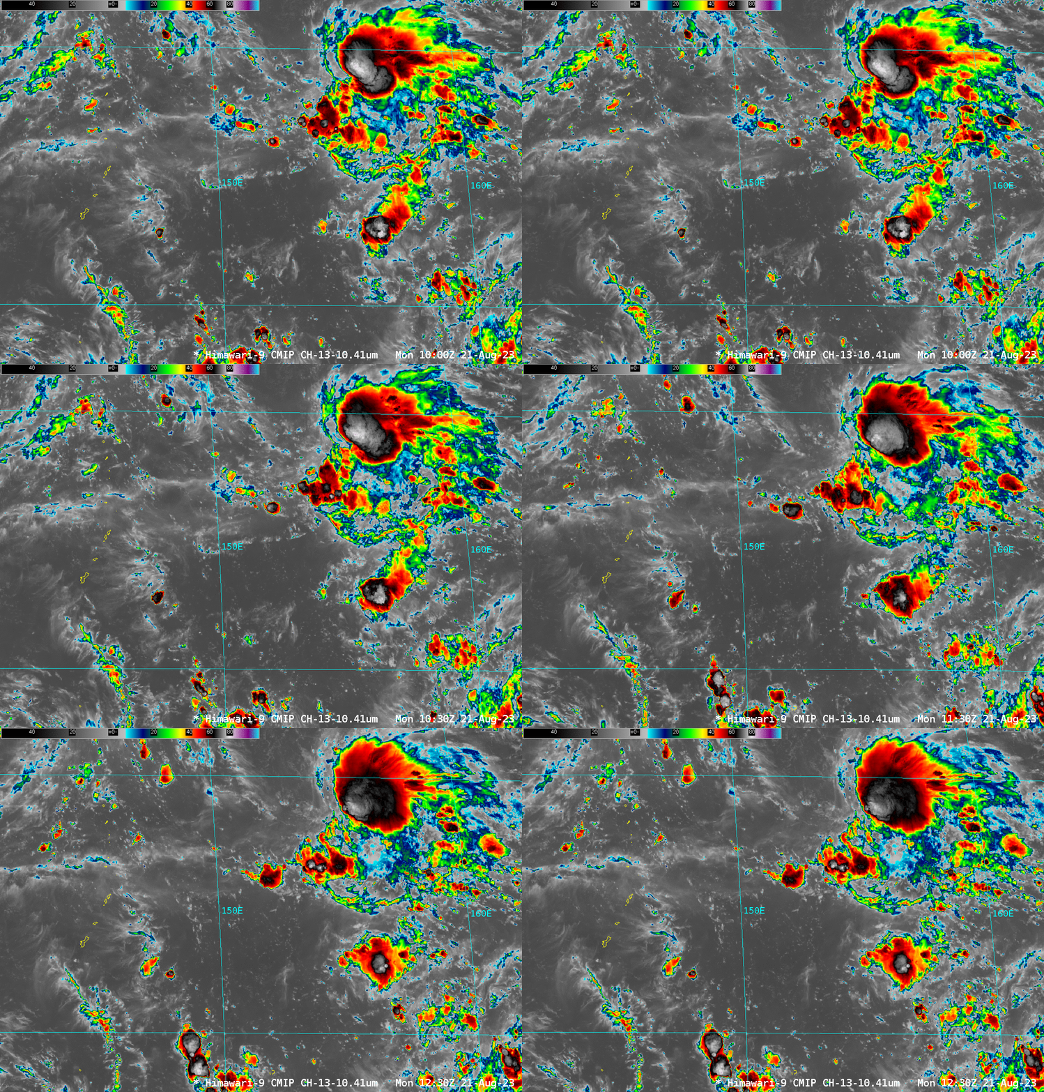
Does the southern convection seems less long-lived than the northern convection? Hard to tell from just this two-plus-hour animation below.

Himawari-9 imagery from the Pacific Island 1 sector at this website, from 21 August 2023, below, does show persistent convection near the shear line (the invest 90W according to JTWC); the southern convection is not as long-lived.

The best way to interpret a single satellite data source is to incorporate other satellite data into the analysis!

