Eruption of Mount Shishaldin in the Aleutian Islands

GOES-18 Ash RGB and SO2 RGB images [click to play animated GIF | MP4]
1-minute GOES-18 True Color RGB images from the CSPP GeoSphere site (below) helped to highlight the ash-rich volcanic cloud (shades of tan to brown) moving northeast from the summit of Shishaldin, and also showed the higher-altitude volcanic cloud drifting southeast (which contained SO2).
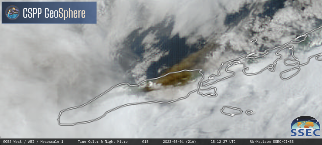
GOES-18 True Color RGB images [click to play MP4 animation]
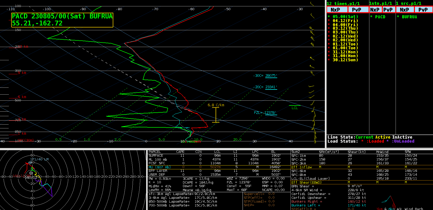
Plot of 0000 UTC rawinsonde data from Cold Bay, Alaska [click to enlarge]
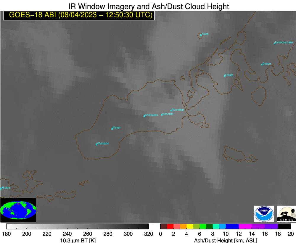
GOES-18 Ash Cloud Height [click to play animated GIF | MP4]
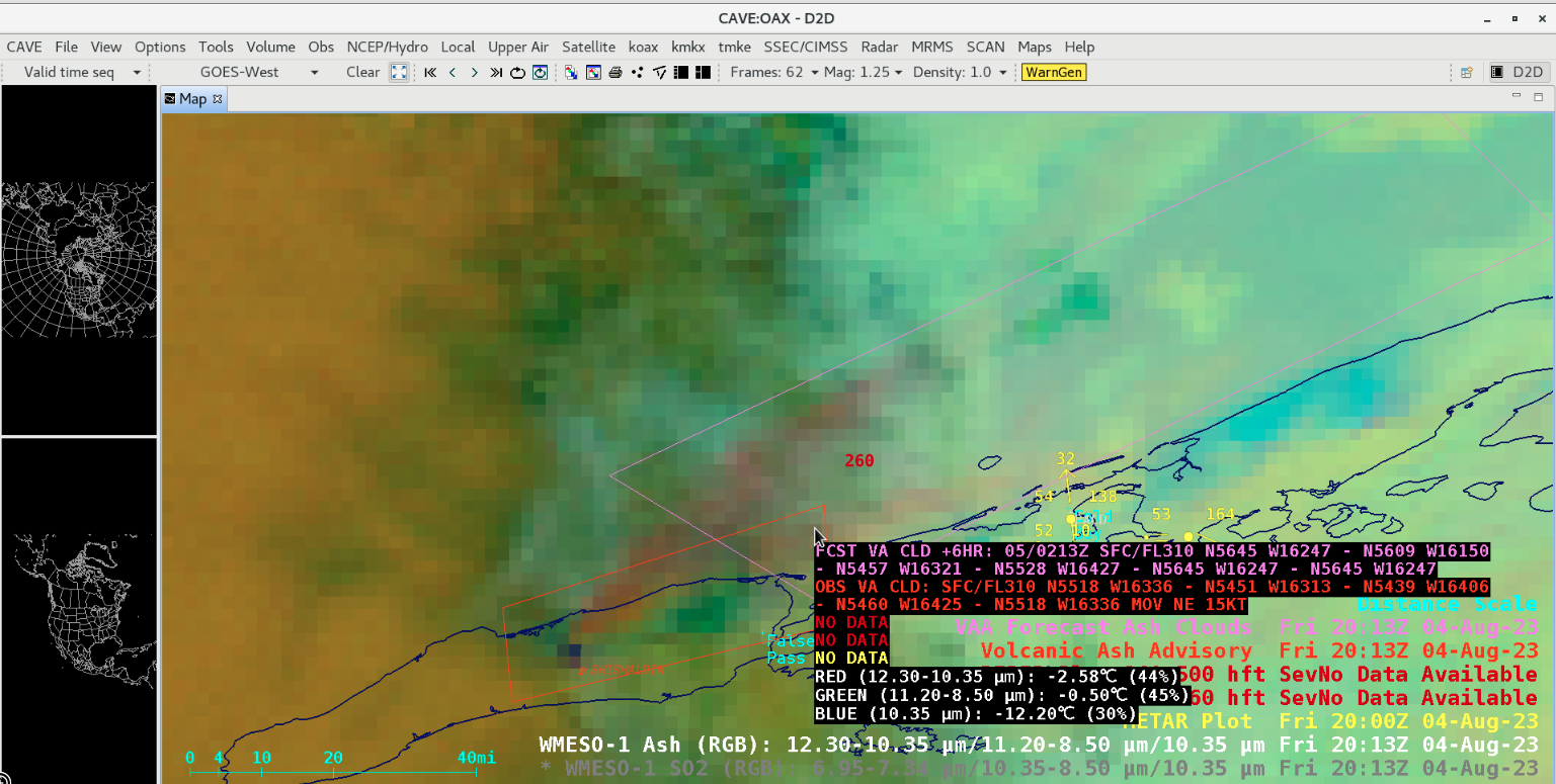
GOES-18 Ash RGB image, with Volcanic Ash Advisory (red) and Forecast (violet) polygons issued at 2013 UTC [click to enlarge]
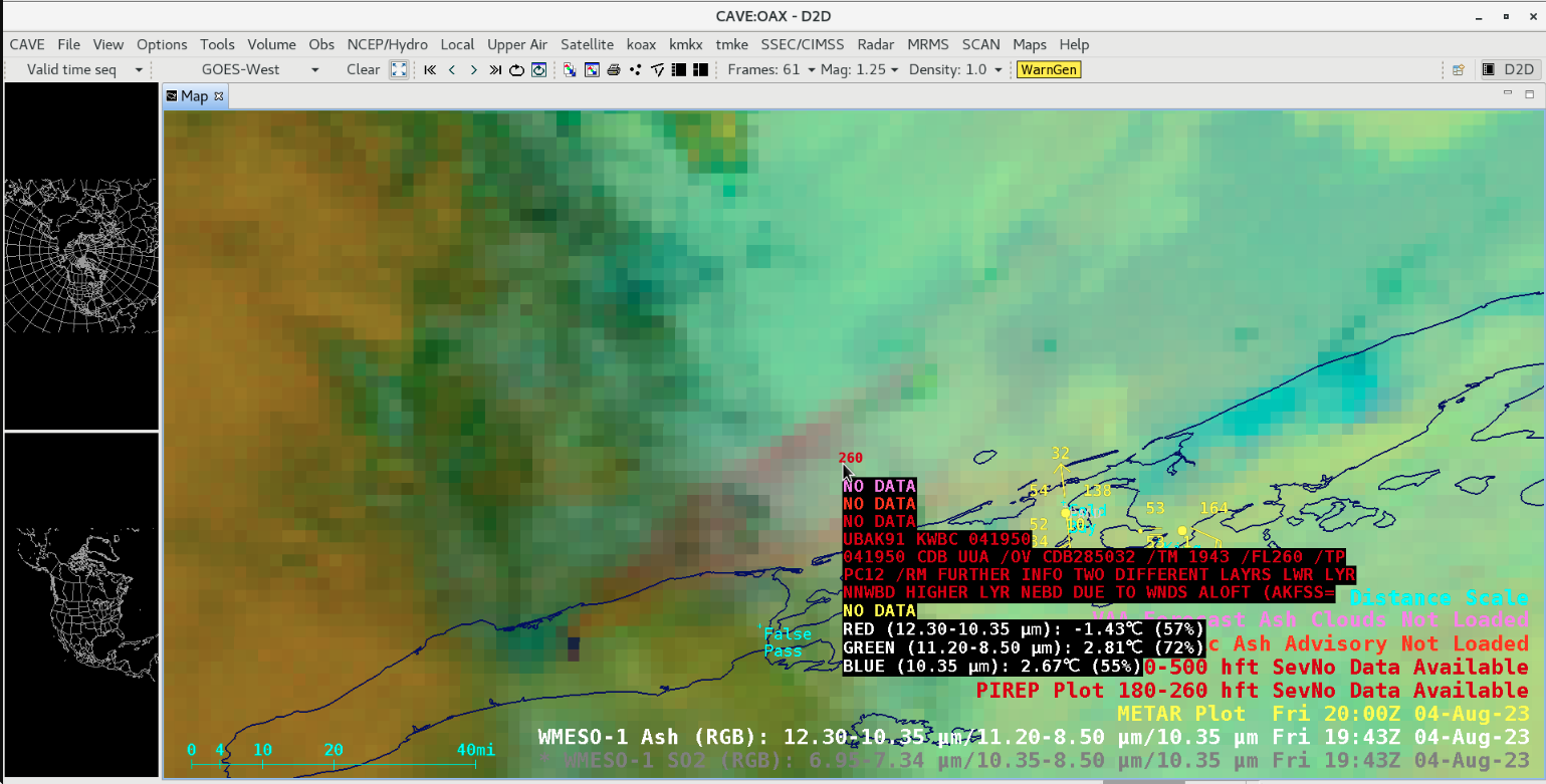
Pilot Report at 1943 UTC, mentioning ash at two different altitudes (moving in different directions) [click to enlarge]
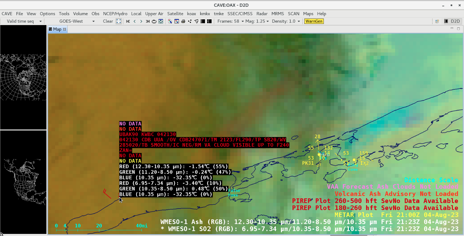
Pilot Report at 2123 UTC, describing volcanic ash (VA) up to an altitude of 24000 ft [click to enlarge]
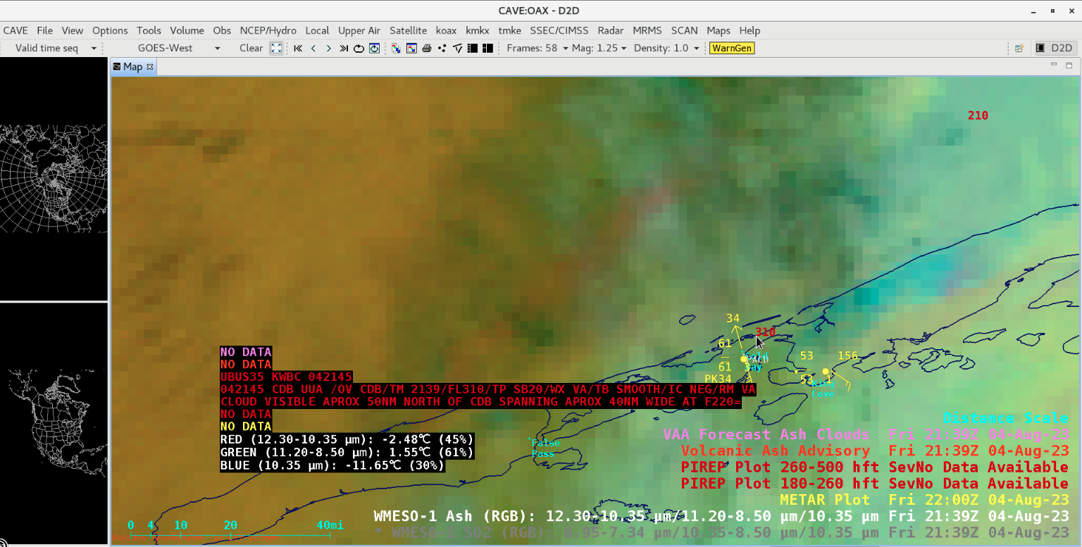
Pilot Report at 2139 UTC, mentioning volcanic ash (VA) visible 50 miles north of Cold Bay (CDB) at an altitude of 22000 ft [click to enlarge]
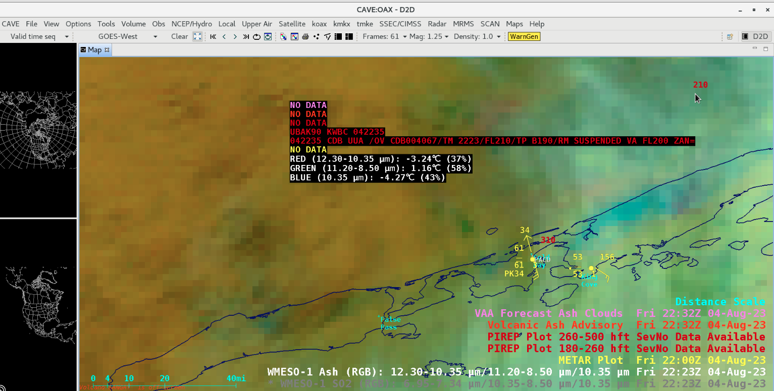
Pilot Report at 2223 UTC, describing volcanic ash (VA) suspended at an altitude of 20000 ft [click to enlarge]