Near-simultaneous SAR observations over Typhoon Doksuri

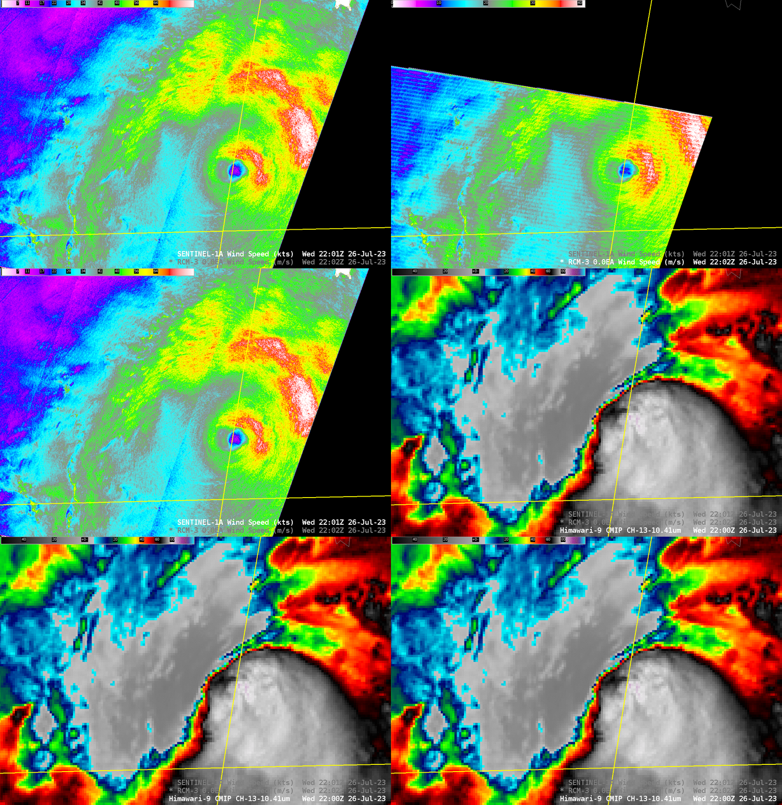
Typhoon Doksuri moved between the Philippines and Taiwan late on 26 July 2023 as it approached mainland China. Both Sentinel-1A and RCM-3 overflew the storm shortly after 2200 UTC on 26 July, and those two scenes are shown above in concert with a Band 13 Himawari-9 Clean Window infrared (10.4 µm) imagery. (All SAR observations of Doksuri are available here). The asymmetric nature of the storm is very notable, with winds exceeding 70 knots in the eyewall to the north and east of the storm (winds exceed 80 knots in the convective band farther to the east — the region of white in the wind enhancement used). In contrast, winds in the western eyewall are between 35 and 50 knots — and there is a curious wind speed minimum just west of the eyewall!
A MIMIC-TC animation from 26 July 2023, below, also shows the marked asymmetry in the storm. Doksuri’s path was right along the northern coastline of of Luzon, the northernmost large island of the Philippines. Mountain ranges on that island may have influenced the structure of the storm.

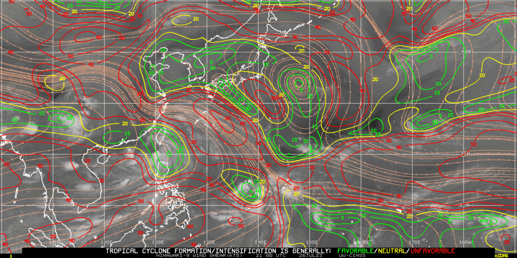
Wind shear over the system at the time of the SAR overpasses was light, but would be acting to displace the convection south and east of the storm center, as observed. The image below was taken from the CIMSS Tropical Weather Site.

For current information on Doksuri, refer to the Joint Typhoon Warning Center, the Tokyo RSMC, the CIRA Real-Time Tropical Website and the CIMSS Tropical Weather Site.

