Mountain waves on water vapor imagery
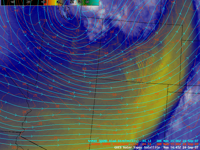
Strong winds in the middle troposphere (50-70 knots at 500 hPa) were seen around the base of a large trough of low pressure that was centered over the Great Basin region of the western US (above) on 24 September 2007.
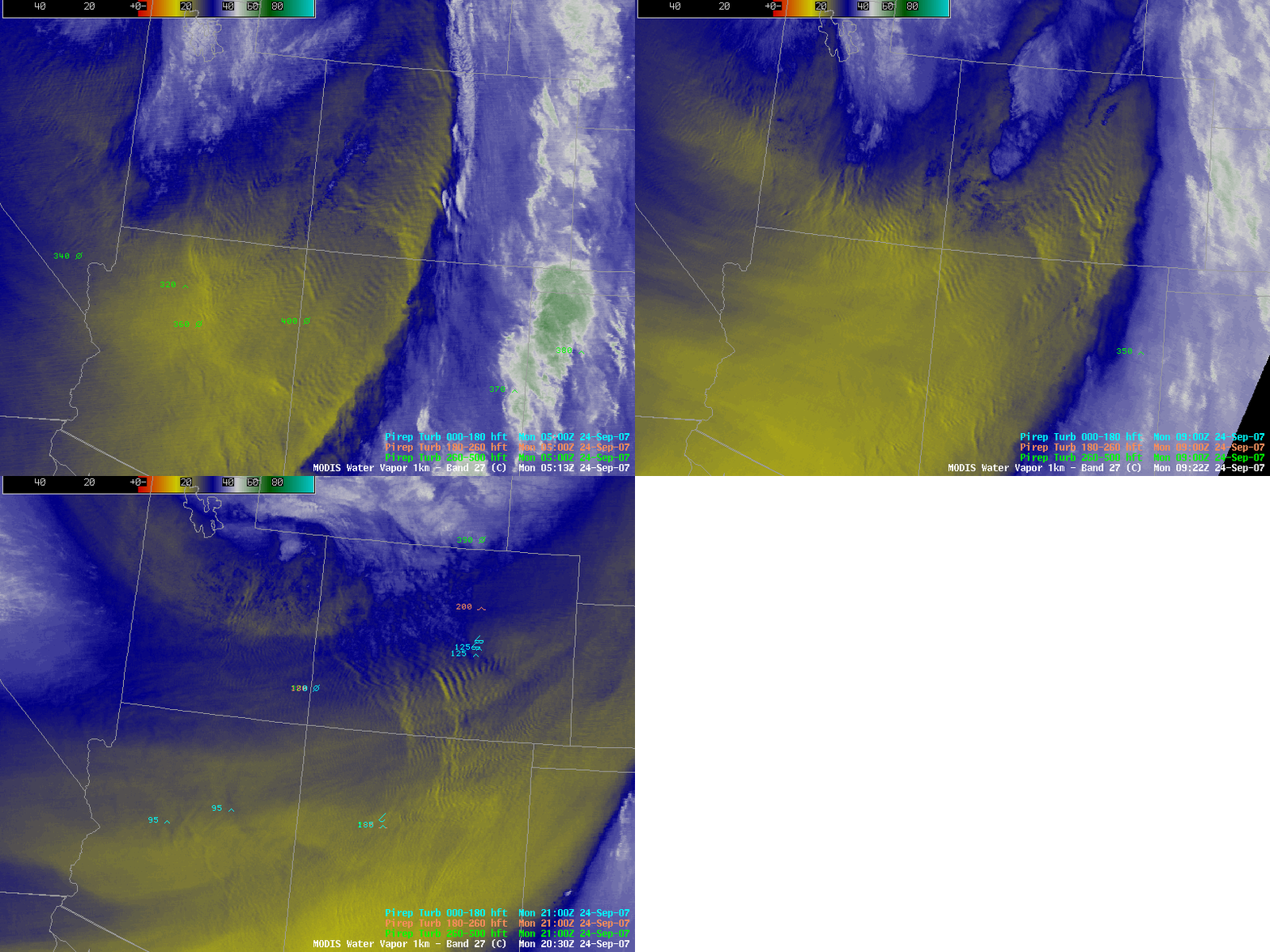
A sequence of three AWIPS images of the MODIS 6.7µm “water vapor channel” from that day (below) revealed widespread areas of mountain wave signatures indicating that the strong winds were interacting with the rugged terrain across the southern and central Rocky Mountains. These types of mountain waves are known to be a satellite signature of lee turbulence; the pilot reports of turbulence were only isolated around the times of the 3 MODIS images (05:13, 09:22, and 20:30 UTC), but it could be that no aircraft were flying in the exact areas (or altitudes) where the lee wave signatures (and any associated turbulence) might have been present.
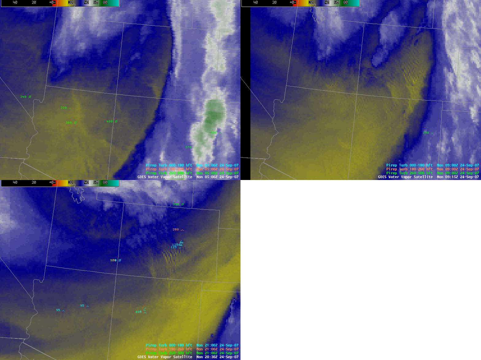
The corresponding sequence of three GOES-12 water vapor images (below) did indicate a few of the more well-defined areas of mountain waves signatures (especially over central Colorado), but the presentation of these features using 4-km resolution GOES data was not as clear as it was using the 1-km resolution MODIS data.


