Cold water upwelling in western Lake Michigan
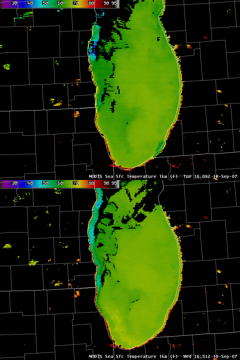
As pointed out by the NWS forecast office at Milwaukee/Sullivan WI, a narrow ribbon of cooler water temperatures was seen along parts of the western nearshore waters of Lake Michigan on 19 September 2007. Strong westerly winds in the wake of a cold frontal passage aided in the upwelling of cooler water from below the lake surface, which was evident in a comparison of AWIPS images of MODIS Sea Surface Temperature (SST) from 18 and 19 September (above).
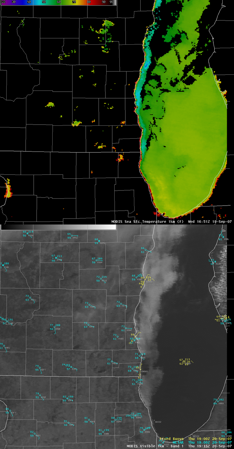
A comparison of the 19 September MODIS SST image with the MODIS visible channel image on the following day (20 September, below) shows that patchy low-level fog and stratus cloud had formed over much of the western portion of Lake Michigan (where cooler SST values were seen on the previous day).
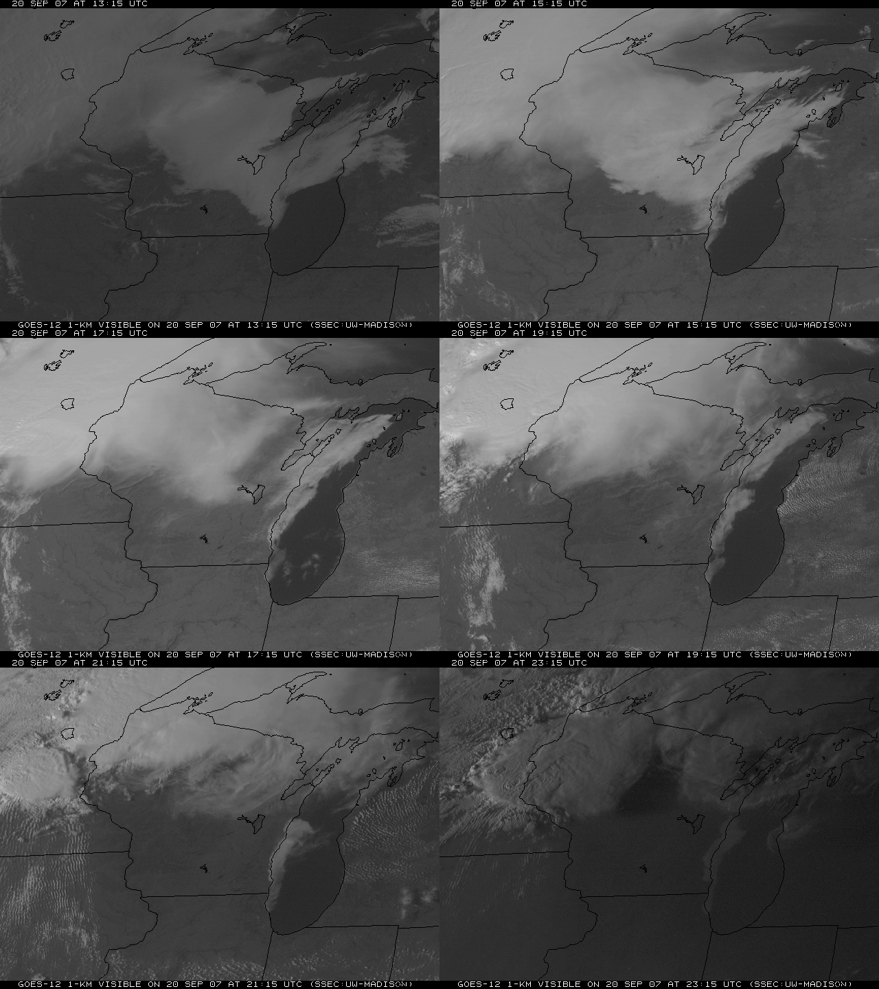
An animation of GOES-12 visible imagery (below) indicated that the offshore fog and stratus persisted for much of the day on 20 September, and even began to move inland along parts of the lakeshore counties in southeastern Wisconsin shore as an easterly component of the surface winds increased during the afternoon hours. The cooler nearshore waters seen on the MODIS SST images above likely played a role in maintaining the fog/stratus along the west coast of Lake Michigan.
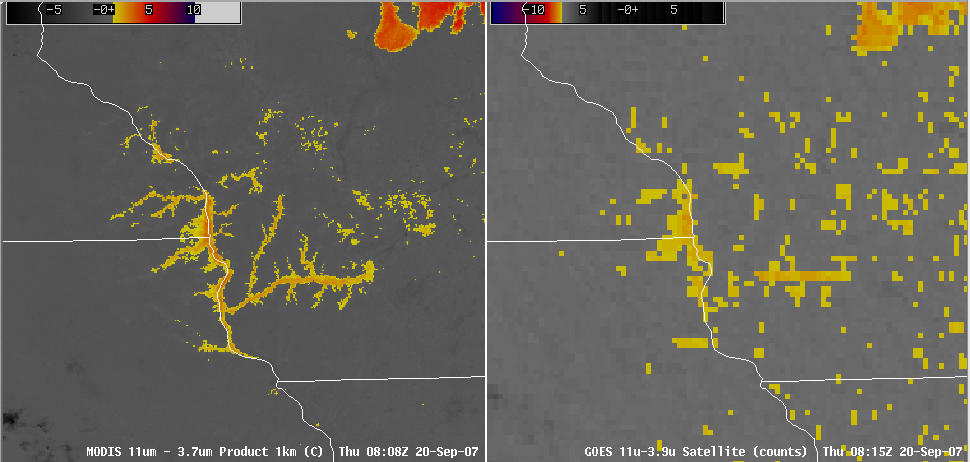
Also evident in the early portion of the GOES-12 visible animation are fingers of river valley fog across southwestern Wisconsin, northeastern Iowa, and southwestern Minnesota — this fog (which formed during the nighttime hours) quickly burned off with daytime heating. A comparison of the MODIS and GOES-12 fog/stratus products (below) around 08 UTC (3am local time) shows the more detailed river valley fog structure that was apparent on the 1-km resolution MODIS imagery (compared to the 4-km resolution data from GOES-12).


