Elie, Manitoba tornado
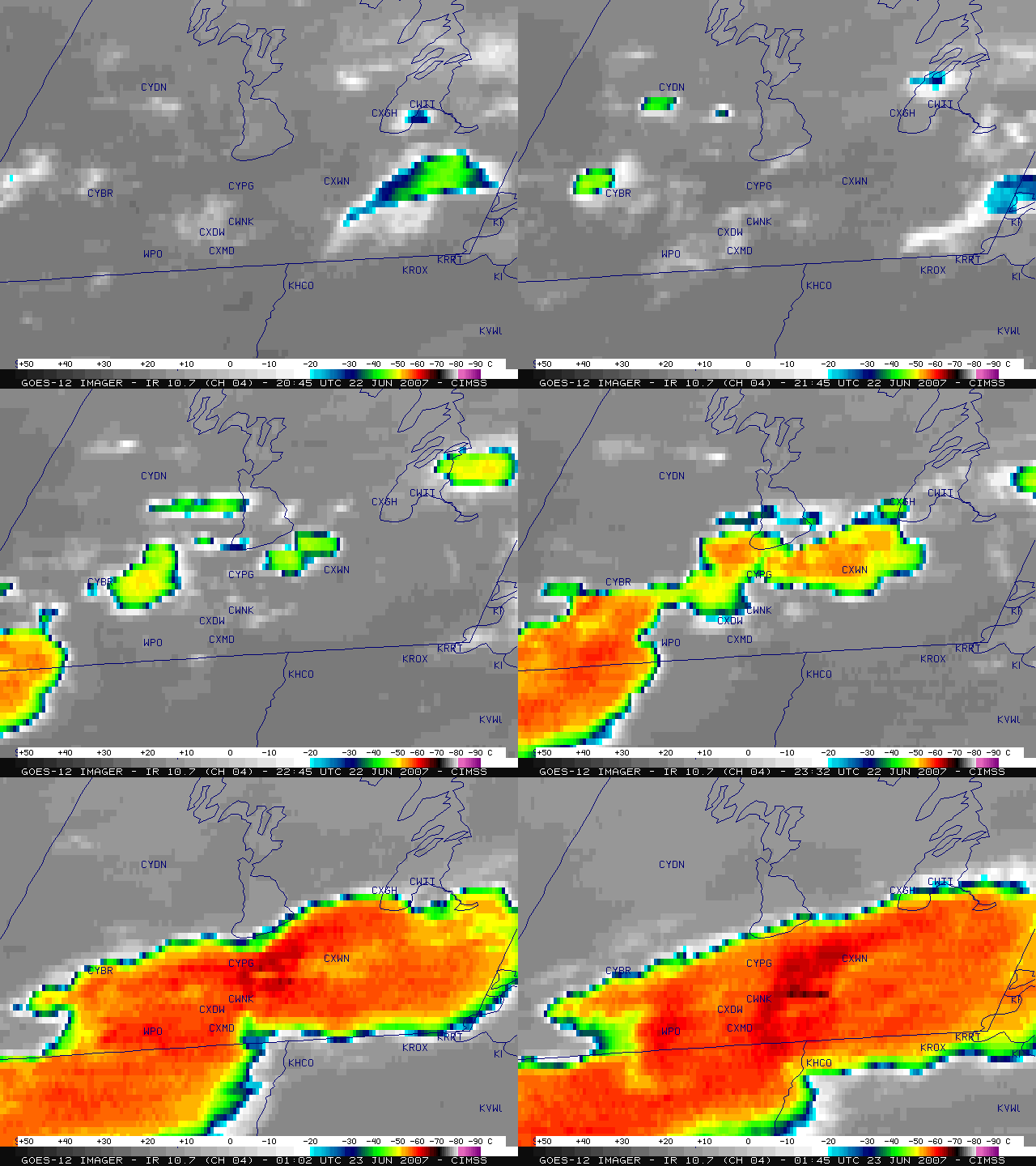
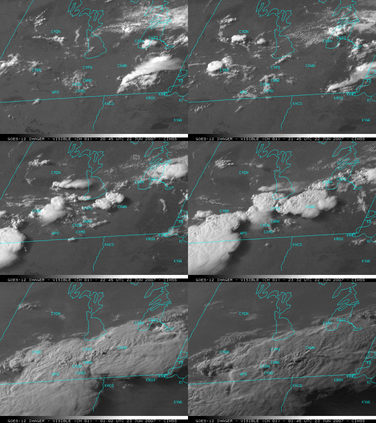
The first documented F5 tornado damage on record in Canada occurred on 22 June 2007. GOES-12 10.7µm InfraRed channel imagery (above) and visible channel imagery (below) show the development of severe convection that spawned the tornado that struck the town of Elie in south-central Manitoba (just west of Winnipeg, station identifier CXWN) around 23:30 UTC. A subtle “enhanced-v” signature was seen on the GOES-12 IR imagery (with the most well-defined cold/warm cloud top temperature couplet of -62ºC/-51ºC appearing on the 00:15 UTC IR image); however, in this case the enhanced-v signature did not have the typical 20-30 minutes of “severe weather lead time” that is often noted with severe storms in the central US.
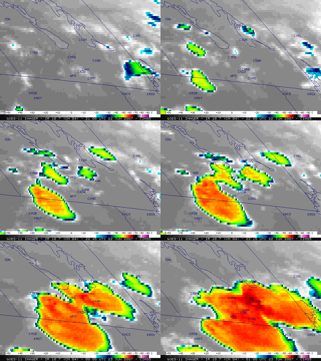
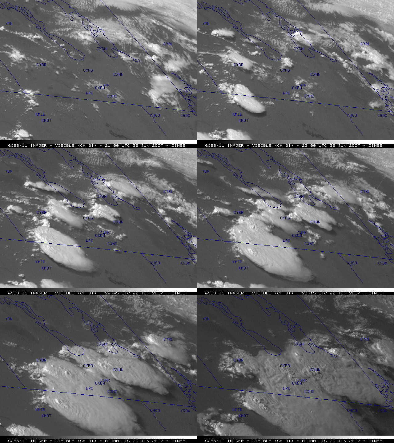
An alternate view of these severe thunderstorms is available using imagery from the GOES-11 satellite (below), which is positioned much father to the west (at 135º west longitude) than GOES-12 (at 75º west longitude). The well-defined cold/warm cloud top temperature couplet associated with the developing enhanced-v signature was evident on GOES-11 imagery a bit earlier in time (at 23:45 UTC).
An overpass of the NOAA-15 polar-orbiting satellite occurred around 22:31 UTC; a false-color image (using AVHRR channels 1, 2, and 3) shows a pair of convective towers that appear to be developing along a SW-NE oriented boundary just southeast of Lake Manitoba (below).
A closer view using the NOAA-15 AVHRR 10.8µm IR channel data (below) reveals cloud top temperature structures that resemble cold/warm couplets associated with those two developing storms just southeast of Lake Manitoba — however, the other NOAA-15 AVHRR visible and IR channel images suggest that the cloud mass was probably “thinner” in those particular regions, allowing warmer radiation from below to bleed upward through the cloud and be sensed as warmer IR pixels.


