Accessing and displaying historical ATMS imagery and products with Polar2Grid (version 3.0)
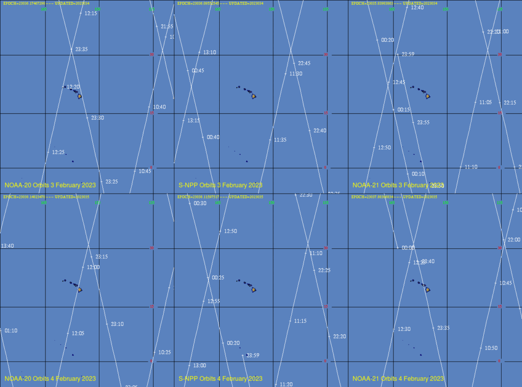
Polar2Grid version 3.0 (released earlier this year; see this blog post, and this one on displaying individual VIIRS channels) has the capability (like earlier versions) to create imagery from selected individual ATMS (Advanced Technology Microwave Sounder) channels, and for some derived products as well. In this example, I would like to create imagery on February 3rd and 4th around the Hawai’ian Islands. The ATMS is an instrument on board Suomi-NPP, NOAA-20, and NOAA-21. When, during those two days (I’m most interested in early morning on the 4th), did these Low Earth Orbit satellites view the Hawai’ian Island chain? The SSEC Polar Orbit Track website answers that question. Orbits are shown below from the ‘Hawaii’ sector at that website for Suomi NPP (3 February, 4 February), NOAA-20 (3 February, 4 February) and NOAA-21 (3 February, 4 February) are shown below. Overpass times of interest are, for NOAA-20, 23:30-23:35 on 3 February and 12:00-12:05 on 4 February; for Suomi-NPP, 12:50-12:55 on 4 February; for NOAA-21, 23:55-23:59 on 3 February and 12:23-12:30 on 4 February.
Polar2Grid software expects data of a certain type. When ordering the data from NOAA-CLASS, select JPSS Sounder Products as shown below, and then click GO:

After clicking ‘GO’ you will see the order page, as shown below. The one below is filled out for NOAA-20 data between 12:00 and 12:05 on 4 February. The Datatype is ‘MIRS Precipitation and Surface Products’ — and the NOAA-20 Satellite is checked. (Note that for this date/time, NOAA-21 data are not available, as data were still provisional; once data become operational, a ‘NOAA-21’ selection will be available). You will also note that a map is available, and one could order data based on latitude/longitude bounds on the map, but I find ordering specific times simpler.
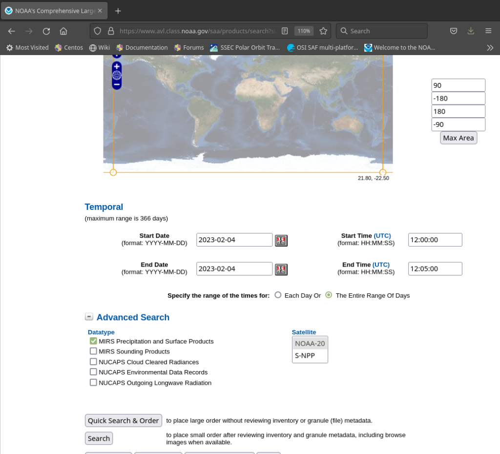
When you click on ‘Search’, one file is returned, as shown below. Order it!
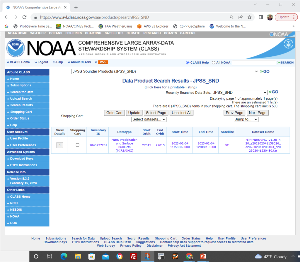
The file supplied by NOAA CLASS, below, is a tar file and contains data from 1158 though 1208 UTC. Download the file from NOAA CLASS and un-tar it on your local machine.
NPR-MIRS-IMG_v11r8_n20_s202302041158026_e202302041208103_c202302041230480.tar
Note that only IMG files are recognized by Polar2Grid; if have instead a SND file by mistake, go back and re-order! The expanded tar file included 19 separate files, each holding about 30 seconds’ worth of data. I put the data into a single directory, and used Polar2Grid’s –list-products-all in conjunction with the ‘mirs‘ reader to see what kind of data and products were available, that is:
./polar2grid.sh -r mirs -w geotiff --list-products-all -f /path_to_data/WFOHNL/MIRS/N201/*.nc .
Many different individual channels and products are available, as shown below, in a list I’ve modified from the Polar2Grid output (which gives one per line!).
Standard Available Polar2Grid Products
btemp_165h btemp_183h1 btemp_183h2 btemp_183h3 btemp_183h4 btemp_183h5 btemp_23v btemp_31v btemp_50h btemp_51h btemp_52h btemp_53h btemp_54h1 btemp_54h2 btemp_55h btemp_57h1 btemp_57h2 btemp_57h3 btemp_57h4 btemp_57h5 btemp_57h6 btemp_88v clw rain_rate sea_ice sfr snow_cover surface_type swe tpw tskin
Next — after downloading other days/times from Suomi-NPP — I created a mapping region for the data using the p2g_grid_helper shell scripts that sits within the Polar2Grid bin directory. The p2g_grid_helper command I used is below. The grid (‘HNL’) — with a grid spacing of 750 x 750 m — is centered, roughly, on Honolulu, has 1440 elements and 1200 lines, and the created attributes are stored in the named yaml file. (The grid resolution is much greater than the ATMS microwave resolution, which for 31 GHz is at best 75 km!)
./p2g_grid_helper.sh HNL -158.0 21.4 750 -750 1440 1200 > $POLAR2GRID_HOME/HNL.yaml
I want to create images for 31 and 88 GHz data, and also the MIRS Total Precipitable Water product. The Polar2Grid call, using the mirs reader and the geotiff writer, is shown below; the -p (for product) flag is followed by the list of fields to create, and the fields are gridded onto the HNL grid that has specifications within the yaml file specified with the –grid-configs flag.
./polar2grid.sh -r mirs -w geotiff -p btemp_88v btemp_31v tpw -g HNL --grid-configs $POLAR2GRID_HOME/HNL.yaml -f /path_to_data/WFOHNL/MIRS/N201/NPR-MIRS-IMG_v11r8_*.nc
The Polar2Grid command above created three files: noaa20_atms_btemp_88v_20230204_115802_HNL.tif, noaa20_atms_btemp_31v_20230204_115802_HNL.tif and noaa20_atms_tpw_20230204_115802_HNL.tif. I did a similar command with Suomi NPP data from NOAA CLASS.
Polar2Grid supplies software to add information to these files. For example, the grey-scaled .tif files can be color-enhanced using the add_colorbar script:
./add_colormap.sh /home/scottl/Polar2Grid/polar2grid_v_2_3/colormaps/amsr2_36h.cmap n*atms*_HNL.tif
The command above transforms all the .tif files that match the wildcarded name — including both noaa20 and npp imagery — to .tif files that are color enhanced. Next, I used ./add_coastlines.sh to add the Hawai’ian islands, and a colorbar to all of the .tif images matching the wildcarded filename. A png file for each matching .tif file was created.
./add_coastlines.sh –add-coastlines –coastlines-resolution f –add-colorbar –colorbar-height 32 –colorbar-text-size 16 –colorbar-tick-marks 25 n*_HNL.tif
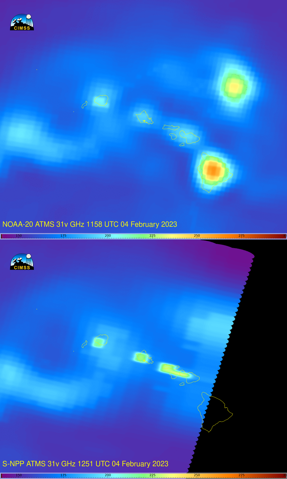
I added annotation to the images, using ImageMagick. Results are shown at top (for 31 GHz) and below (for 88 GHz and MIRS total precipitable water (TPW)).
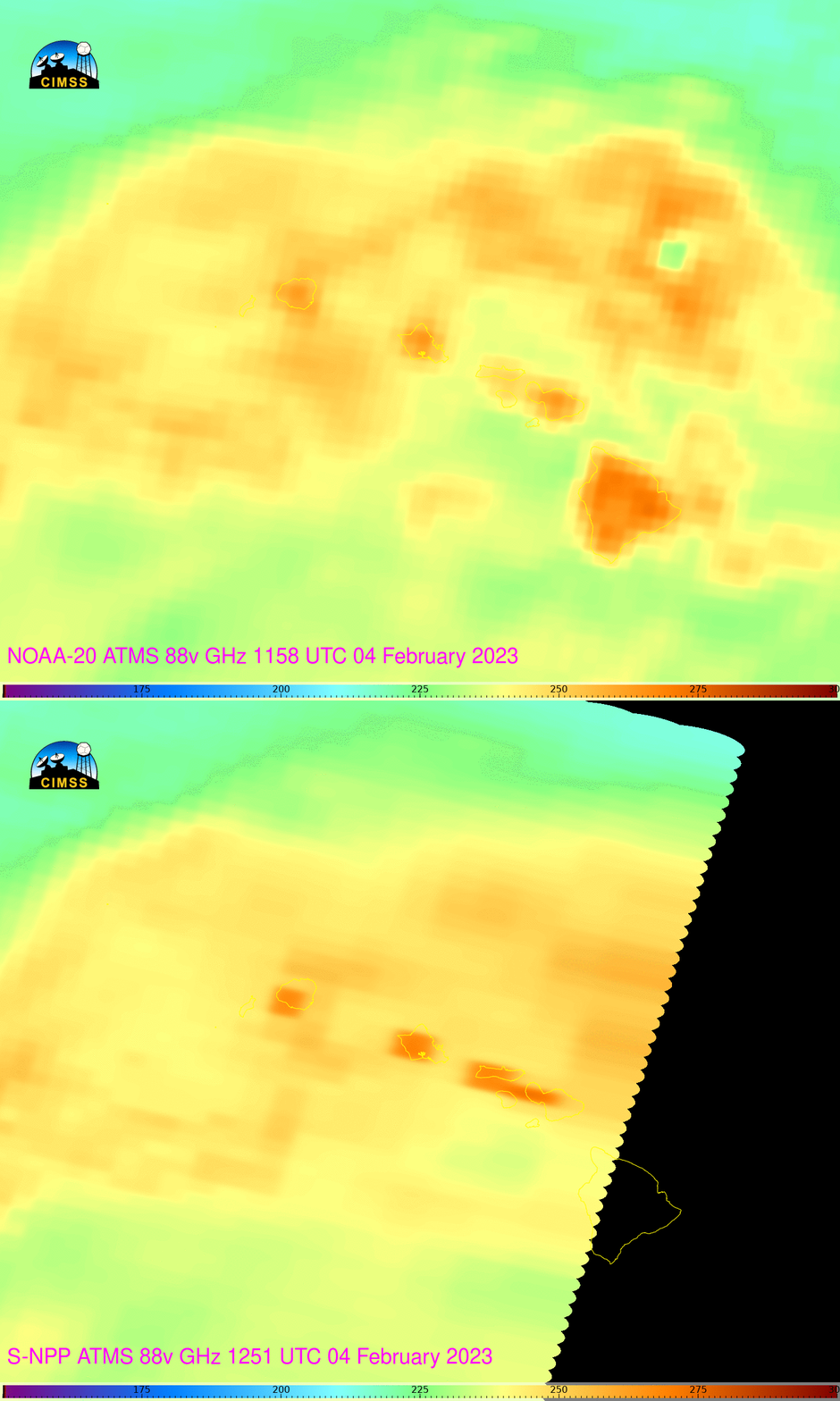
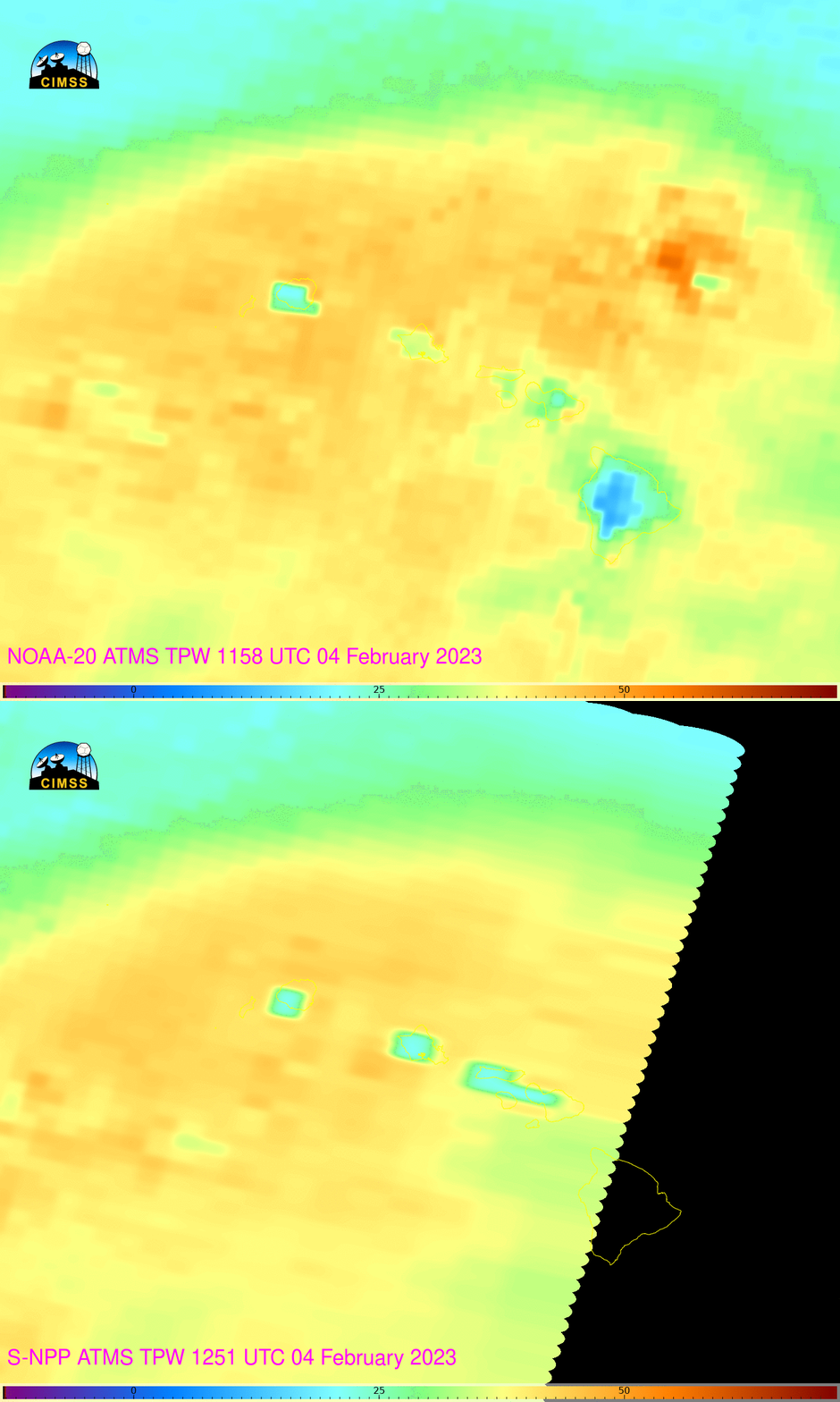
The 31 GHz imagery at the top shows a region south of Oahu where nominally warmer brightness temperatures (lighter blue surrounded by darker blue (see this annotated image — focus between the two arrows)) What might happen as this region moves over the islands?
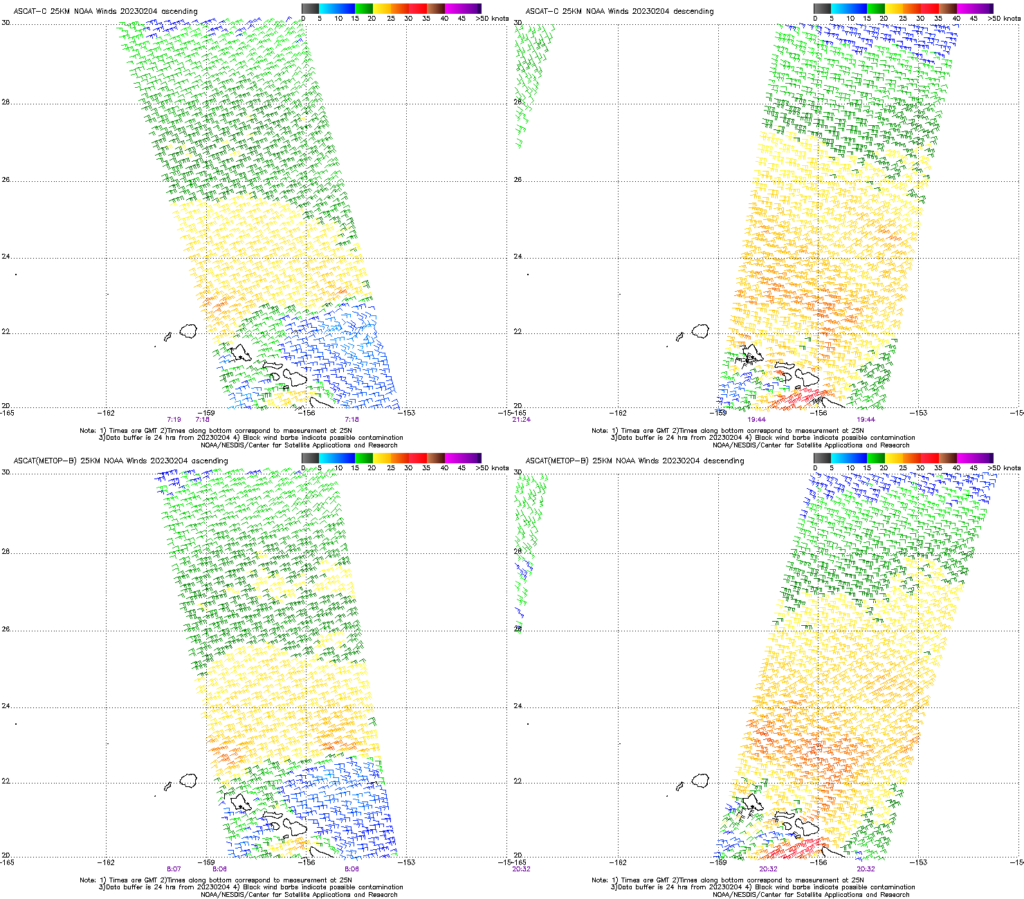
Microwave data can also reveal wind structures that might effect convective development. ASCAT imagery from MetopB and MetopC, below, do show an expansion of stronger winds and the development of shear between the ascending (left in the image below) and descending (right in the image below) passes.
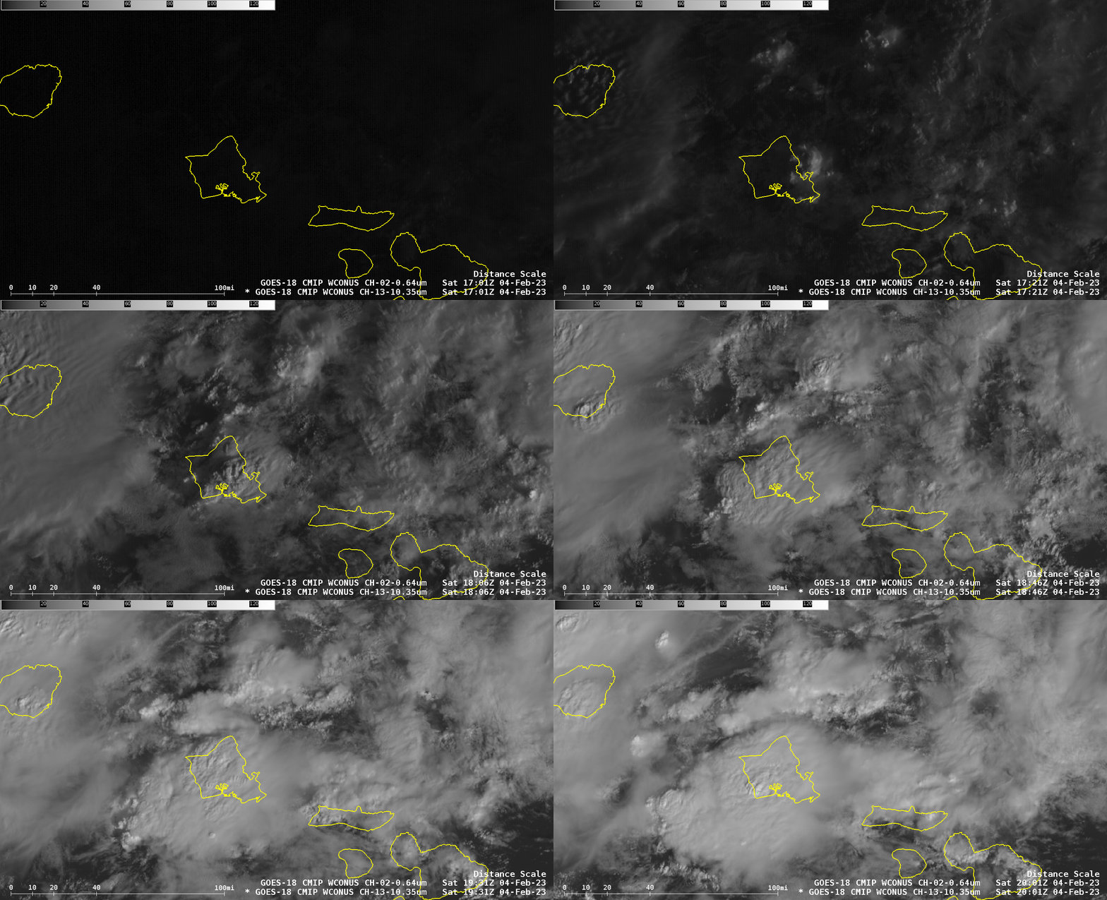
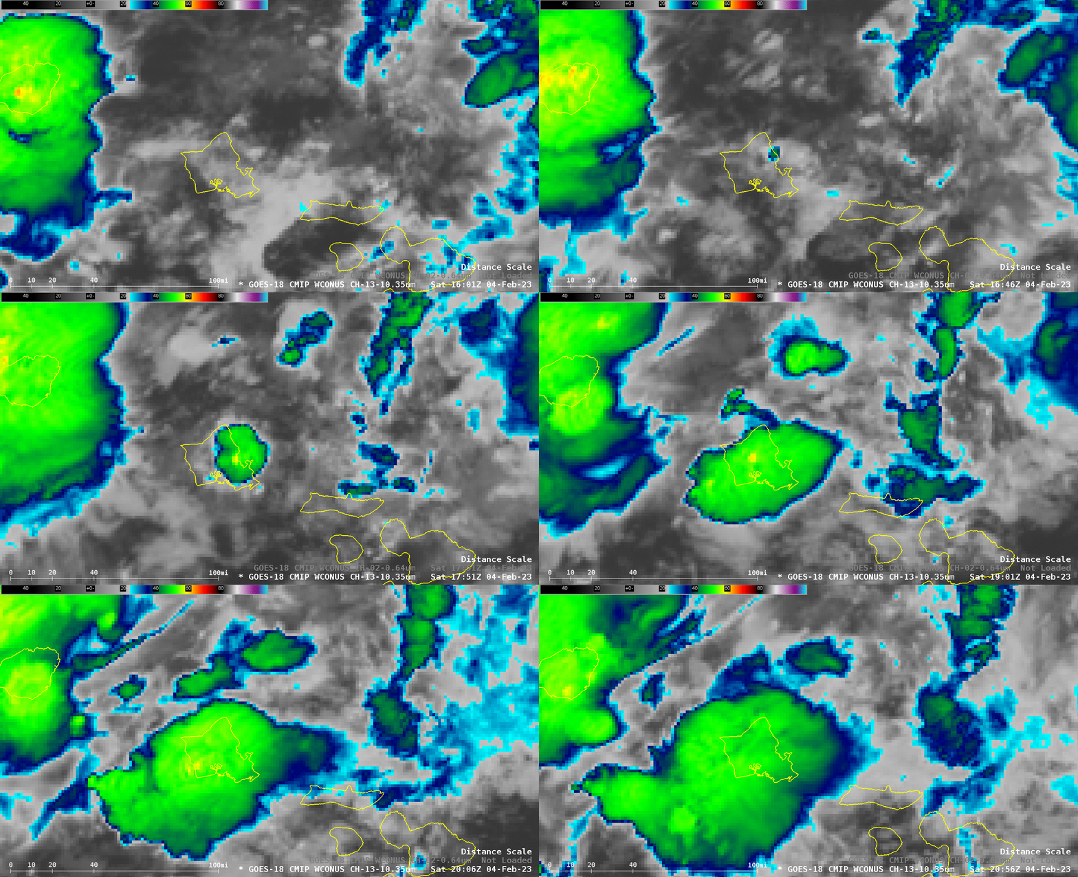
GOES-18 Visible (below) and Infrared (at bottom) imagery both show the development of convection starting along the north shore of Oahu and developing westward across the entire island. An interesting question is: Did the faint feature apparent in the microwave imagery affect the convective development?
