Predicting lightning initiation with AI
The NOAA/CIMSS ProbSevere LightningCast model uses GOES-R ABI reflectances and brightness temperatures along with artificial intelligence methods to predict next-hour lightning anywhere in the GOES-R field of view. It is particularly adept at nowcasting lightning initiation.
A long, potent cold front spawned a number of storms from Iowa to Texas today (many of which were severe). The GOES-16 mesoscale sectors were providing rapid-scan service to forecasters in the middle of country, providing 1-minute updates of satellite imagery.
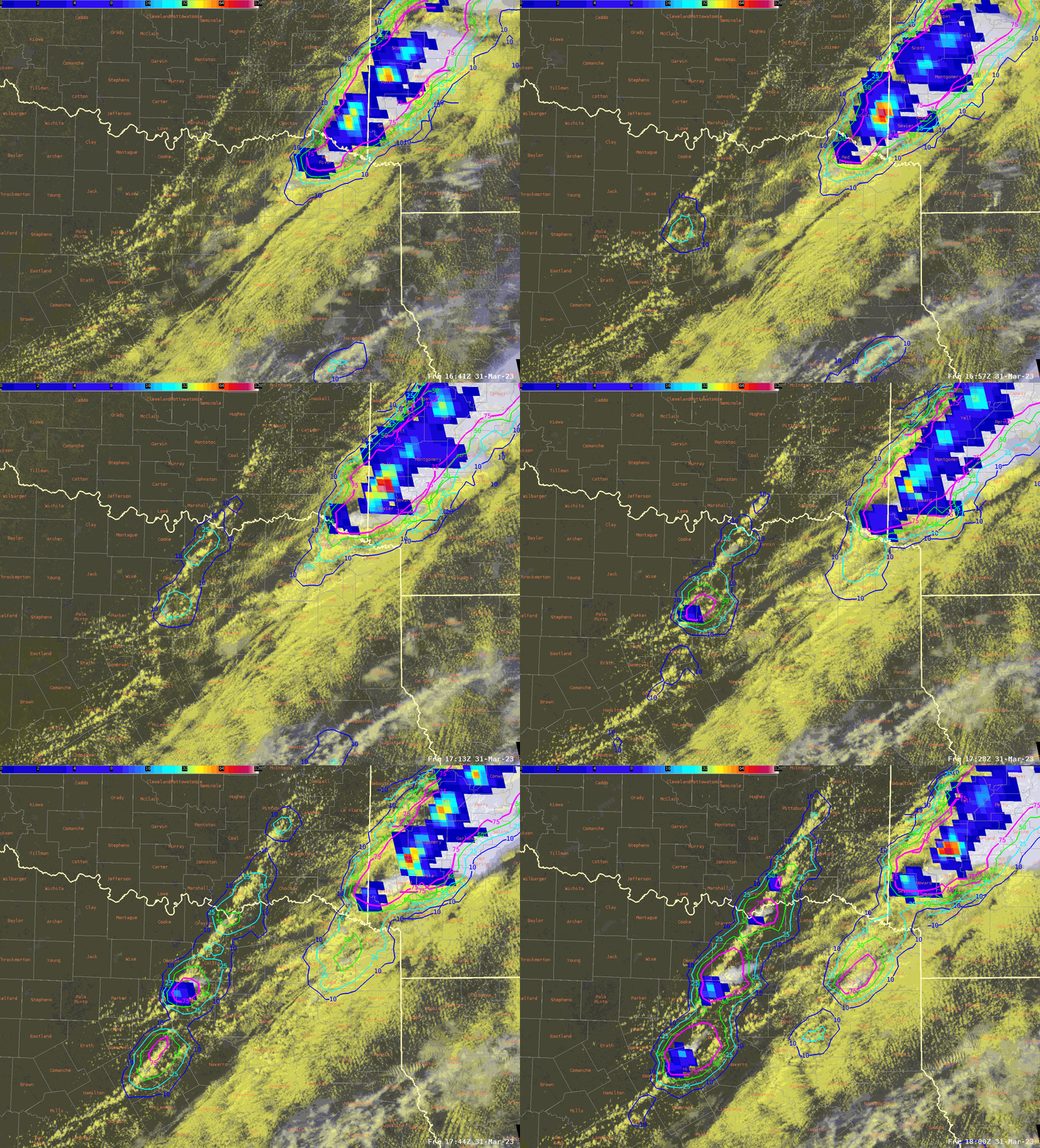
In Texas, the cold front is clearly delineated between clear sky to its west and low clouds to its east, in the warm/moist sector. The probabilities of lighting from LightningCast increased rather quickly from <10% to >75% in many regions, prior to the first detection of GLM flashes (Figure 1). Elevated probabilities of lightning were observed from 15 to 35 minutes prior to lightning initiation for most of these storm cells.

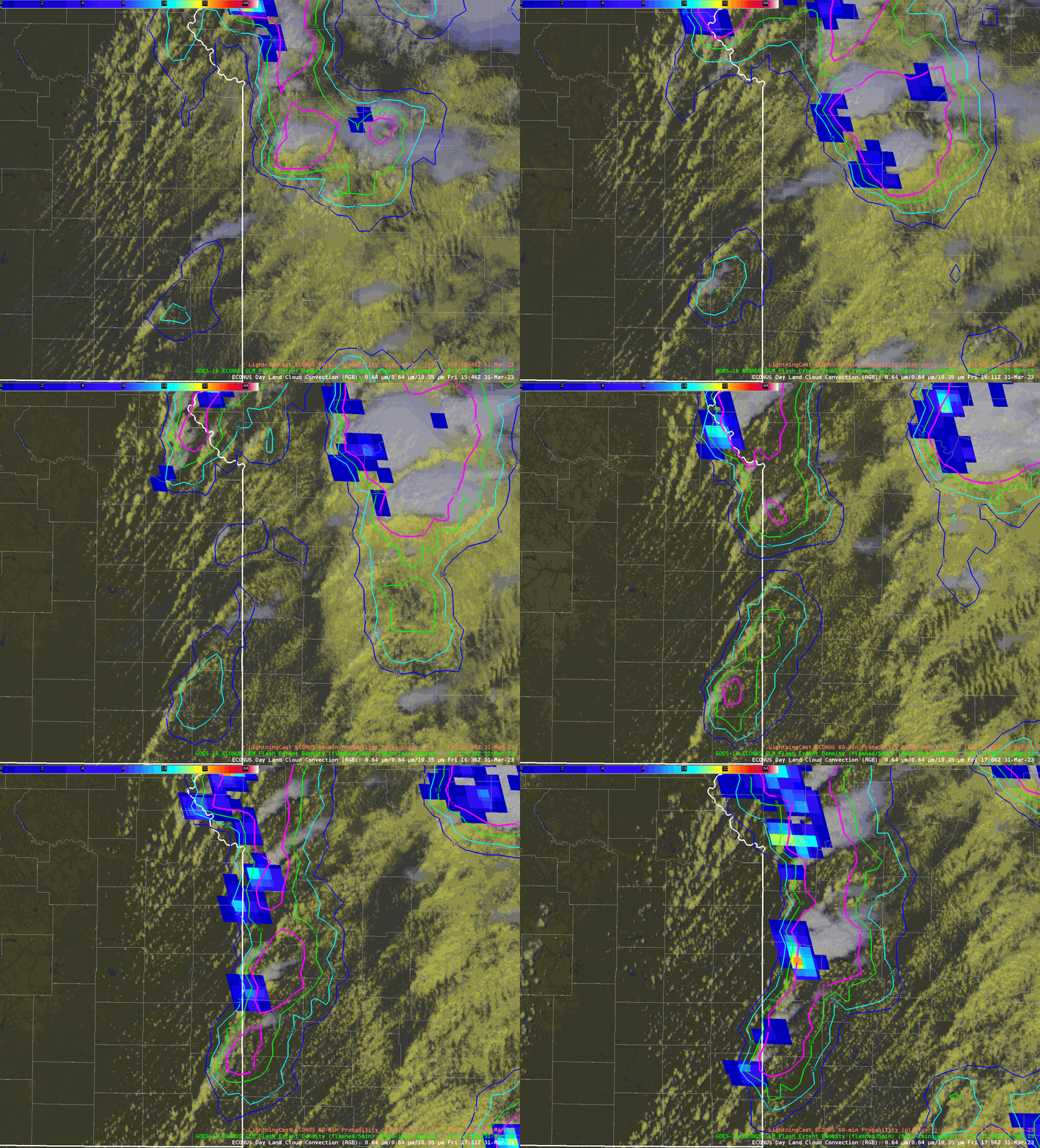
Further north, along the Kansas / Missouri border, LightningCast accurately highlighted the line of lightning initiation forced by the cold front (Figure 2). Along this part of the front, there is good evidence that the model’s contours of probability are leading the convective regions, anticipating the prevailing motion. While LightningCast currently only uses a single time of data to make predictions, it seems to have learned (to some extent) the motion of storms from patterns in single images of reflectance and brightness temperature data.
LightningCast will be evaluated by forecasters at the 2023 Hazardous Weather Testbed. Forecaster feedback is important to help direct research-and-development and potential transition-to-operations efforts.


