Cyclone Freddy intensifies to a Category 5 storm

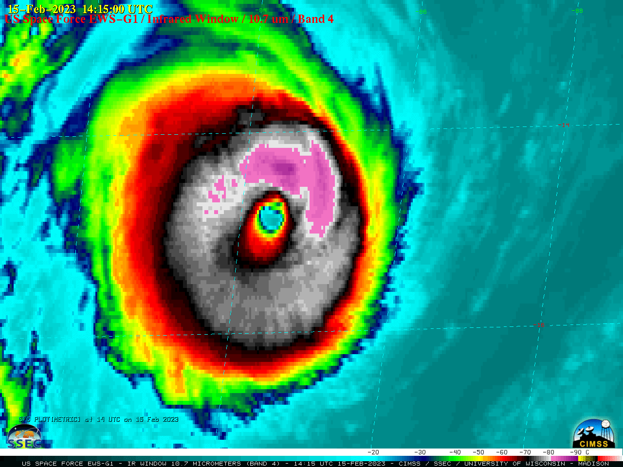
EWS-G1 Infrared Window (10.7 µm) images [click to play animated GIF | MP4]
US Space Force EWS-G1 — formerly GOES-13 — Infrared Window (10.7 µm) images (above) showed Cyclone Freddy in the South Indian Ocean, after it re-intensified to a Category 4 storm at 0000 UTC on 15 February 2023. Freddy then briefly peaked at 145 knots at 0000 UTC on 16 February (SATCON), making it the first Category 5 tropical cyclone of 2023.
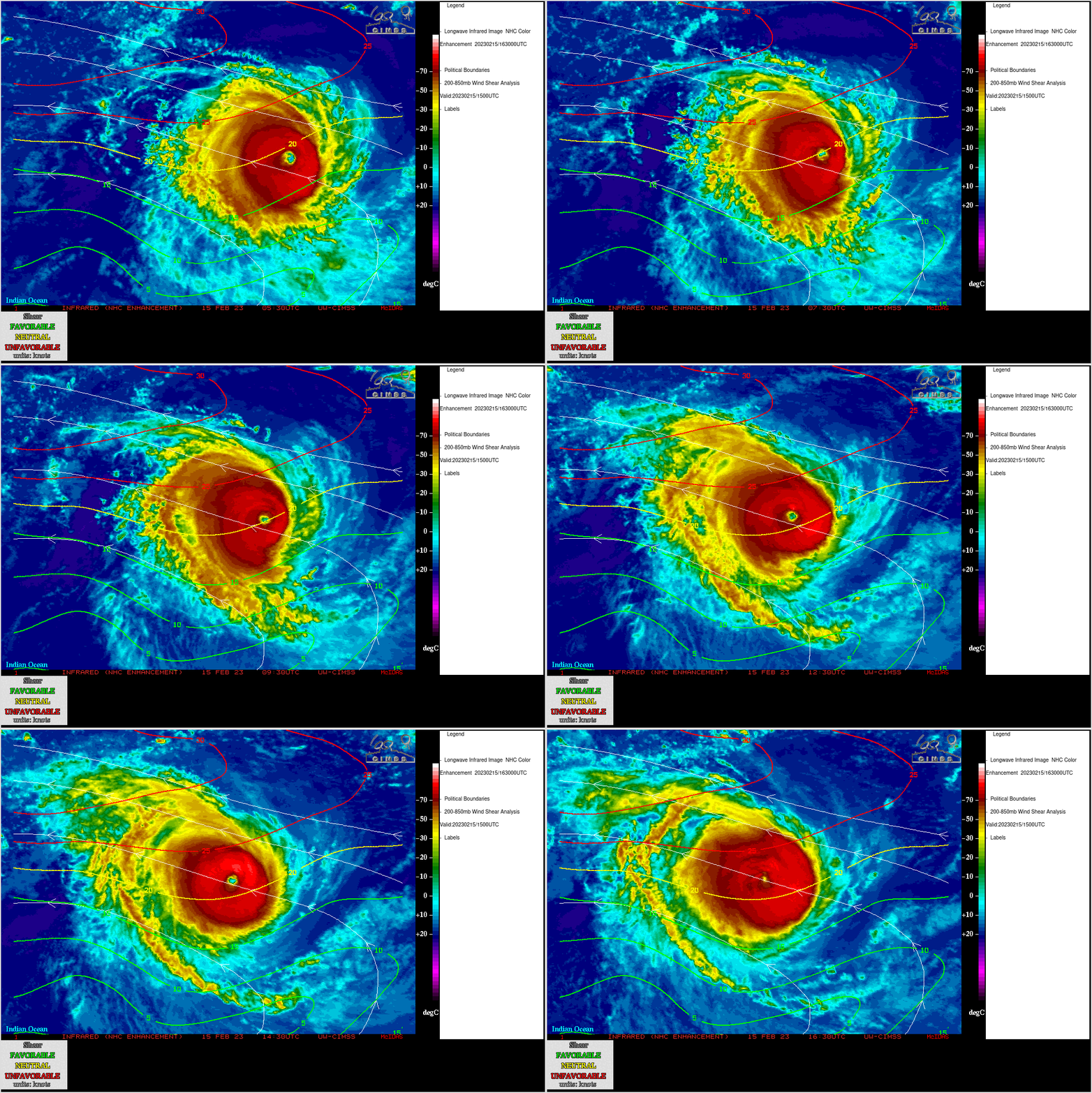
Meteosat-9 Infrared Window (10.8 µm) images from the CIMSS Tropical Cyclones site (below) included contours and streamlines of deep-layer (850-200 hPa) wind shear. The intensification of Freddy occurred in spite of this environment of moderate east-southeasterly shear.

Meteosat-9 Infrared Window (10.8 µm) images, with an overlay of 1500 UTC on 15 February [click to enlarge]
Two SAR satellite (RADARSAT-2 and RCM-1) overpasses occurred at 0000 UTC on 16 February, as noted here.

