Tropical Storm Gabrielle moves inland over North Carolina
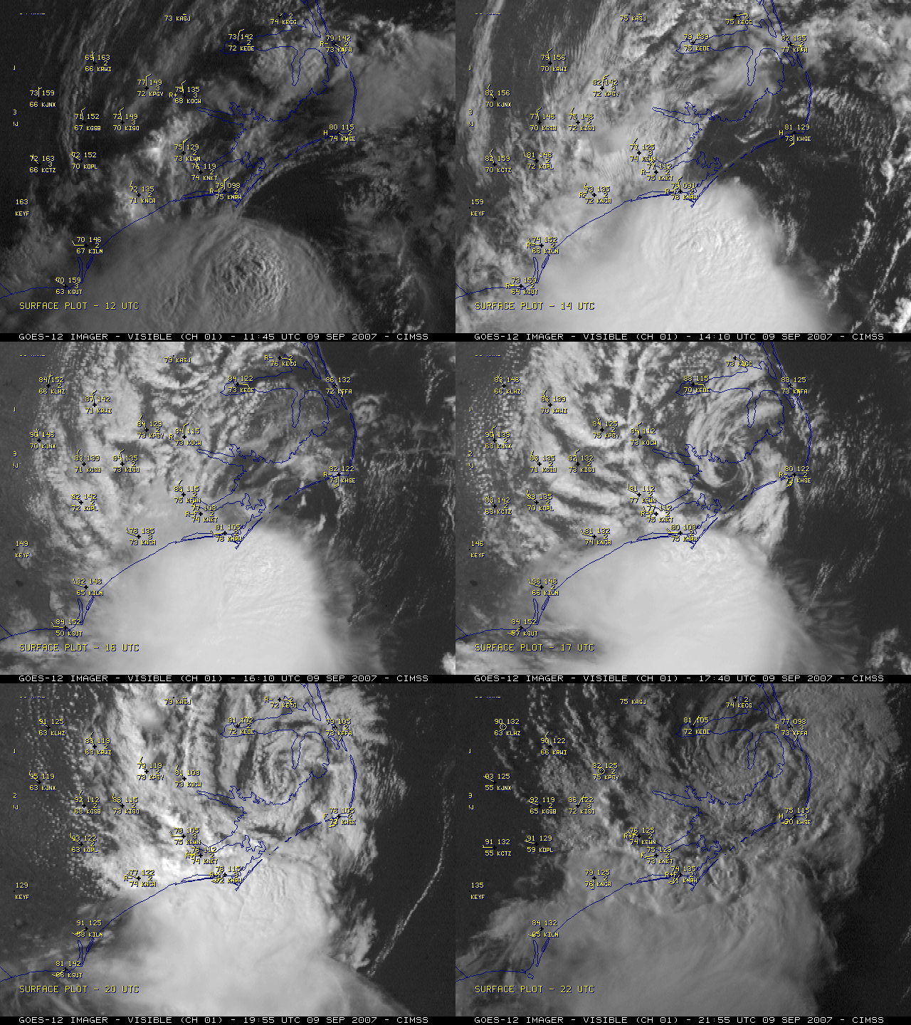
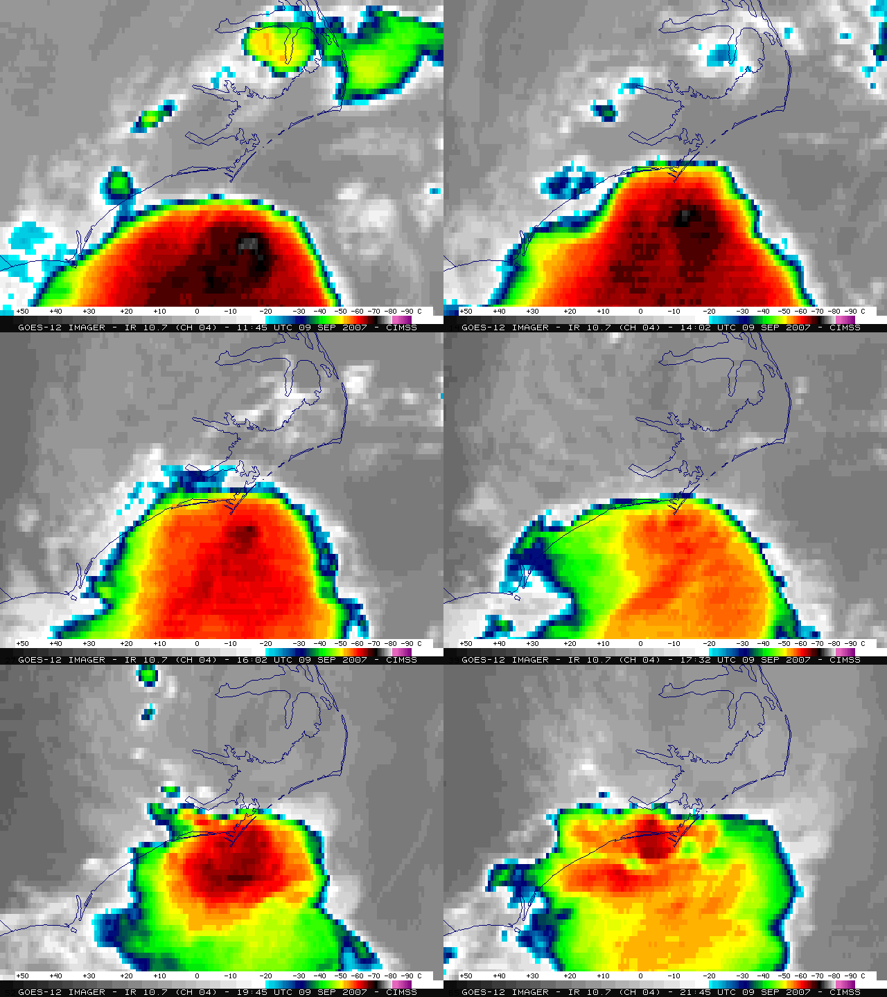
Tropical Storm Gabrielle made landfall over North Carolina early in the day on 09 September 2007. GOES-12 Rapid Scan Operation (RSO) visible channel imagery at 5-10 minute intervals (above) shows the low-level circulation of Gabrielle emerging from beneath a quasi-stationary cluster of convection and then moving slowly north/northeastward across eastern North Carolina during the afternoon hours. GOES-12 10.7µm IR imagery (below) depicts cold cloud top brightness temperatures of -60º to -79º C (red to black to white enhancement) associated with the convective cluster — these cold cloud tops did manage to move slightly inland across the Morehead City NC region (located near the center of the IR images) after about 15 UTC (11 am local time), and the resulting rainfall amounts along the coast were as high as 8.60 inches at Harlowe.
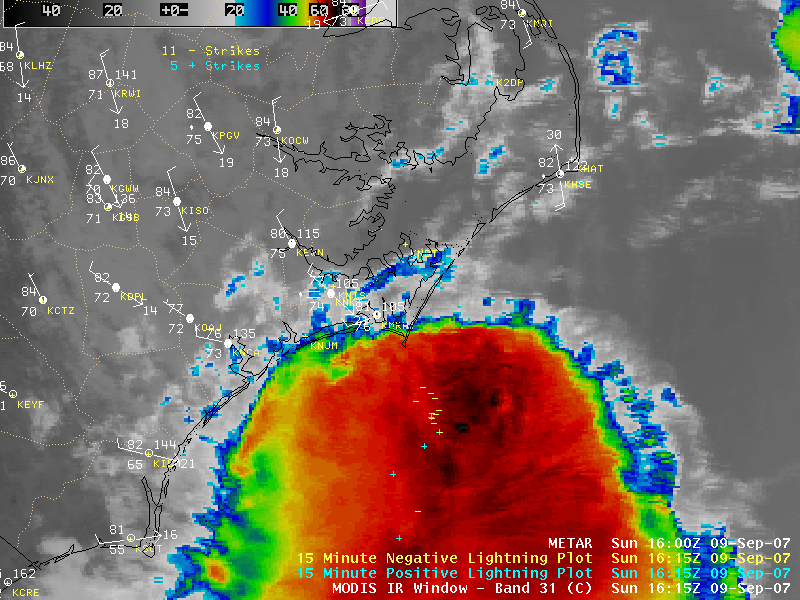
An AWIPS image of the 1-km resolution MODIS 11.0µm IR channel (below) shows better detail in the cloud top temperature structure compared to the 4-km resolution GOES-12 IR imagery above. An overlay of cloud to ground lightning strikes indicates that lightning activity was fairly minimal with this cluster of thunderstorms.


