A Tropical Cyclone Tries to Form
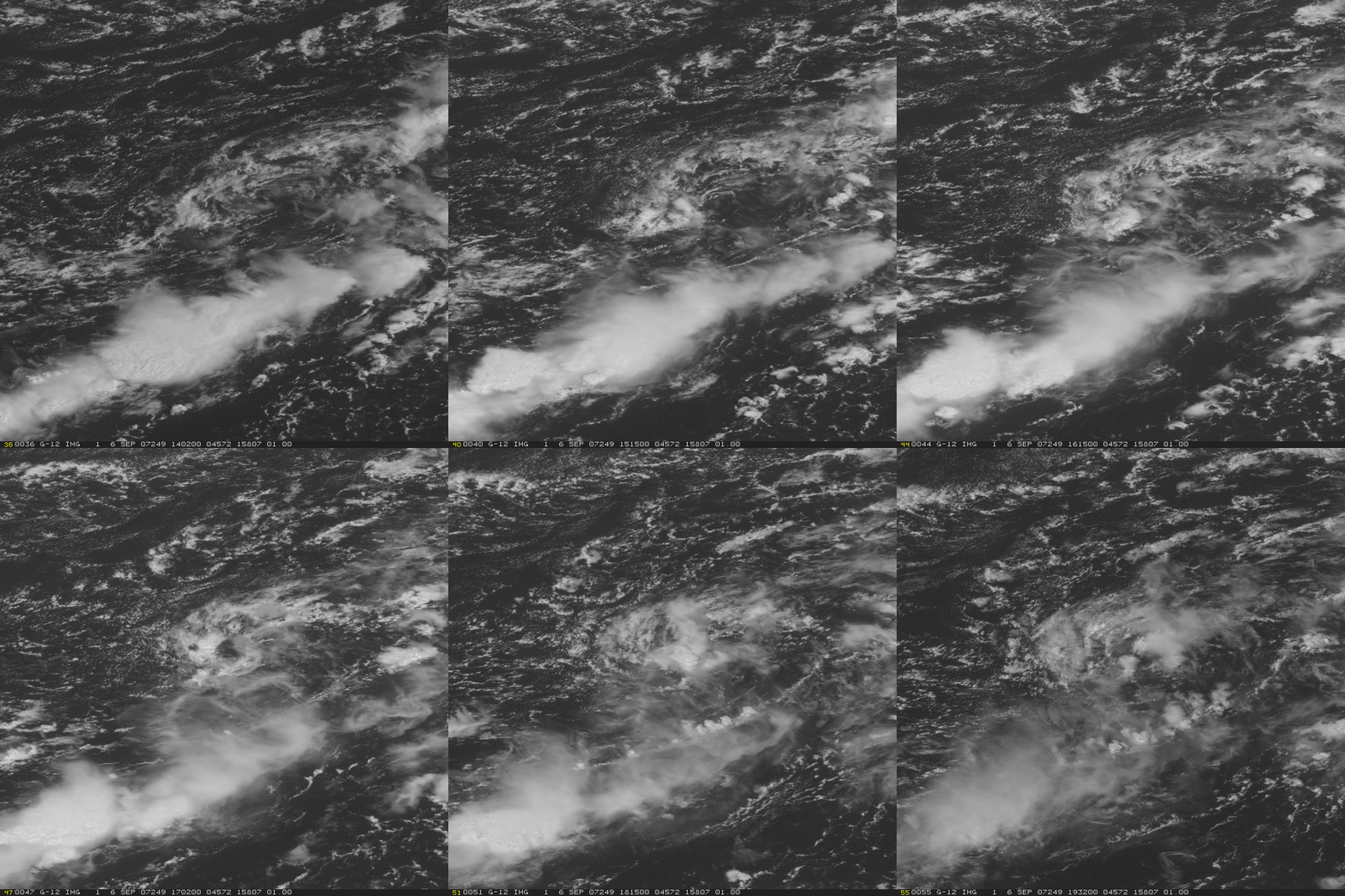
Many meteorological eyes have been watching a system in the western Atlantic during the past couple of days. This GOES-12 visible image includes a circulation near 28 N, 70 W (more easily seen in the animation above) that could be the kernel of the next tropical system in the Atlantic.
There are several notable features in the loop. First, there is an obvious shear line at the surface running southwest-northeast in the loop. North of the shear line, persistent northeasterlies are obvious, as cloud features (including a very nice example of an expanding outflow boundary at the northern edge of the domain) steadily propagate to the southwest. In the southeast corner of the domain, surface feature motion is characteristic of southwesterly flow. Convection is promoted in the convergent zone between these two airstreams. The mesoscale circulation evident in the center of the domain has persisted for several days. Such circulations can develop into tropical systems if the energy that is released in the convection can be restricted to a small central region. When that happens, pressures at the surface can fall, accelerating the wind, which acceleration enhances evaporation of vapor from the sea surface, and that enhanced vapor then supports further convective development.
In the present case, very strong shear (as diagnosed here by CIMSS-generated cloud-drift winds) at the southernmost end of a strong mid-latitude trough have displaced significantly the mid- and upper-level convective towers downstream of their boundary layer roots. This displacement is evident especially in the convection on the southern edge of the circulation later in the loop above. As long as the convection, and associated latent heating, is displaced downshear of its boundary layer roots, a tropical depression is unlikely to form. Shear is forecast to relax as the mid-latitude trough pulls away from the system (Note the low shear values just to the west of the system in the mapping of shear here). If the region of low shear overspreads the lower-tropospheric circulation before the circulation erodes, then a tropical depression will likely form.


