SAR data over Guam (Part VI and VII)

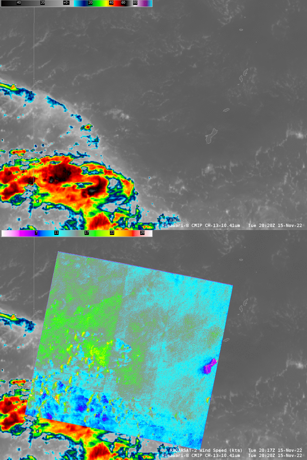
RADARSAT-2 observations of SAR data near/around the island of Guam in the Marianas Islands continue in November (as previously discussed here, here and here). Overpasses on 15 November (above) and 17 November (below) contain features that deserve comment. For example, there is an obvious seam (and a less-obvious second seam) in the SAR wind analysis above. The “Beam Seams” arise because the 500-km wide scan for SAR winds is created from smaller individual beam positions. Each beam position has its own set of adjustments applied during SAR image processing and sometimes there is slight disagreement from one beam to the next. The image above has 3 subswaths – so 2 beam seams. The seams are also apparent in the normalized radar cross section (NRCS) image here.
Although SAR winds as displayed in AWIPS do not have a wind direction, a direction can be inferred from the ‘shadow’ of weaker winds in the lee of Guam. Imagery at this website does include the constraining GFS wind barbs (as shown here). Note that MetopB Advanced Scatterometer (ASCAT) winds show winds (from this site) in the 15-20 knot range in the region to the west of Guam, in agreement with the SAR observations.
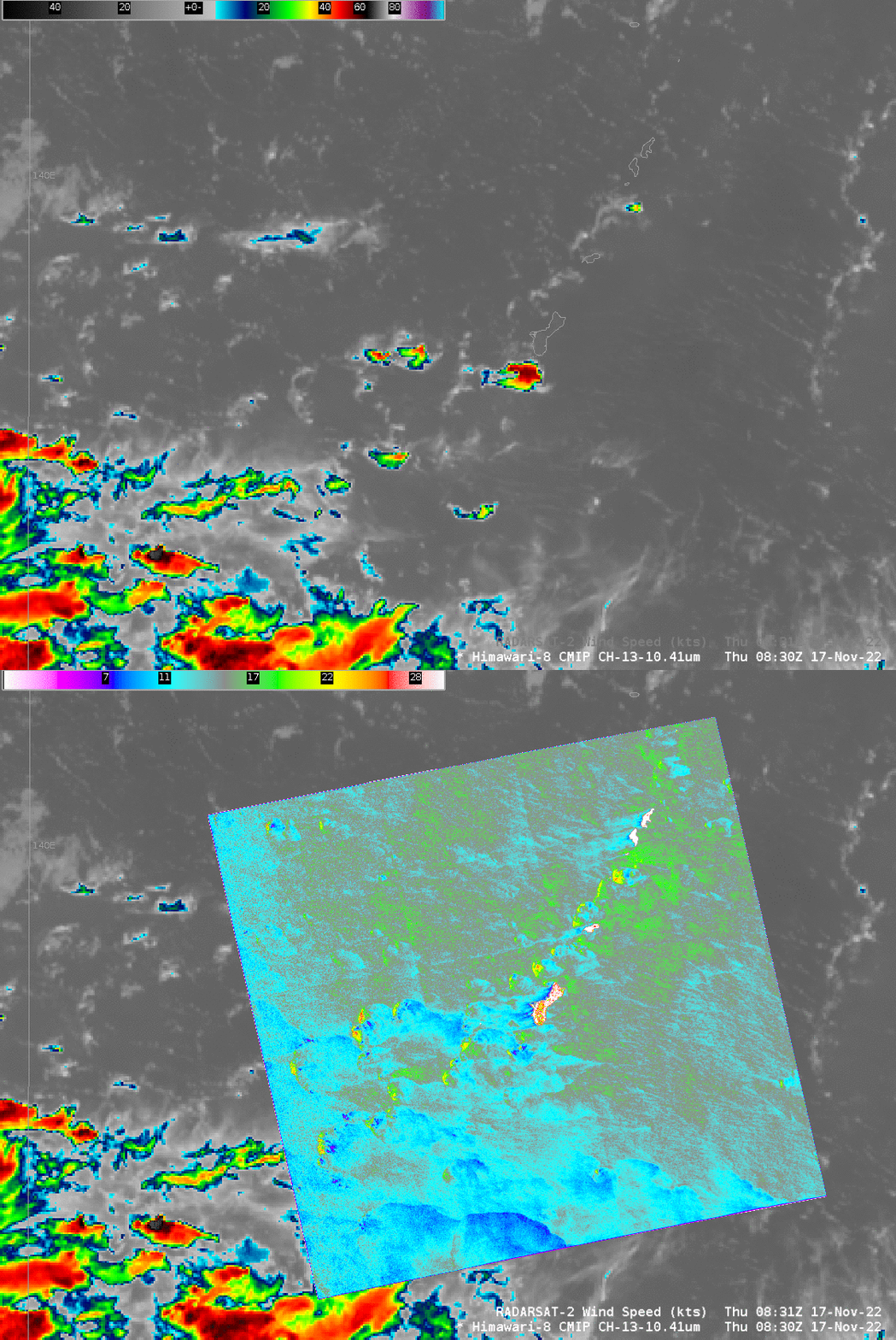
SAR winds on 17 November at 0830 UTC, shown below with Himawari-8 infrared imagery, show winds of similar strength to those on the 15th. (Click here to view the analysis with wind barbs, or the NRCS analysis, both from this site.) On this day, the Marianas Islands all have an apparent effect on the downstream winds (Click here to see the AWIPS image of SAR winds; here’s a similar example over the Caribbean). The wake from Rota, for example, extends all the way from Rota to the western edge of the SAR scan! The wake from Guam is being affected by convection, but it too can be followed to the western edge of the SAR domain. Islands in the Marianas have an effect on winds that stretches for 100s of kilometers on some days, such as the 17th, but not on others, such as the 15th. (Note also: very faint Beam Seams are detectable on the 17th).

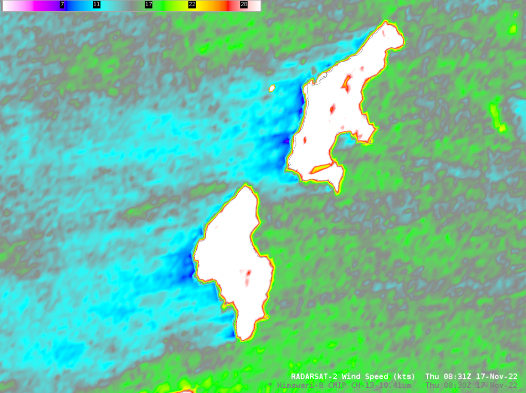
This SAR scan includes the islands of Tinian and Saipan, as shown below. Are there still large ships near Saipan, as noted in this blog post where 5 are present? Per the SAR data below, perhaps only one! Also, the lighter winds downwind of both Saipan and Tinian are very apparent in the image below: winds of 20 knots on the windward side of the islands (green in the enhancement used) and 10 knots or less (blue and purple) on the leeward side.

You can find information on RADARSAT-2 at this WMO link.

