SAR data over Guam (part IV)

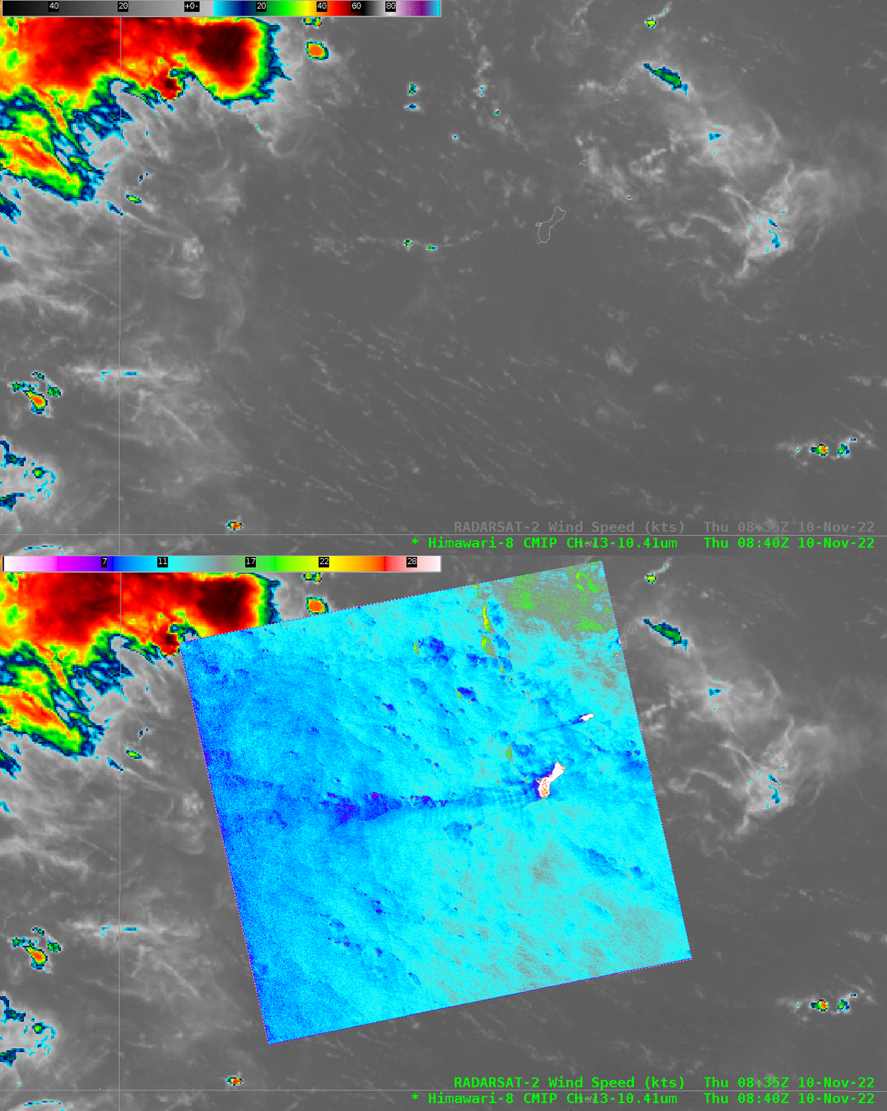
RADARSAT-2 overflew Guam early on 10 November 2022, and the toggle above shows both Himawari-8 imagery at that time with the SAR wind estimates overlain. This was a time of light winds and minimal shower activity. It’s interesting that the wake of weak winds downwind of the islands of Guam (and Rota) are apparent in this regime of weak easterly winds. (Metop-B ASCAT winds from late on 9 November are here, and late on 10 November are here; both images are from the NOAA/NESDIS ‘manati’ website).
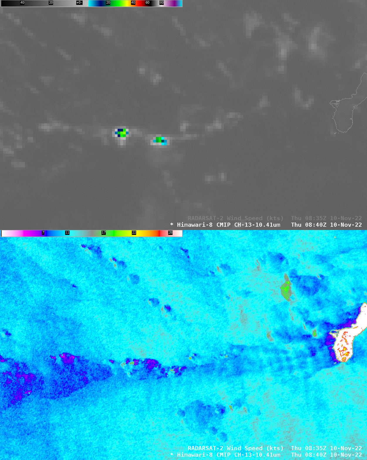
A zoomed-in version of the image above is shown below. The windspeed downwind of Guam shows downstream variations in speed, oriented north-south. Those speed changes are very small, from 11-12 knots (cyan enhancement) to 8 or 9 knots (dark blue) enhancements. The coldest cloud tops in the Himawari-8 imagery — to the west of Guam — are associated with strong/weak wind dipoles. The region of stronger winds (around 18 knots, green in the enhancement used) to the west-northwest of Guam are associated with slightly cooler cloud tops, but this line of tropical convection has brightness temperatures in the 15-18oC range: not very tall at all!

Imagery is also available at the NOAA/NESDIS STAR SAR Winds calendar here; the wind speed and the Normalized Radar Cross Section information are both available, and they are shown in a toggle below.


