SAR data over Guam (part II and III)
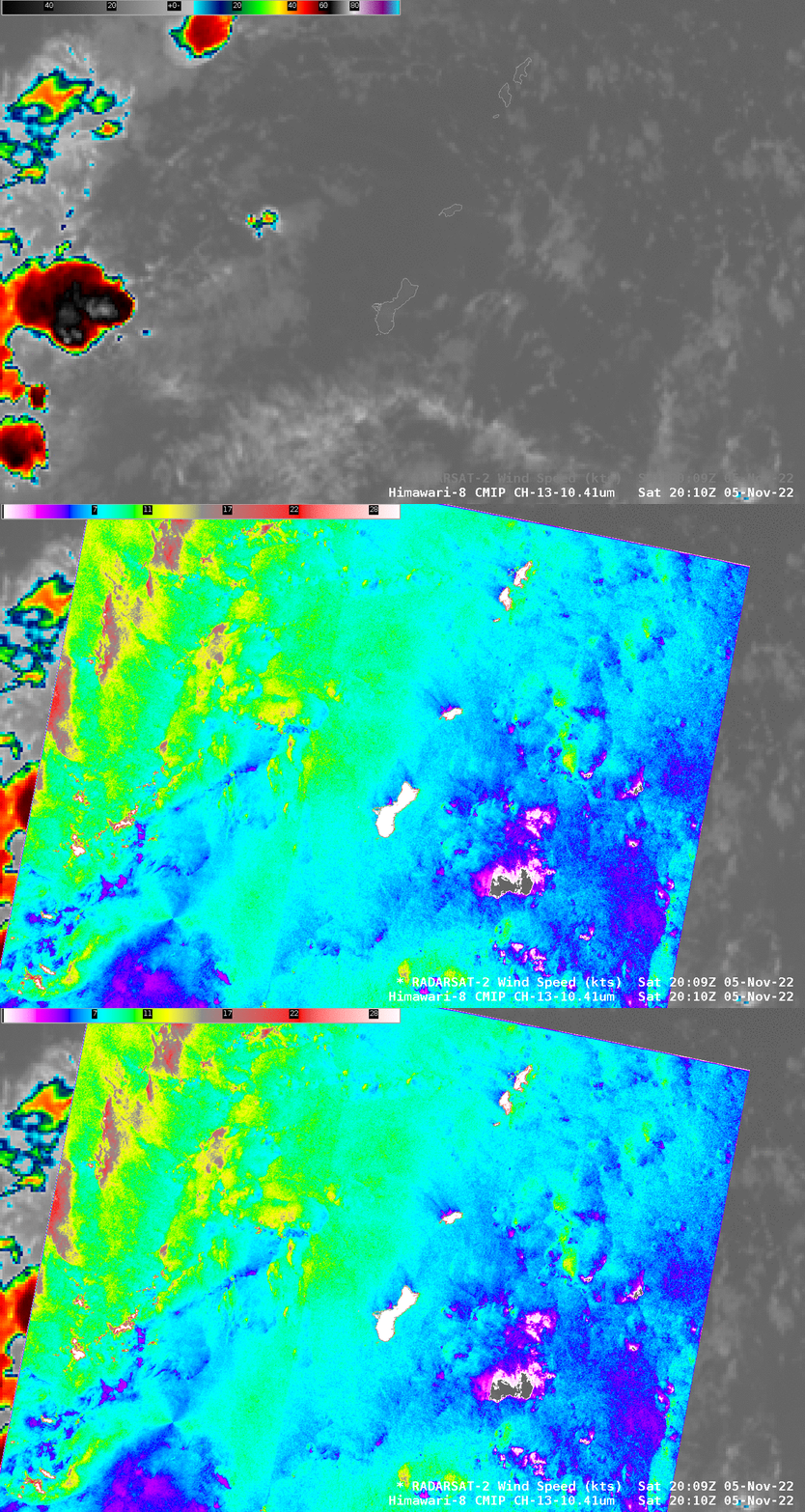
Synthetic Aperture Radar (SAR) data retrievals continue over Guam, with 10 planned for November. The toggle above compares the 2009 UTC SAR footprint (from RADARSAT-2) with Himawari-8 Clean Window (10.41) infrared imagery at 2010 UTC (on 5 November 2022). These data are also available online at this NOAA/STAR Website; there are also direct links to wind analyses and Normalized Radar Cross Section (NRCS) data. MetOp-B Scatterometer winds for this time (from the manati website), show light southeasterly winds over the Guam and islands to its northeast: Rota, the very small Aquipan, Tinian and Saipan.
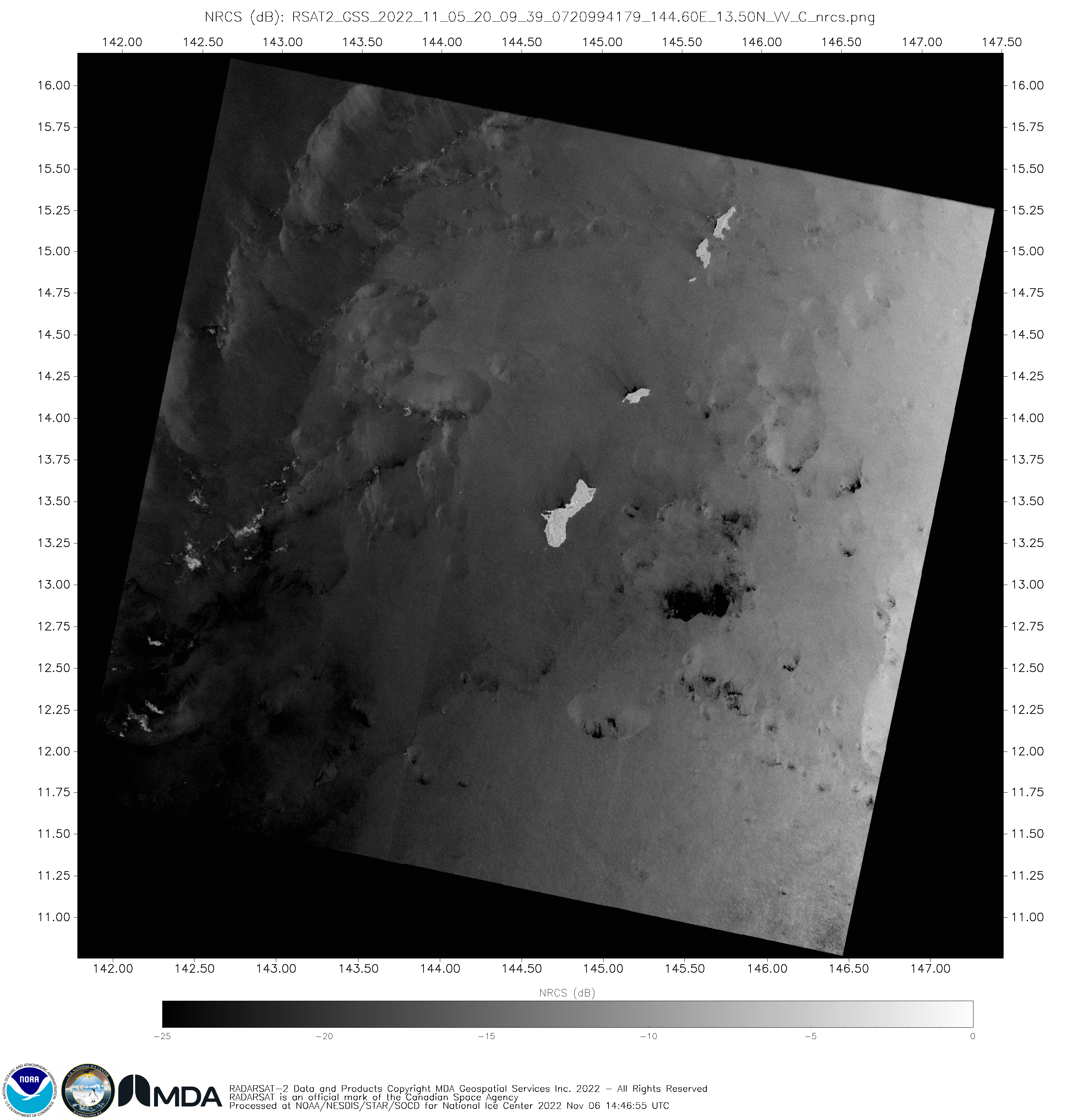
The SAR Wind observations show several things. Each of the islands has a wind shadow, with lighter winds downwind of the islands (that is, to their north and west given the prevailing southeasterlies). The strongest winds — 30 to 40 knots — are most likely a result of cloud ice causing a much greater SAR return, and this can be verified by viewing the Normalized Radar Cross Section, shown below, from this link. Feathery features that occur in the NRCS imagery are most likely cloud ice, and the enhanced reflection from that cloud ice results in an analysis that shows stronger surface winds than may be present. So an analyst who sees very strong winds in/near deep convection should verify what kind of hydrometeors might be in the cloud.
SAR Winds just to the west of the island of Saipan show 5 separate strong maxima in a region where Himawari-8 data show little evidence of cloudiness. This image of Saipan from the International Space Station suggests a possible reason: ships at anchor in Saipan’s harbor! Such ships are highly reflective in C-band frequencies as used on RADARSAT-2.
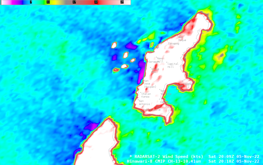
Thanks to Brandon Aydlett, SOO at WFO Guam, for pointing out the artifacts near Saipan!
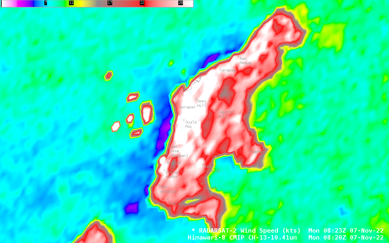
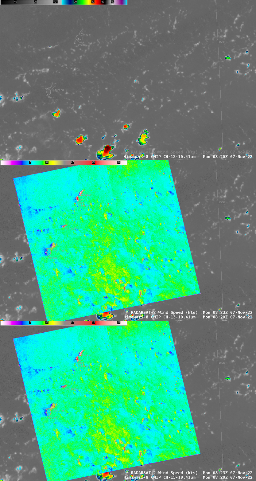
Another RADARSAT-2 pass occurred at 0823 UTC on 7 November. The toggle with Himawari-8 infrared imagery is shown below. Again, weaker winds are shown downwind of the islands (in this case, to the west of the islands as winds have shifted to a more easterly direction; click here to see the wind analysis and the NRCS analysis, both from this website) To the east of Guam are numerous dipoles of strong/weak winds associated with showers.
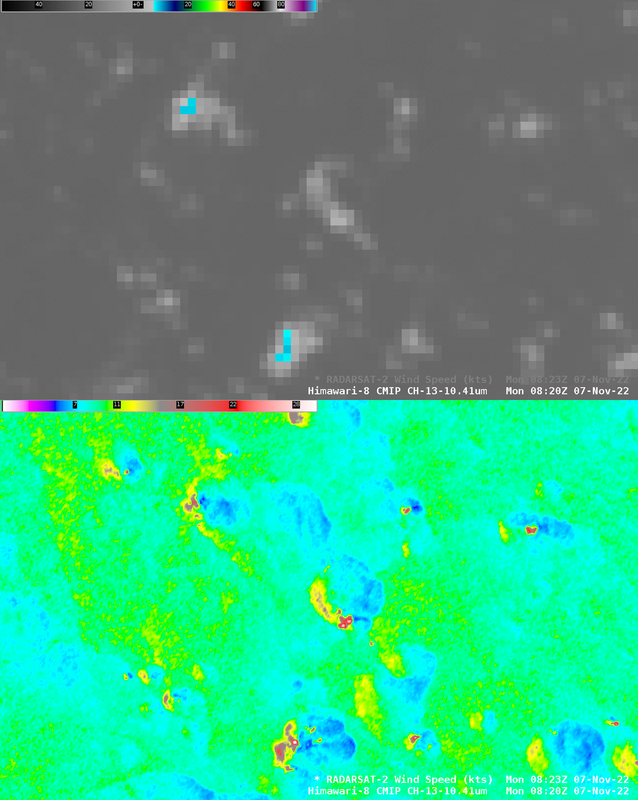
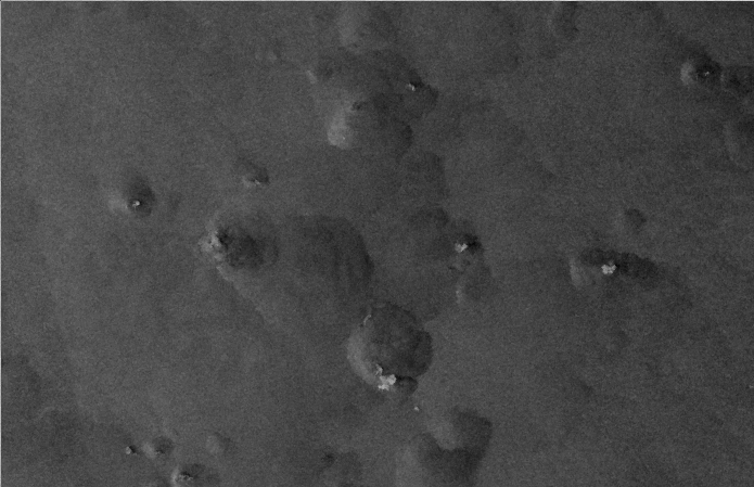
The toggle below zooms in on the shower activity near 13.5oN, 147.75oE, to the east of Guam. Stronger winds (10-15 knots, yellow and brown in the enhancement) are apparent to the east of the cooler clouds that are mostly likely tradewind cumulus showers. The strongest winds, 20+ knots might be associated with ice in clouds. Himawari-8 Band 13 brightness temperatures over the showers are in general not sub-freezing (the exception being the cyan and blue enhancements where brightness temperatures are from -5o to -8o C. The small NRCS image underneath the toggle (snipped from here), however, shows some bright feathered regions that suggest ice is present in small (perhaps smaller than the Himawari-8 infrared resolution) regions within the clouds (this image references NRCS features with the zoomed-in SAR wind image shown below)
Note that the very large signals persist just to the west of Saipan — and there’s one more ship, apparently!
