Super Typhoon Hinnamnor once again reaches Category 5 intensity
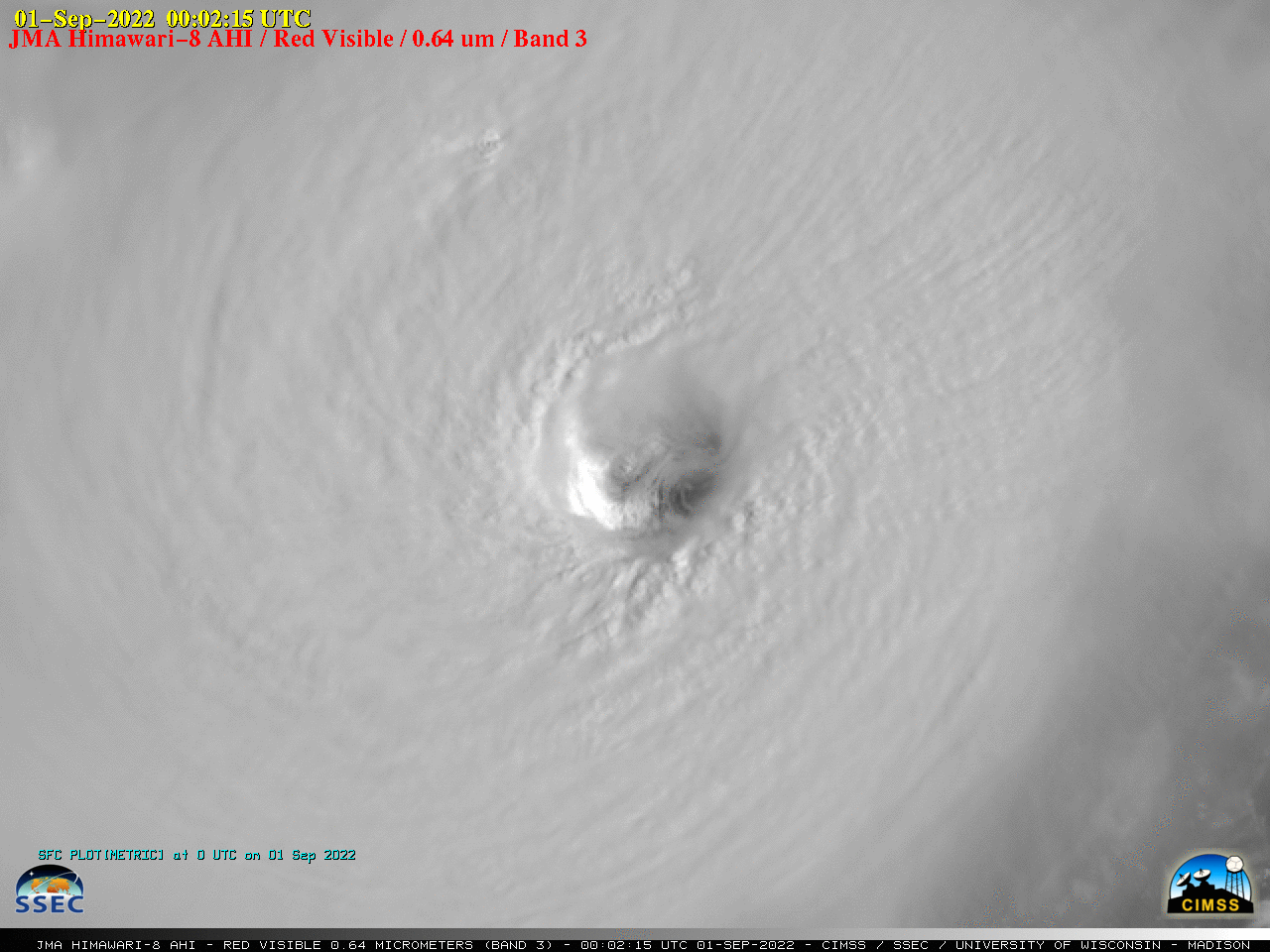
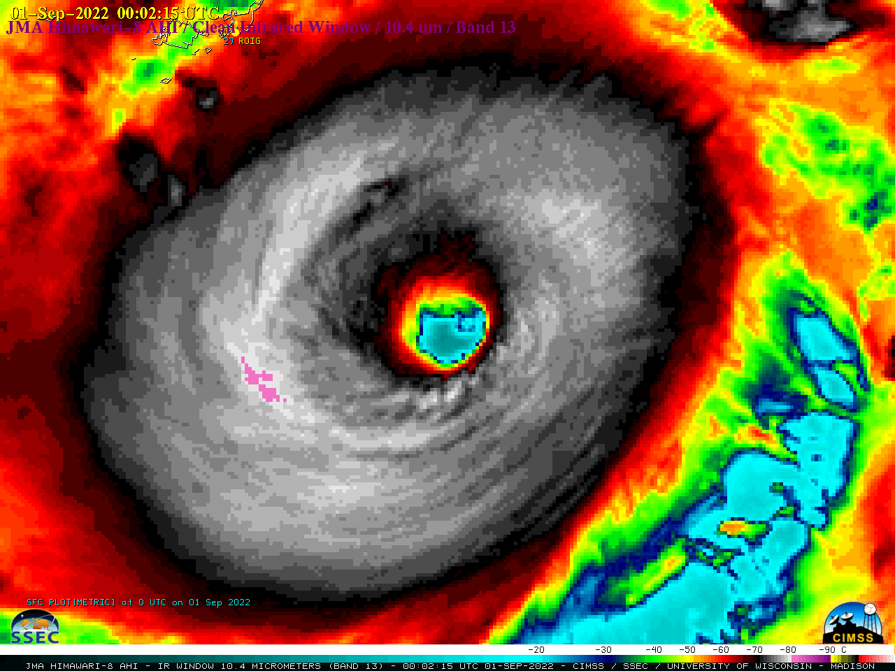
2.5-minute rapid scan JMA Himawari-8 Visible (0.64 µm) images (above) showed rapidly-intensifying Typhoon Hinnamnor as it once again reached Category 5 intensity (ADT | AiDT | SATCON) about 3 hours after local sunrise on 31 August 2022. Mesovortices rotating within the eye were evident though breaks in patchy high clouds overhead.2.5-minute Himawari-8 Infrared (10.4 µm) images (below) revealed convection within the eyewall region which exhibited cloud-top infrared brightness temperatures of -80°C and colder (violet pixels).
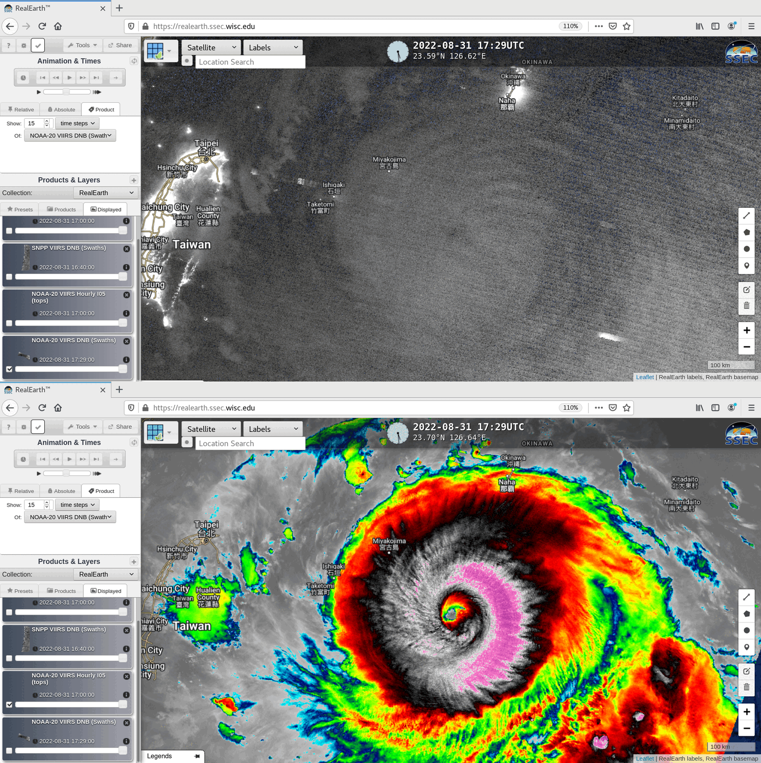
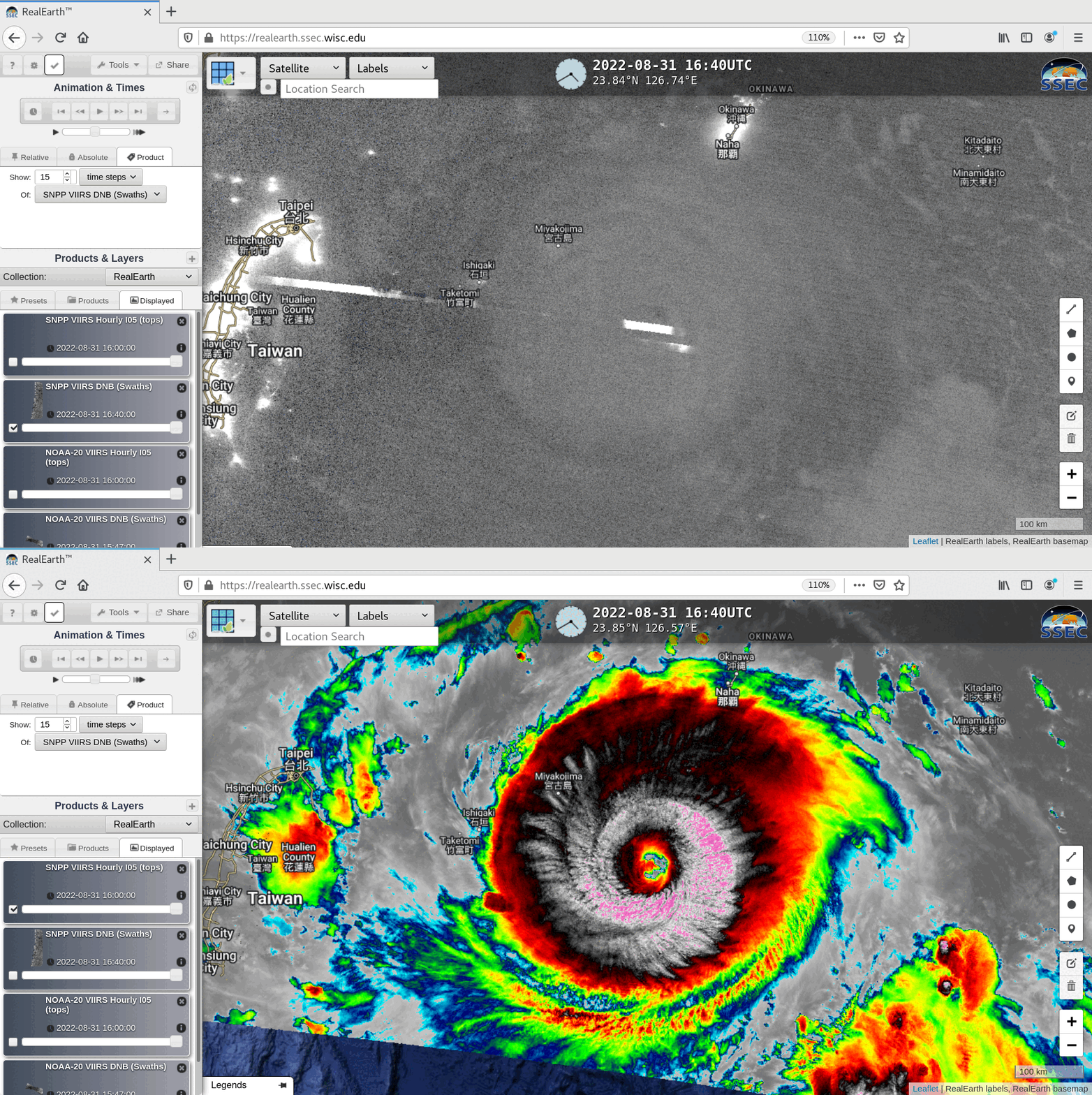
Several hours before sunrise, a toggle between NOAA-20 VIIRS Day/Night Band (0.7 µm) and Infrared Window (11.45 µm) images valid at 1749 UTC, viewed using RealEarth (below) revealed concentric mesospheric airglow waves in the DNB image, propagating away from Hinnamnor (primarily to the north of the storm). The mesospheric airglow waves were less evident in an earlier comparison of Suomi-NPP VIIRS Day/Night Band and Infrared Window images, valid at 1700 UTC (below) — however, at that time the DNB displayed bright streaks near the eye, indicative of clouds illuminated intense lightning activity.