Mesoscale Convective Vortex over southern Nevada

GOES-18 “Red” Visible (0.6.4 .µm) images [click to play animated GIF | MP4]
GOES-18 images shown in this blog post are preliminary and non-operational
Overlapping 1-minute Mesoscale Sectors provided 30-second images of GOES-18 “Red” Visible (0.64 µm) data, which showed the circulation of a Mesoscale Convective Vortex (MCV) that moved northward across southern Nevada early in the day on 17 July 2022. Ongoing thunderstorms along the periphery of this MCV slowly dissipated as they moved across California and Nevada — and according the morning NWS Las Vegas forecast discussion, some of these storms produced rare July rainfall in parts of Death Valley, California.
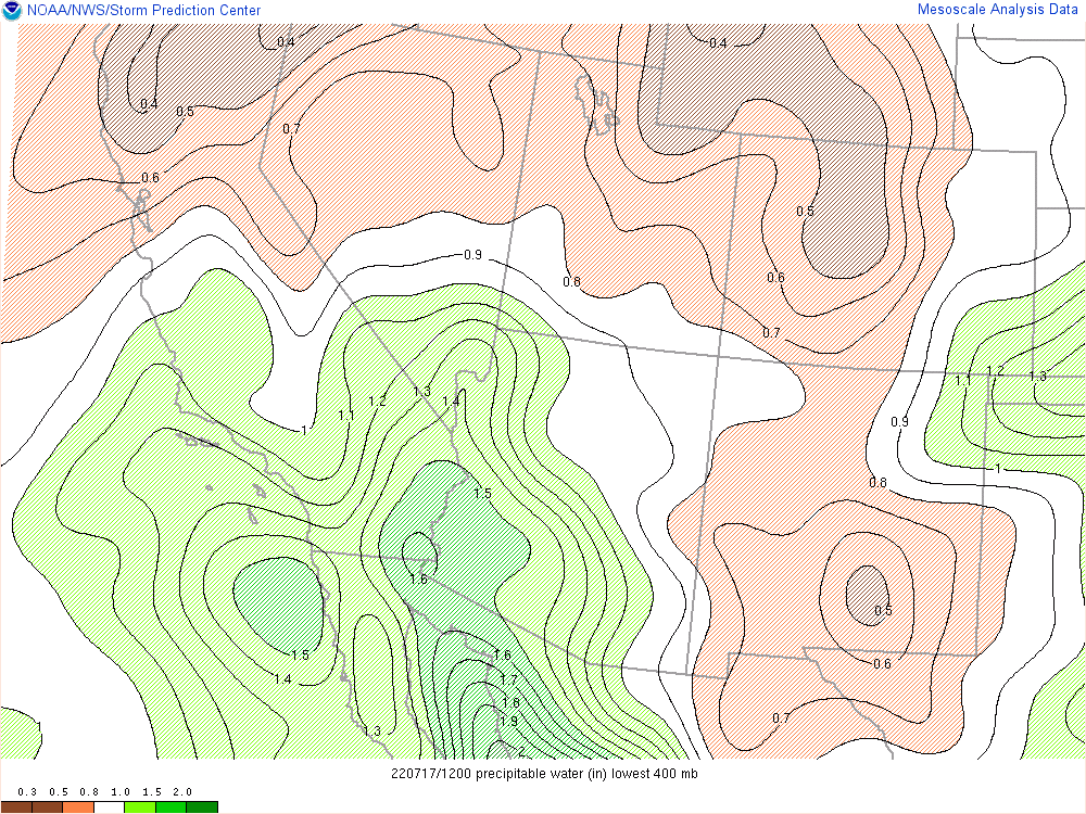
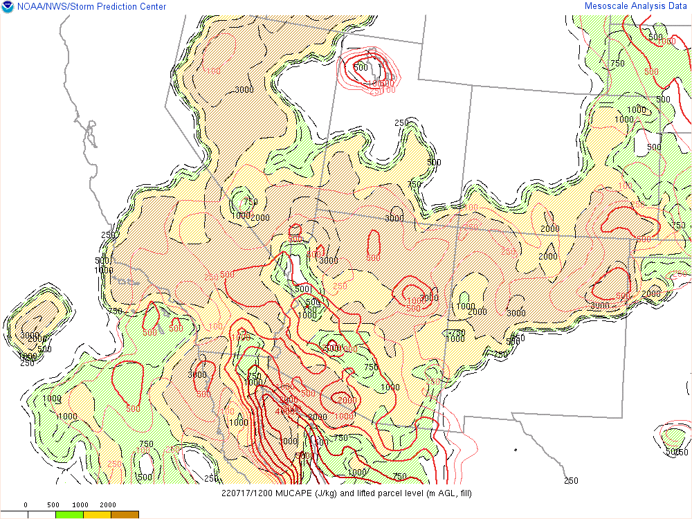
According to NAM40 model winds, this MCV was moving through an environment of generally low wind shear (below), where there was also sufficient moisture and instability.
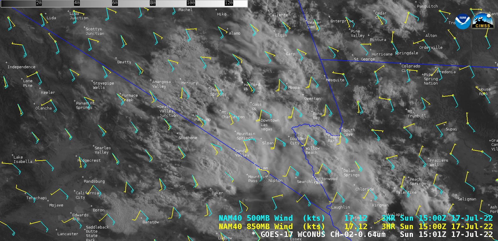
GOES-17 “Red” Visible (0.6.4 .µm) image, with plots of NAM40 model 850 hPa and 500 hPa wind barbs [click to enlarge]
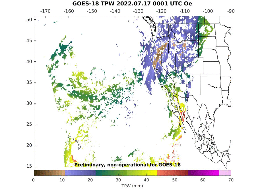
GOES-18 Total Precipitable Water derived product [click to play animated GIF | MP4]