Grassland fire in Mongolia generates a pyrocumulonimbus cloud
JMA Himawari-8 “Red” Visible (0.64 µm, top), Shortwave Infrared (3.9 µm, center) and “Clean” Infrared Window (10.4 µm, bottom) images [click to play animated GIF | MP4]
Consecutive NOAA-20 VIIRS Infrared image valid at 0401 UTC and 0541 UTC — viewed using RealEarth (below) — showed the eastward drift of individual small pyrocumulonimbus (pyroCb) clouds, which exhibited cloud-top infrared brightness temperatures of -40ºC and colder (brighter green color enhancement).
NOAA-20 VIIRS Infrared Window (11.45 µm) images at 0401 UTC and 0541 UTC [click to enlarge]

NOAA-20 VIIRS True Color RGB and Infrared Window (11.45 µm) images at 0541 UTC [click to enlarge]
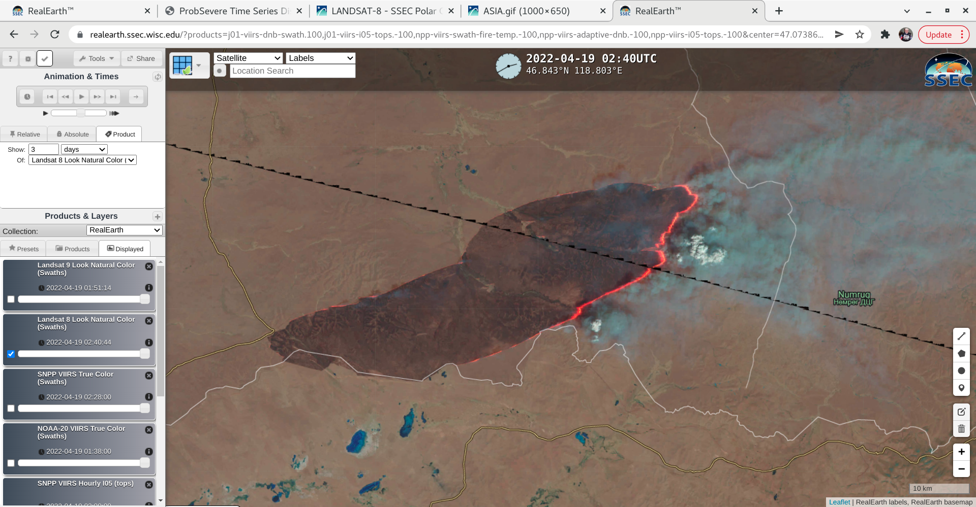
Landsat-8 False Color image at 0252 UTC [click to enlarge]
JMA Himawari-8 “Red” Visible (0.64 µm, top), Shortwave Infrared (3.9 µm, center) and “Clean” Infrared Window (10.4 µm, bottom) images [click to play animated GIF | MP4]
NOAA-20 VIIRS Day/Night Band (0.7 µm) and Infrared Window (11.45 µm) images at 1742 UTC [click to enlarge]