Grassland fire in the Oklahoma Panhandle

GOES-16 “Red” Visible (0.64 µm, top left), Shortwave Infrared (3.9 µm, top right), Fire Power (bottom left) and Fire Temperature (bottom right) [click to play animated GIF | MP4]
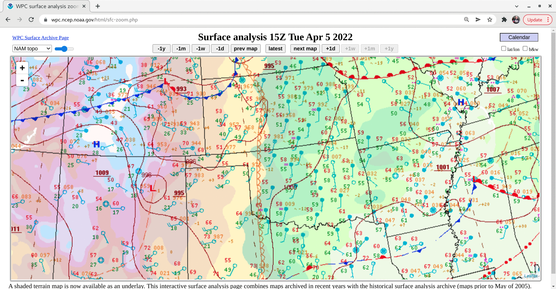
A strong cold front was moving southward across the High Plains during the day (surface analyses) — and arrived at the grass fire’s location just after 2000 UTC (causing a brief flare-up of the fire thermal signatures, and a final pyrocumulus pulse). The surge of colder air behind the cold front showed up as darker shades of green in the 3.9 µm images. Th initial east-southeastward expansion of the hot thermal 3.9 µm signature quickly transitioned to a south-southwestward expansion in the wake of the frontal passage.
1-minute GOES-16 True Color RGB images created using Geo2Grid (below) showed the initial eastward spread of the smoke plume prior to the arrival of the cold front — followed by a pronounced south-southwestward transport of smoke from the fire source region after the cold front moved across the area.

GOES-16 True Color RGB images [click to play animated GIF | MP4]
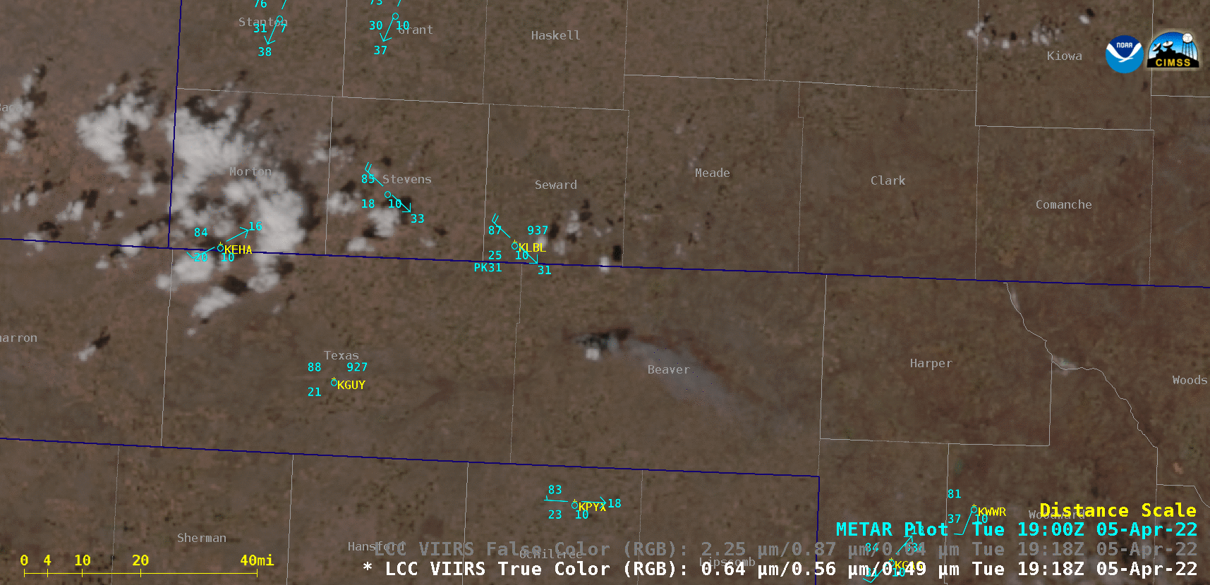
Suomi-NPP VIIRS True Color and False Color RGB images at 1923 UTC [click to enlarge]