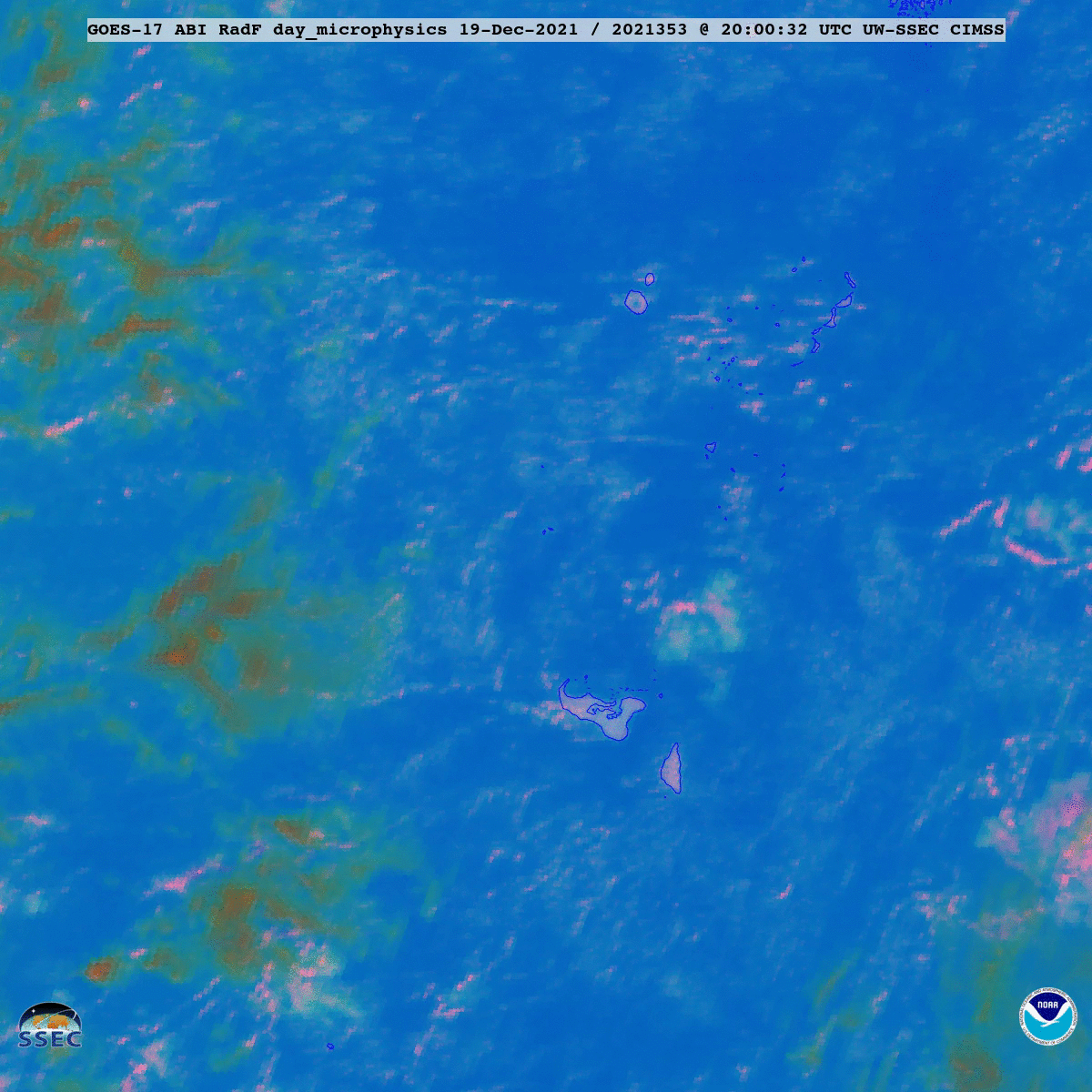
Eruption of the Hunga Tonga-Hunga Ha’apai volcano
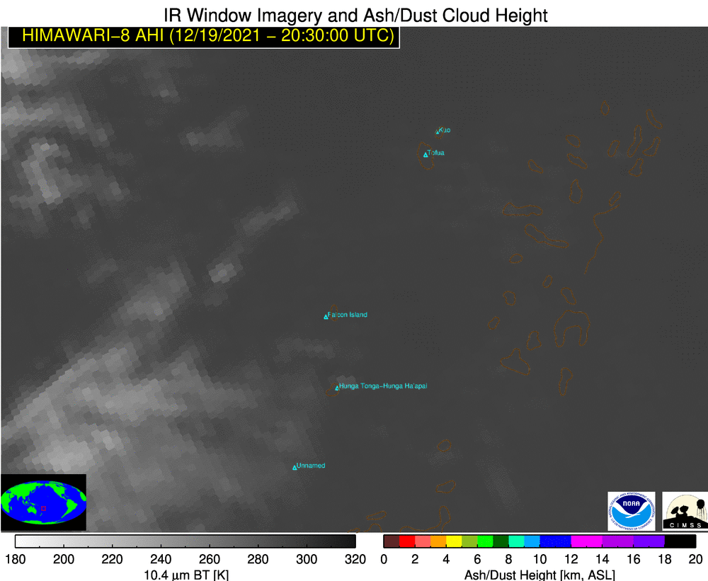
Ash Height product [click to play animated GIF | MP4]
The Hunga Tonga-Hunga Ha?apai volcano in Tonga violently erupted around 2030 UTC on 19 December 2021 — and a radiometrically-retrieved Ash Height product from the NOAA/CIMSS Volcanic Cloud Monitoring site (using JMA Himawari-8 data) indicated that ash was ejected as high as 16-18 km (above).
Ash Loading was very high within the volcanic cloud, with particles having a large Ash Effective Radius (below).
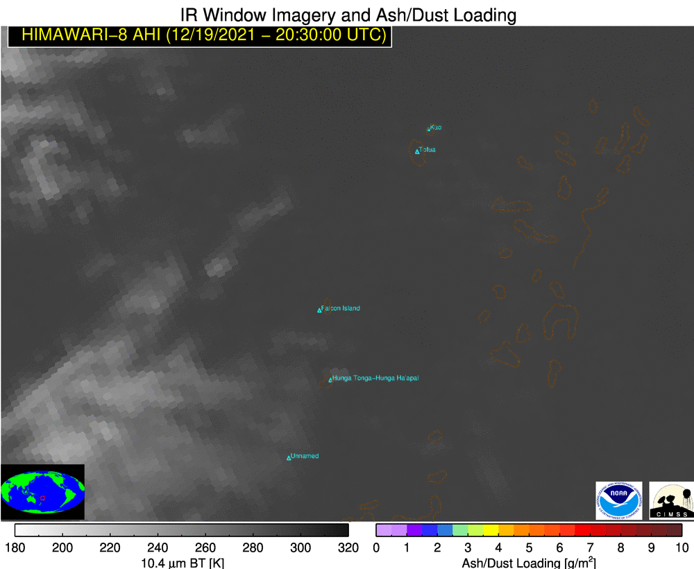
Ash Loading product [click to play animated GIF | MP4]
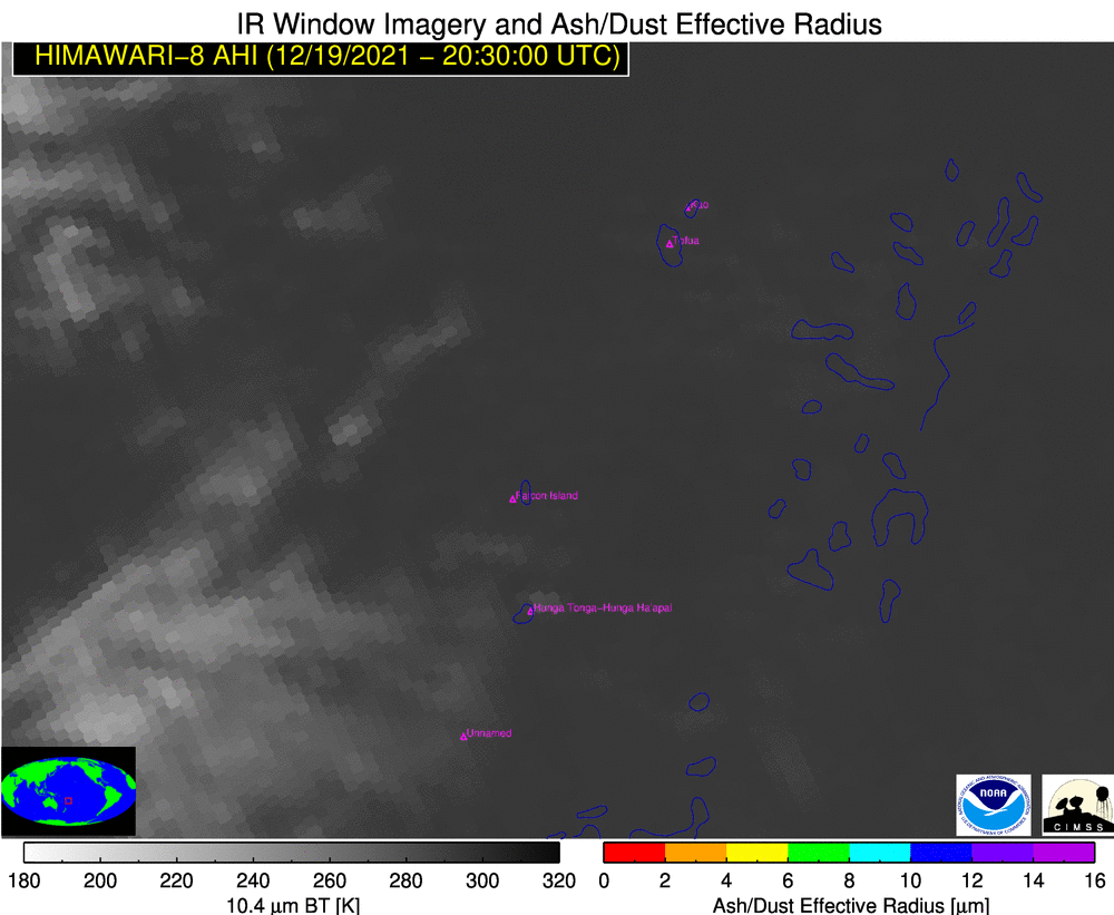
Ash Effective Radius product [click to play animated GIF | MP4]
In GOES-17 (GOES-East) Ash RGB images created using Geo2Grid (below), brighter shades of yellow indicated that significant concentrations of SO2 were present within the volcanic cloud — while shades of red supported the presence of ash.
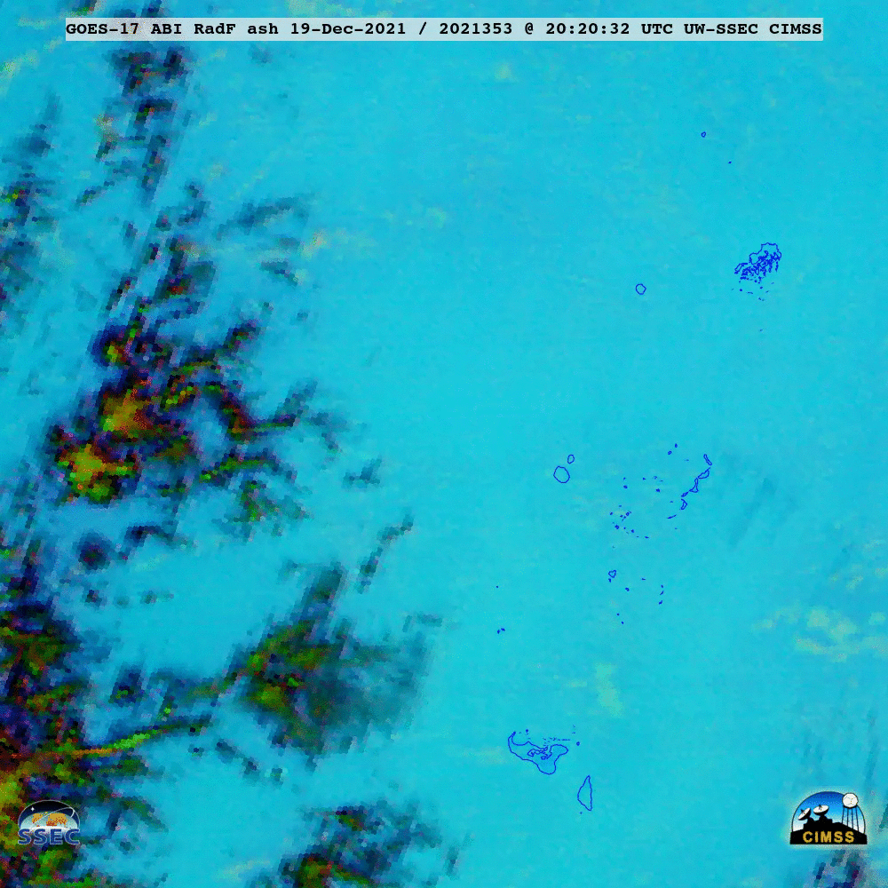
GOES-17 Ash RGB images [click to play animated GIF | MP4]
GOES-17 Day Cloud Phase Distinction RGB images (below) clearly showed the expansion of the glaciated volcanic cloud (brighter shades of orange).
GOES-17 Day Cloud Phase Distinction RGB images (credit: Tim Schmit, NOAA/NESDIS/ASPB) [click to play animated GIF | MP4]
GOES-17 “Clean” Infrared Window (10.35 µm) images (below) indicated that the coldest cloud-top infrared brightness temperatures were in the -80 to -89C range (shades of violet).
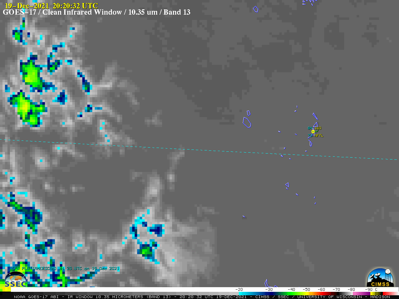
GOES-17 “Clean” Infrared Window (10.35 µm) images [click to play animated GIF | MP4]