Typhoon Nyatoh in the Philippine Sea
NOAA-20 True Color RGB and Infrared Window (11.45 µm) images viewed using RealEarth (above) showed a large convective burst south of the center of Tropical Storm Nahtoh — located in the Philippine Sea — at 0356 UTC on 01 December 2021. A robust overshooting top near the center of the convective burst exhibited a cluster of cloud-top infrared brightness temperatures of -100ºC and colder (red pixels embedded within purple-to-yellow-to-black enhancement).
2.5-minute rapid scan JMA Himawari-8 Infrared Window (10.4 µm) images (below) displayed the evolution of Nyatoh as it transitioned from a Tropical Storm to a Category 1 Typhoon at 1200 UTC. The coldest cloud-top infrared brightness temperatures of convective overshooting tops were in the -90 to -98ºC range, but did not quite reach the -100ºC threshold that was seen in the VIIRS imagery.
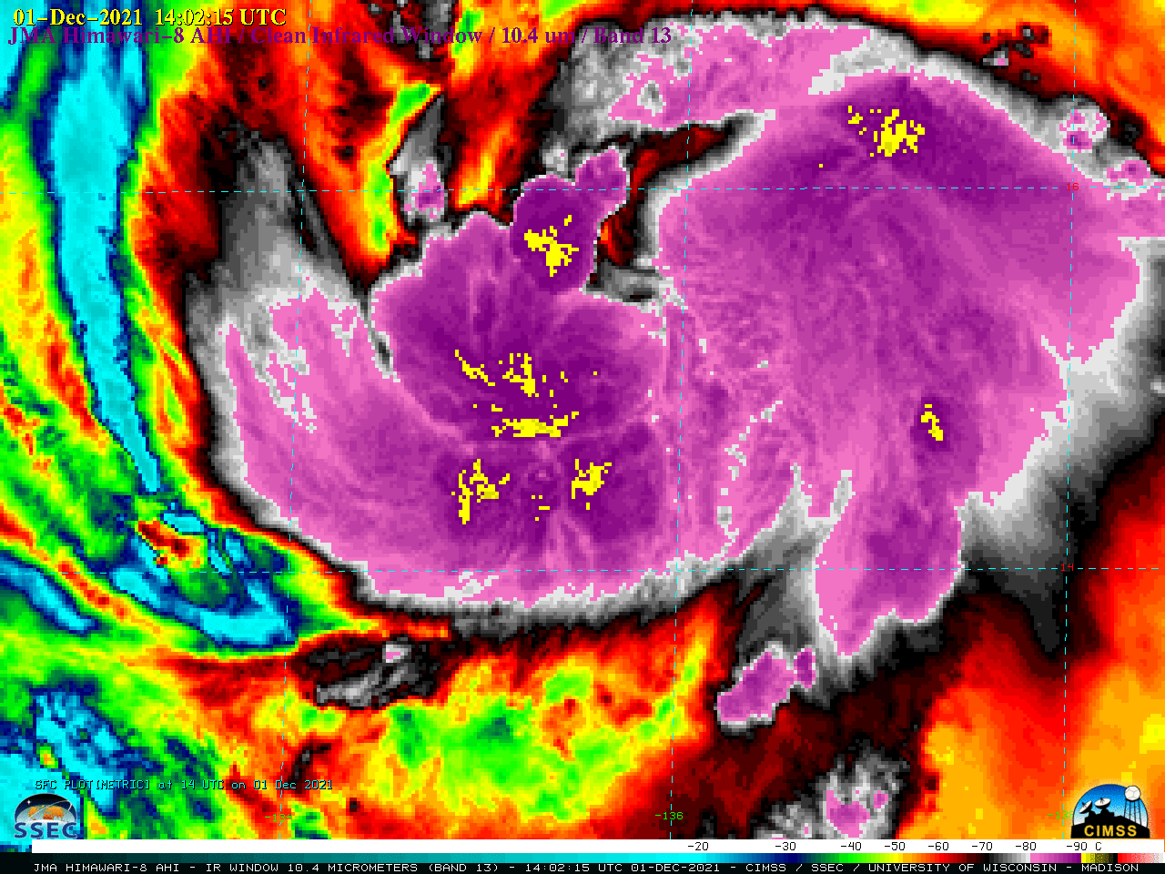
JMA Himawari-8 Infrared Window (10.4 µm) images [click to play animated GIF | MP4]
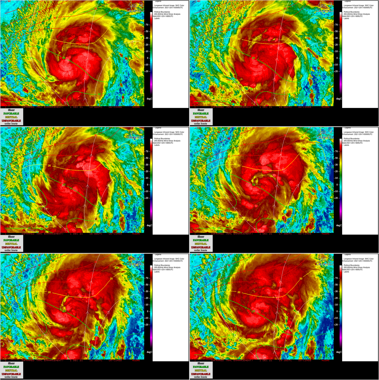
Himawari-8 Infrared images with contours of 18 UTC deep-layer wind shear from the CIMSS Tropical Cyclones site (below) showed that Nyatoh was moving through an environment of low to moderate shear.
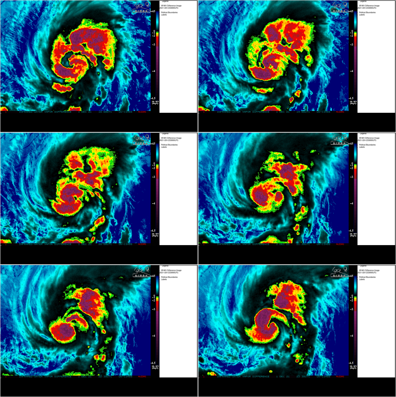
Himawari-8 Infrared – Water Vapor Difference images (below) indicated that much of the deep convection associated with Typhoon Nyatoh was likely penetrating the local tropopause. This product is discussed here.
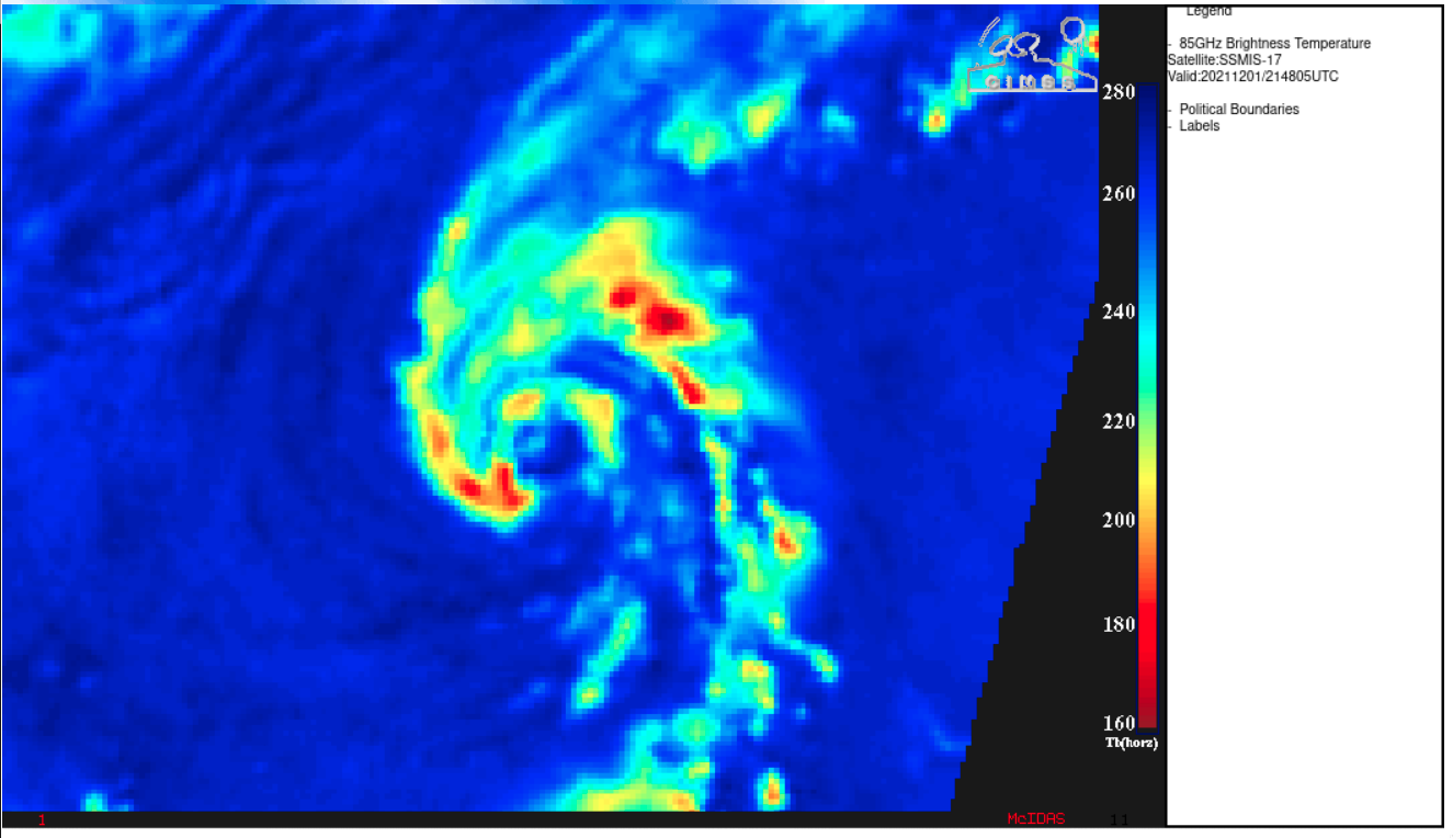
DMSP SSMIS Microwave (85 GHz) images at 1905 UTC and 2148 UTC are shown below. A completely closed eyewall had not yet formed at those times.
===== 02 December Update =====
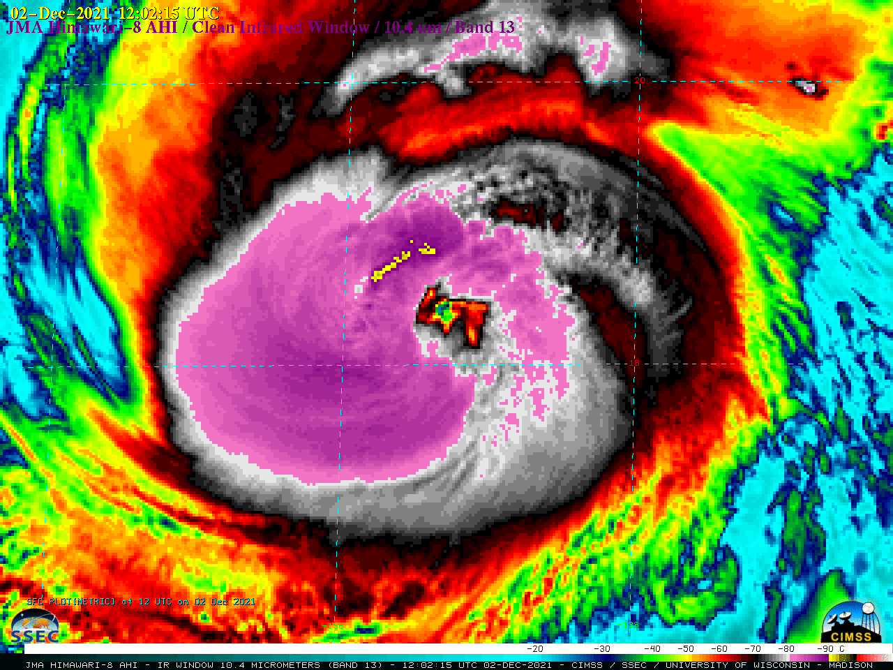
JMA Himawari-8 Infrared Window (10.4 µm) images [click to play animated GIF | MP4]
Typhoon Nyatoh rapidly intensified to a Category 3 storm by 1200 UTC, and then Category 4 by 1800 on 02 December (ADT | SATCON) — 2.5-minute rapid scan Himawari-8 Infrared images (above) showed the storm during this intensification period. During the 1200-1800 UTC time frame, subtle waves could be seen propagating south-southwestward across the cold central dense overcast, away from the center of Nyatoh. Energy from those waves was apparently propagating vertically, such that mesospheric airglow waves (reference) were evident in a Suomi-NPP VIIRS Day/Night Band (0.7 µm) image around 1650 UTC (below). Other examples of mesospheric airglow waves — caused by tropical cyclones, deep convection or jet streams — are available here .


