Drifting ice fields on Lake Erie
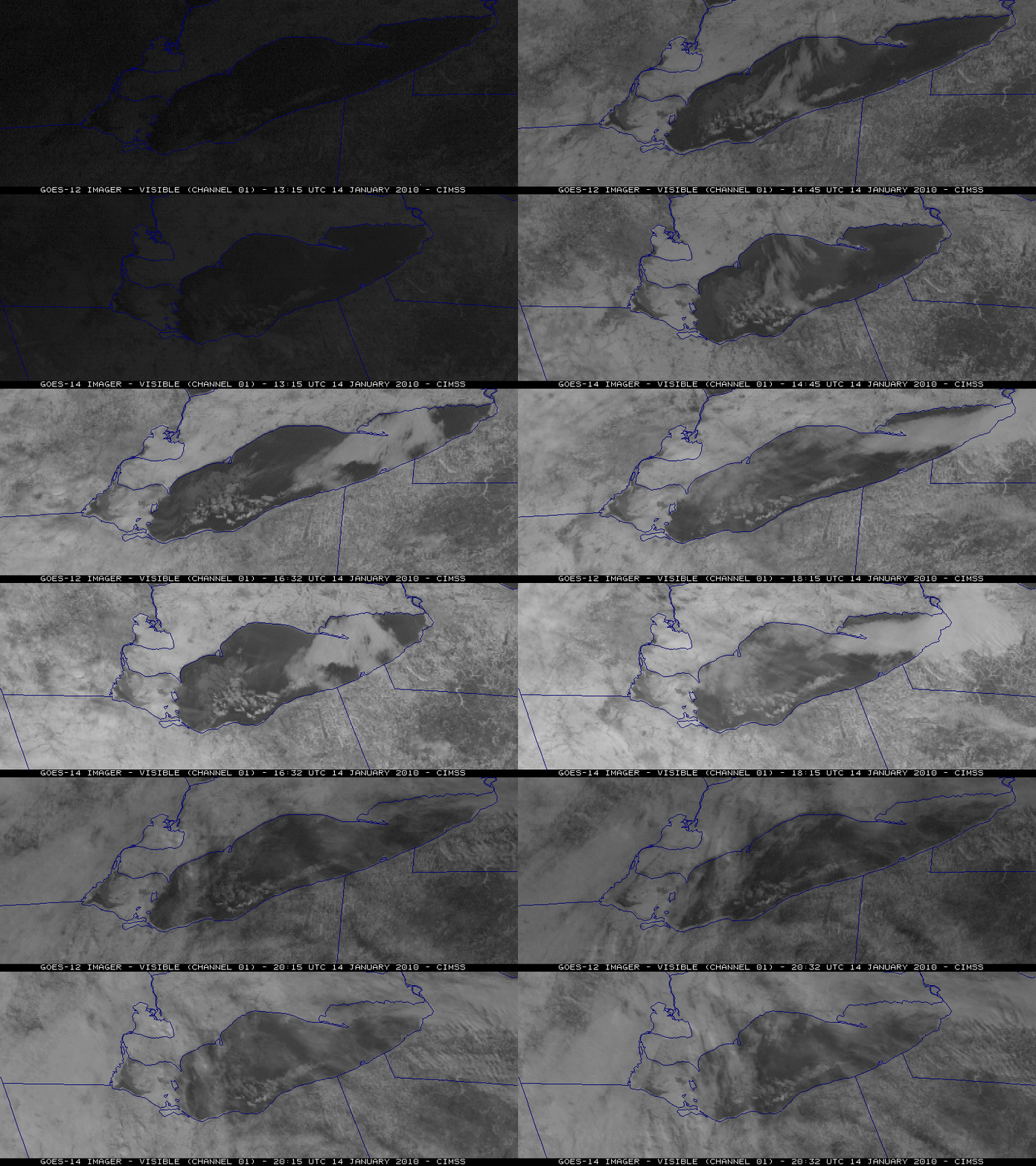
McIDAS images of GOES-12 and GOES-14 visible channel data (above) showed that large chunks of ice (known as “ice fields”) were drifting north-northeastward across the western portion of Lake Erie on 14 January 2010. Southerly to southwesterly winds were beginning to increase on that day, helping to move the ice features across the surface of the lake.
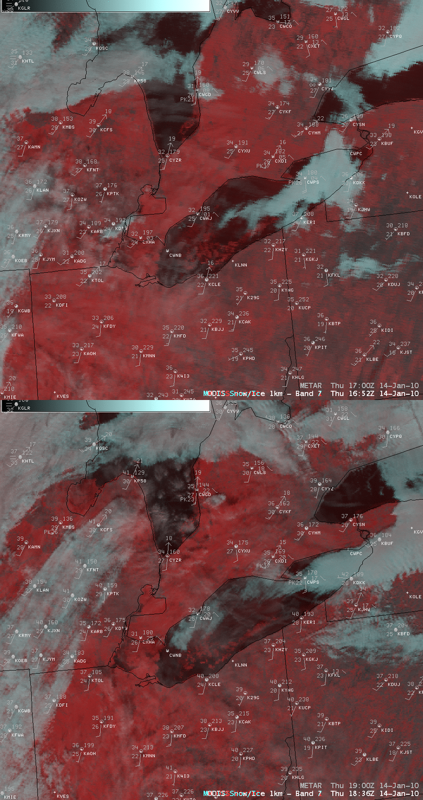
AWIPS images of MODIS false-color Red/Green/Blue (RGB) composites (below) confirmed that these were indeed ice features — snow and ice appear darker red on this false color imagery, in contrast to supercooled water droplet clouds which appear as brighter shades of cyan to white. Surface METAR reports plotted on the imagery indicated that wind speeds were generally in the 10-20 knot range. This example offers a glimpse at the type of RGB image capability that should be available with the upcoming AWIPS II software.
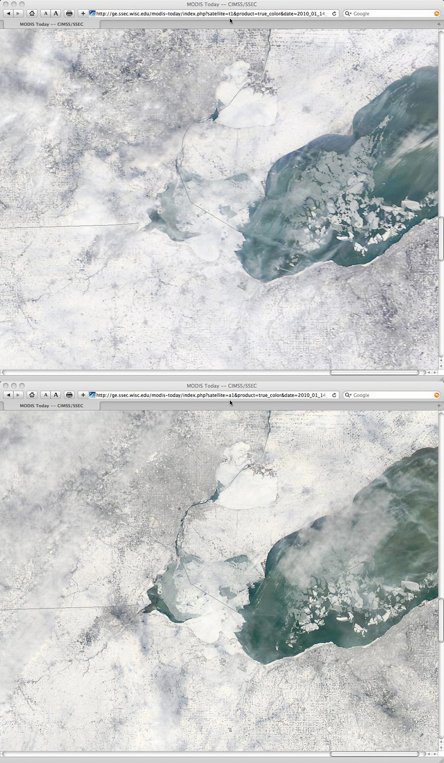
A closer look using 250-meter resolution MODIS true color images from the SSEC MODIS Today site (below) revealed how far the ice fields drifted between the 16:58 UTC overpass of the Terra satellite and the 18:42 UTC overpass of the Aqua satellite.


