“Enhanced-V” and “Warm Trench” IR signatures
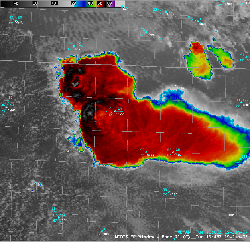
Severe thunderstorms developed over northwestern Kansas on 19 June 2007. An AWIPS image of the MODIS 11.0µm InfraRed (IR) channel (above) revealed an “enhanced-v” and a “warm trench” IR signature on adjacent storm tops. The coldest cloud top brightness temperature values were -77º C on both signatures; the warmest IR temperature associated with the “enhanced-v” was -58º C, while the warmest IR temperature in the “warm trench” was –61º C. You can get a sense that such a “trench” can surround an overshooting top by examining astronaut photography of thunderstorms taken from the space shuttle (image courtesy of Earth Sciences and Image Analysis Laboratory, NASA Johnson Space Center).
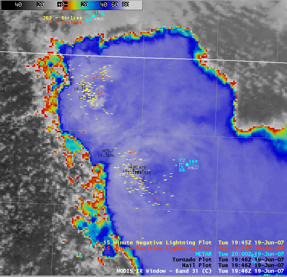
A closer view of the MODIS IR image with a different color enhancement (above) shows that both IR signatures were surrounded by clusters of negative (yellow) and positive (red) cloud-to-ground (CG) lightning strikes. SPC storm reports listed hail (up to 1.75 inches in diameter) within 1 hour of the MODIS image in the region of both IR signatures, but only the southernmost enhanced-v storm produced a tornado; however, higher radar reflectivity values (65-70 dBz) were seen with the northernmost “warm trench” storm.
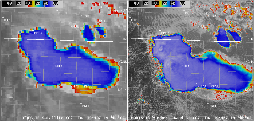
A comparison of the GOES-12 and MODIS IR images (above) demonstrates the better detection capability of these types of IR signatures using 1-km resolution MODIS IR imagery (vs 4-km resolution GOES IR imagery). The IR channels on the next-generation GOES-R Advanced Baseline Imager (ABI) will have a 2-km resolution.
GOES-12 10.7µm IR imagery (above; 100-image QuickTime animation) showed that these severe thunderstorms in Kansas persisted into the nighttime hours, and eventually became part of a very large Mesoscale Convective Complex (MCC) farther to the south over Oklahoma and Texas. Note the large number of IR pixels exhibiting brightness temperatures of -80º C or colder (violet enhancement) after 02:02 UTC; IR brightness temperatures were as cold as -93º C on a 23:22 UTC NOAA-12 AVHRR IR image, and as cold as -84º C on 05:10/05:13 UTC GOES / MODIS IR images (with 4159 negative and 334 positive CG lightning strikes at that time). Later SPC storm reports included hail up to 4.25 inches in diameter in Kansas (at around 00:05 UTC), and wind gusts to 94 mph in Texas (at around 07:09 UTC).


