Tropical Storm Barry
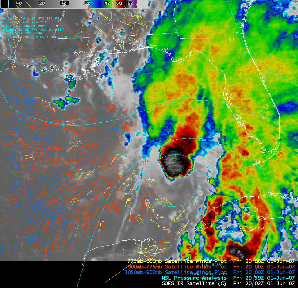
Tropical Storm Barry formed in the eastern Gulf of Mexico on 01 June 2007 (the first official day of the Atlantic hurricane season). An AWIPS image of the GOES-12 10.7µm IR channel (above; Java animation) showed that some bursts of convection were developing just north of the center of Barry, with cold IR brightness temperature values of -70º to -80º C (black to white enhancement). The tropical cyclone was embedded in an environment of strong southwesterly wind shear in the middle levels and upper levels of the atmosphere, which was not conducive to further strengthening of Barry.
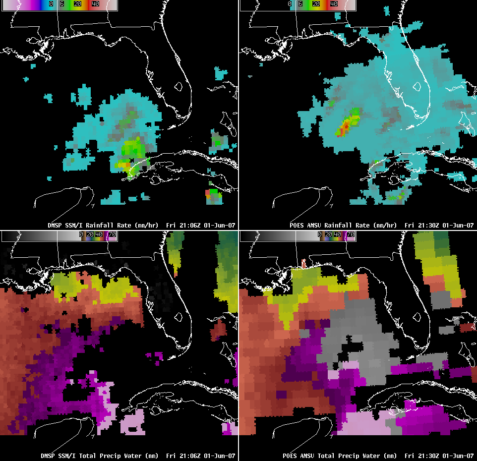
An AWIPS 4-panel comparison of DMSP SSM/I and POES AMSU imagery (below) revealed that rainfall rates near the center of TS Barry were in the 25-35 mm (1.0-1.4 inch) per hour range (orange to red enhancement, upper panels), while total precipitable water values were increasing to 50-60 mm or 2.0-2.4 inches (violet to purple enhancement, lower panels) in the environment surrounding the storm over the eastern Gulf of Mexico. Note that the times displayed on the AWIPS DMSP and POES images do not necessarily correspond to the actual time of the satellite overpass for the particular region being viewed.


