-40º F (-40º C) in eastern Montana
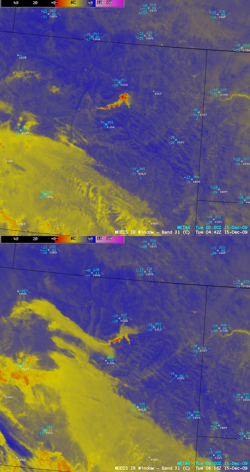
On 15 December 2009, Jordan (located in eastern Montana) won the distinction of recording the first temperature of -40º F (-40º C) or colder in the Lower 48 states during the 2009/2010 winter season. AWIPS images of the MODIS 11.0 µm IR channel data (above) showed a number of areas across eastern Montana which exhibited surface IR brightness temperatures near -40º (darker blue color enhancement) — also note the much warmer thermal signature (yellow to red colors) of Fort Peck Lake, most of which which was still unfrozen. However, there was also a patch of clouds with relatively warm tops (around -20º C, yellow enhancement) that was moving northeastward across Montana during that time, with surface air temperatures significantly warmer under that blanket of clouds. As the leading edge of this cloud deck began to move over Jordan (surface identifier KJDN), the strong radiational cooling was halted (one has to wonder how much colder Jordan might have gotten had the clouds not moved overhead?). In fact, Glendive (station identifier KGDV) continued to drop to a low of -35º F (-37º C) under clear skies.
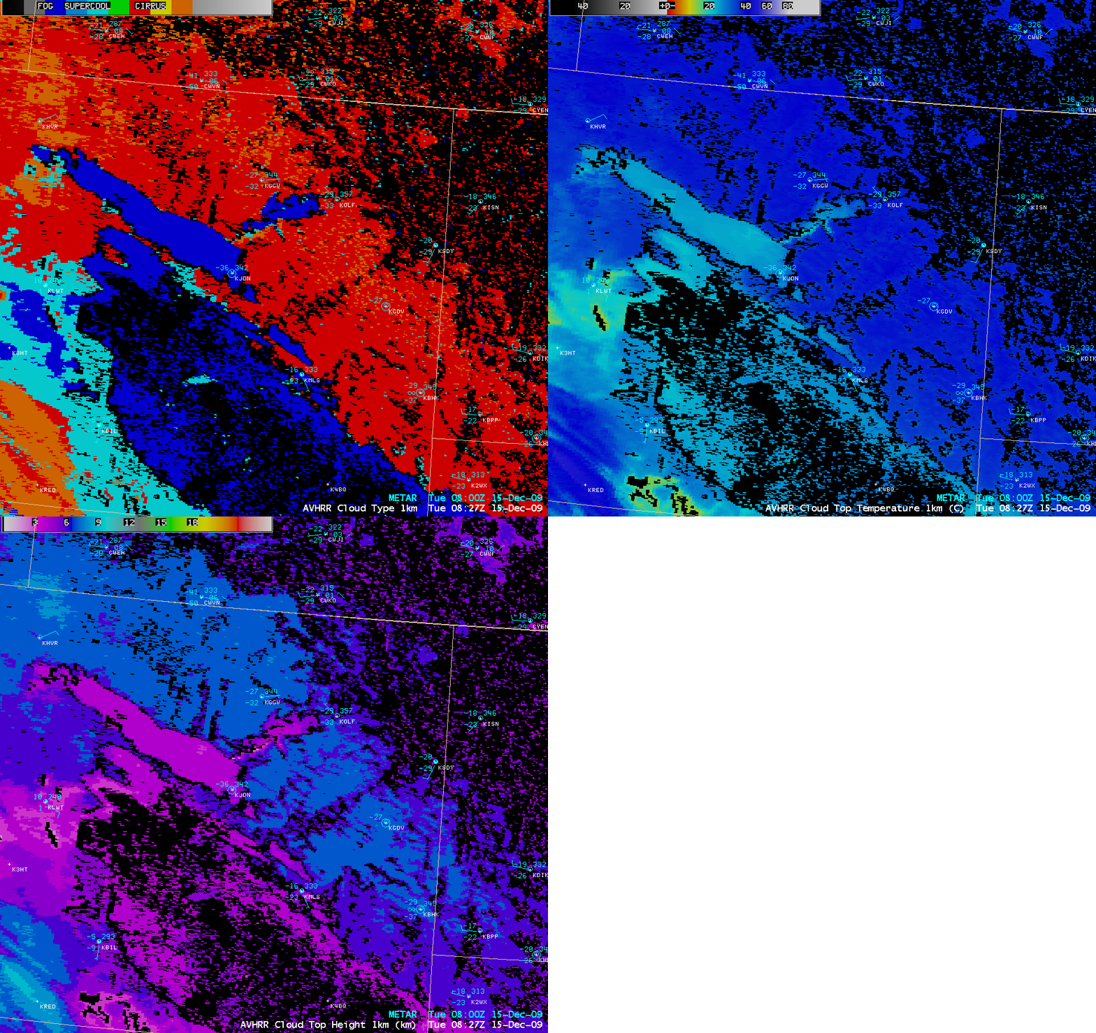
A comparison of the AVHRR Cloud Type, Cloud Top Temperature (CTT), and Cloud Top Height (CTH) products at 08:27 UTC or 2:27 am local time (below) showed that this advancing cloud deck was composed of supercooled water droplets, with CTT values near -20º C and CTH values around 3-4 km.


