Hurricane Iota in the Caribbean Sea
![GOES-16 “Red” Visible (0.64 µm), “Clean” Infrared Window (10.35 µm) and Mid-level Water Vapor (6.9 µm) images [click to play animation | MP4]](https://cimss.ssec.wisc.edu/satellite-blog/images/2020/11/201115_goes16_visible_infrared_waterVapor_Hurricane_Iota_anim.gif)
GOES-16 “Red” Visible (0.64 µm), “Clean” Infrared Window (10.35 µm) and Mid-level Water Vapor (6.9 µm) images [click to play animation | MP4]
GOES-16 Longwave Infrared (11.2 µm) images, with contours of 02 UTC deep-layer wind shear from the CIMSS Tropical Cyclones site (below)showed that the hurricane was moving through an environment of low southwesterly shear, which favored intensification.
![GOES-16 Longwave Infrared (11.2 µm) images, with contours of 19 UTC deep-layer wind shear [click to enlarge]](https://cimss.ssec.wisc.edu/satellite-blog/images/2020/11/201115_goes16_ir_shear_Iota.gif)
GOES-16 Longwave Infrared (11.2 µm) images, with contours of 19 UTC deep-layer wind shear [click to enlarge]
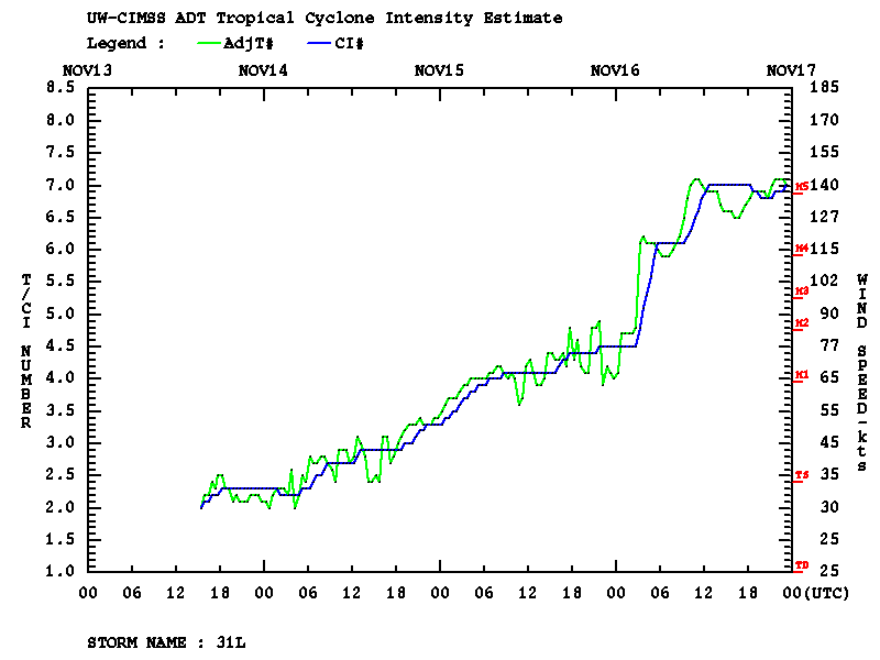
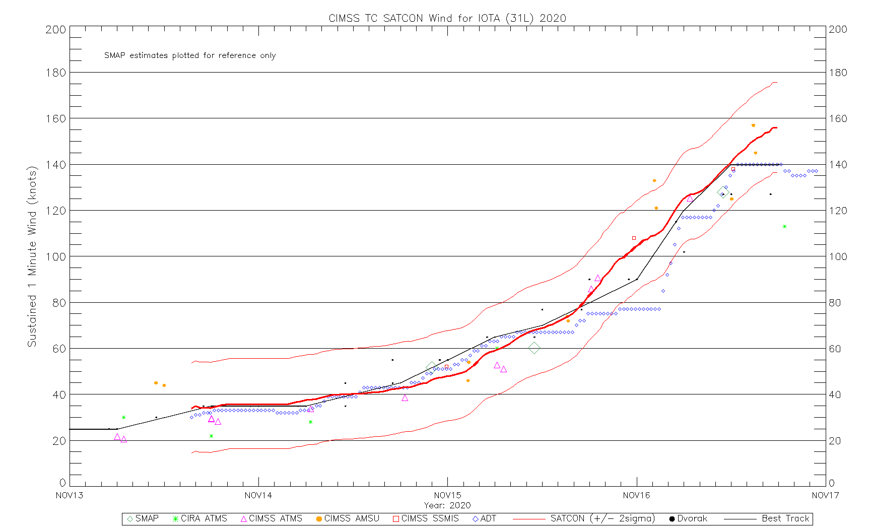
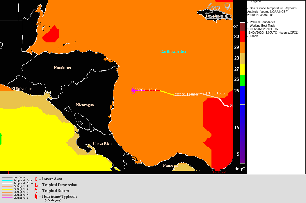
===== 16 November Update =====
![GOES-16 “Red” Visible (0.64 µm) and “Clean” Infrared Window (10.35 µm) images [click to play animation | MP4]](https://cimss.ssec.wisc.edu/satellite-blog/images/2020/11/201116_goes16_visible_infrared_Hurricane_Iota_anim.gif)
GOES-16 “Red” Visible (0.64 µm) and “Clean” Infrared Window (10.35 µm) images [click to play animation | MP4]
![GOES-16 “Clean” Infrared Window (10.35 µm) images [click to play animation | MP4]](https://cimss.ssec.wisc.edu/satellite-blog/images/2020/11/201116_goes16_infrared_Hurricane_Iota_landfall_anim.gif)
GOES-16 “Clean” Infrared Window (10.35 µm) images [click to play animation | MP4]