Atmospheric river of moisture targets Britain and Ireland
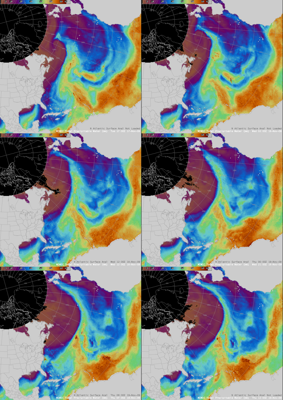
AWIPS images of the MIMIC Total Precipitable Water (TPW) product (above) revealed the formation of a long “atmospheric river” of moisture over the North Atlantic Ocean during the 17-19 November 2009 period. MIMIC TPW values were as high as 60 mm (darker orange color enhancement) within the moisture plume.
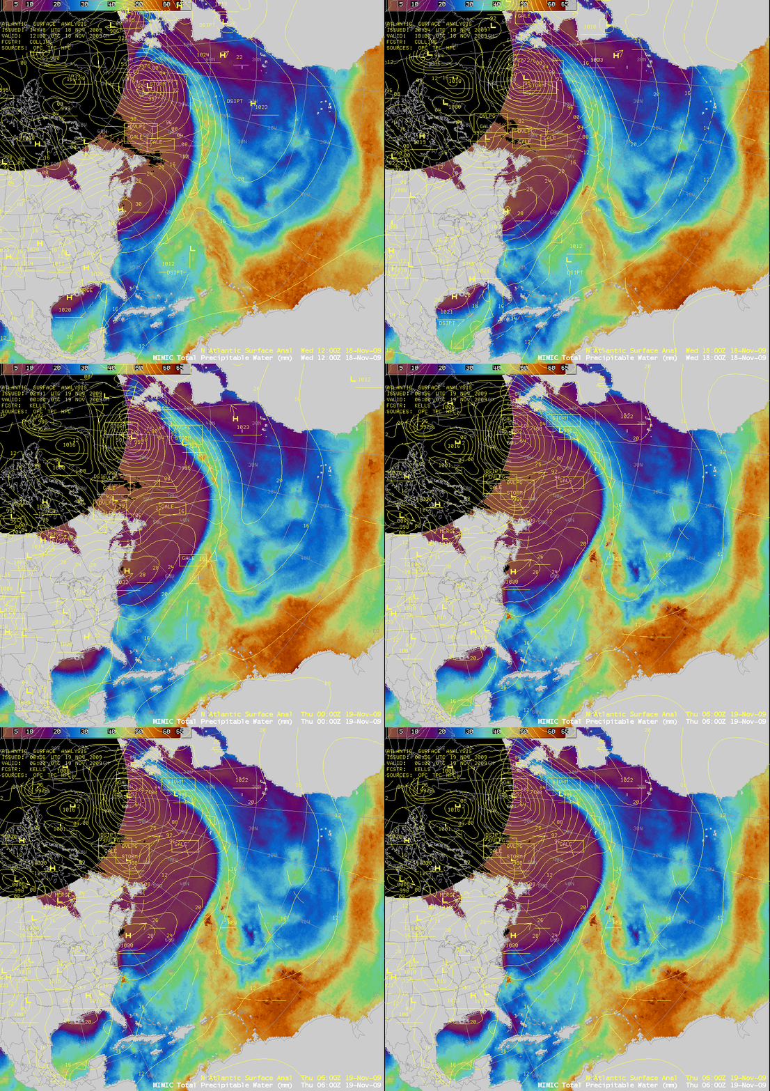
The surface analysis (below) showed that this moist plume was along and ahead of a cold front that was trailing southward from a deepening mid-latitude cyclone. This plume of moisture was contributing to very heavy rainfall and significant flooding over parts of the United Kingdom — Seathwaite reported a 24-hour rainfall amount of 12.36 inches (314 mm), which if confirmed as accurate will set a new record for 24-hour precipitation in the UK (UK Met Office).
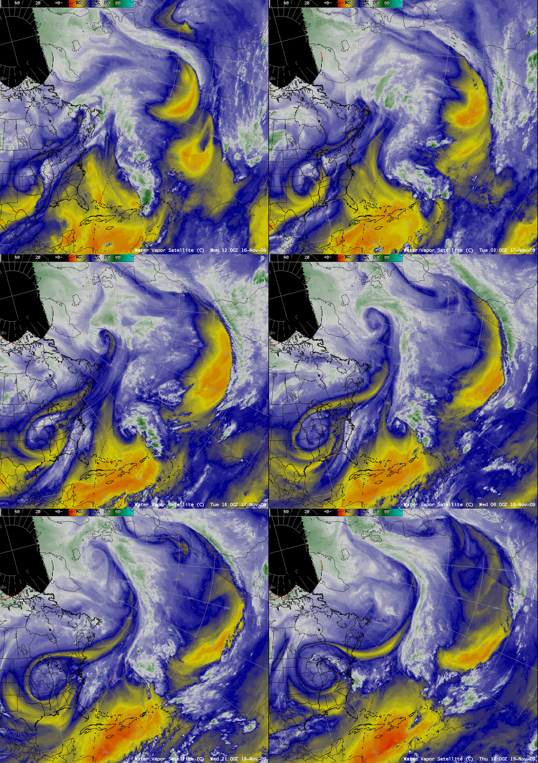
A composite of GOES-12 and Meteosat-9 water vapor imagery (below) suggested that this long atmospheric river tapped into a pocket of deep tropical moisture (associated with the remnants of what was formerly Hurricane/Tropical Storm Ida), and was then brought northward within the warm conveyor belt in advance of the deepening cyclone over the North Atlantic Ocean.
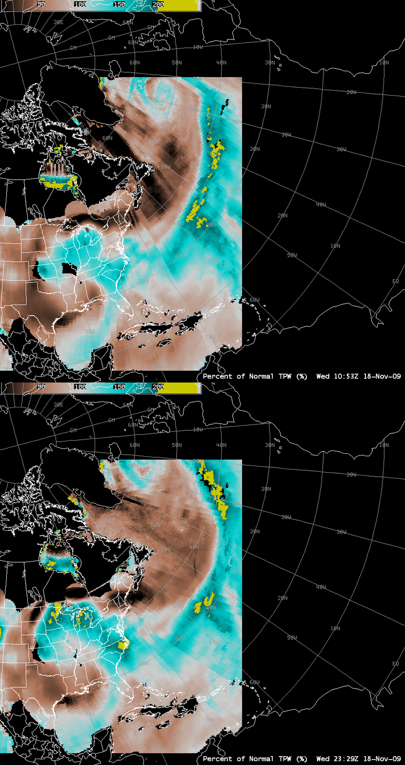
The Blended Total Precpitable Water – Percent of Normal product (below) indicated that this moist plume was rather anomalous for the season over the North Atlantic region, containing values of TPW that exceeded 200% of normal (yellow color enhancement).


