Wildfires in Montana
![GOES-17 Shortwave Infrared (3.9 µm) images, with plots of METAR surface reports and surface fronts [click to play animation | MP4]](https://cimss.ssec.wisc.edu/satellite-blog/images/2020/09/mt2-20200902_212225.png)
GOES-17 Shortwave Infrared (3.9 µm) images, with plots of METAR surface reports and surface fronts [click to play animation | MP4]
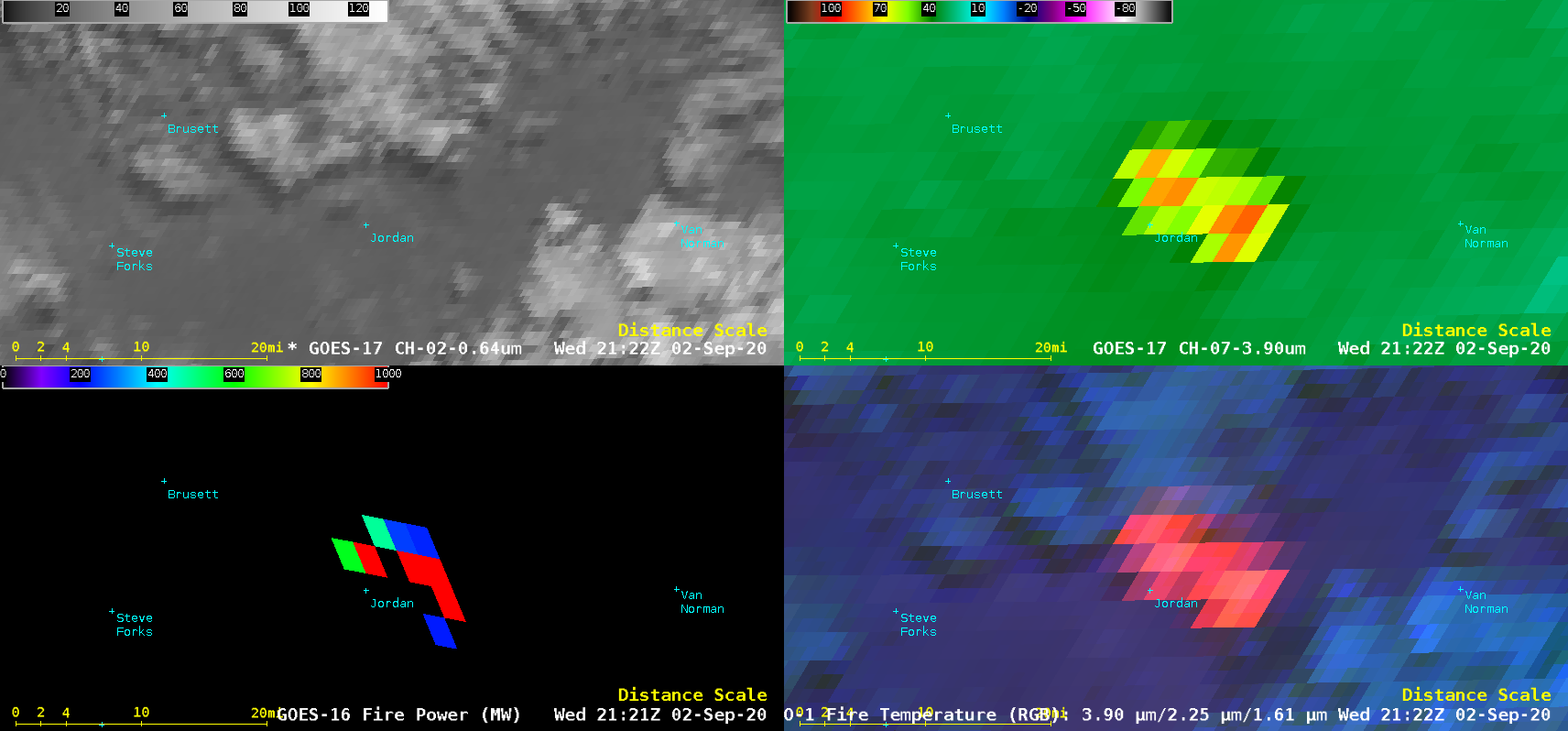
A 4-panel comparison of GOES-17 “Red” Visible (0.64 µm), GOES-17 Shortwave Infrared, GOES-16 (GOES-East) Fire Power and GOES-17 Fire Temperature Red-Green-Blue (RGB) images (below) provided a closer view of the Huff Fire — which, fanned by northwest winds gusting as high as 59 mph, made a rapid run toward the southeast and prompted an evacuation of residents in Jordan.

GOES-17 “Red” Visible (0.64 µm, top left), GOES-17 Shortwave Infrared (3.9 µm, top right), GOES-16 Fire Power (bottom left) and GOES-17 Fire Temperature RGB (bottom right) [click to play animation | MP4]


![Shortwave Infrared images from Suomi NPP (3.7 µm) and GOES-17 (3.9 µm) [click to enlarge]](https://cimss.ssec.wisc.edu/satellite-blog/images/2020/09/200902_20442utc_suomiNPP_goes17_shortwaveInfrared_Huff_Fire_MT_anim.gif)