Moderate to severe turbulence over the Midwest
![GOES-13 Water Vapor (6.7 µm) images with Pilot Reports of turbulence [click to play animation]](https://cimss.ssec.wisc.edu/satellite-blog/wp-content/uploads/sites/5/2016/03/160311_goes13_water_vapor_pireps_anim.gif)
GOES-13 Water Vapor (6.7 µm) images with Pilot Reports of turbulence [click to play animation]
The transverse banding cloud filaments showed up with a bit more clarity on a 1-km resolution Aqua MODIS Water Vapor (6.7 µm) image at 1919 UTC (below).
![Aqua MODIS Water Vapor (6.7 µm) image [click to enlarge]](https://cimss.ssec.wisc.edu/satellite-blog/wp-content/uploads/sites/5/2016/03/MODIS_WV_20160311_1919.png)
Aqua MODIS Water Vapor (6.7 µm) image [click to enlarge]
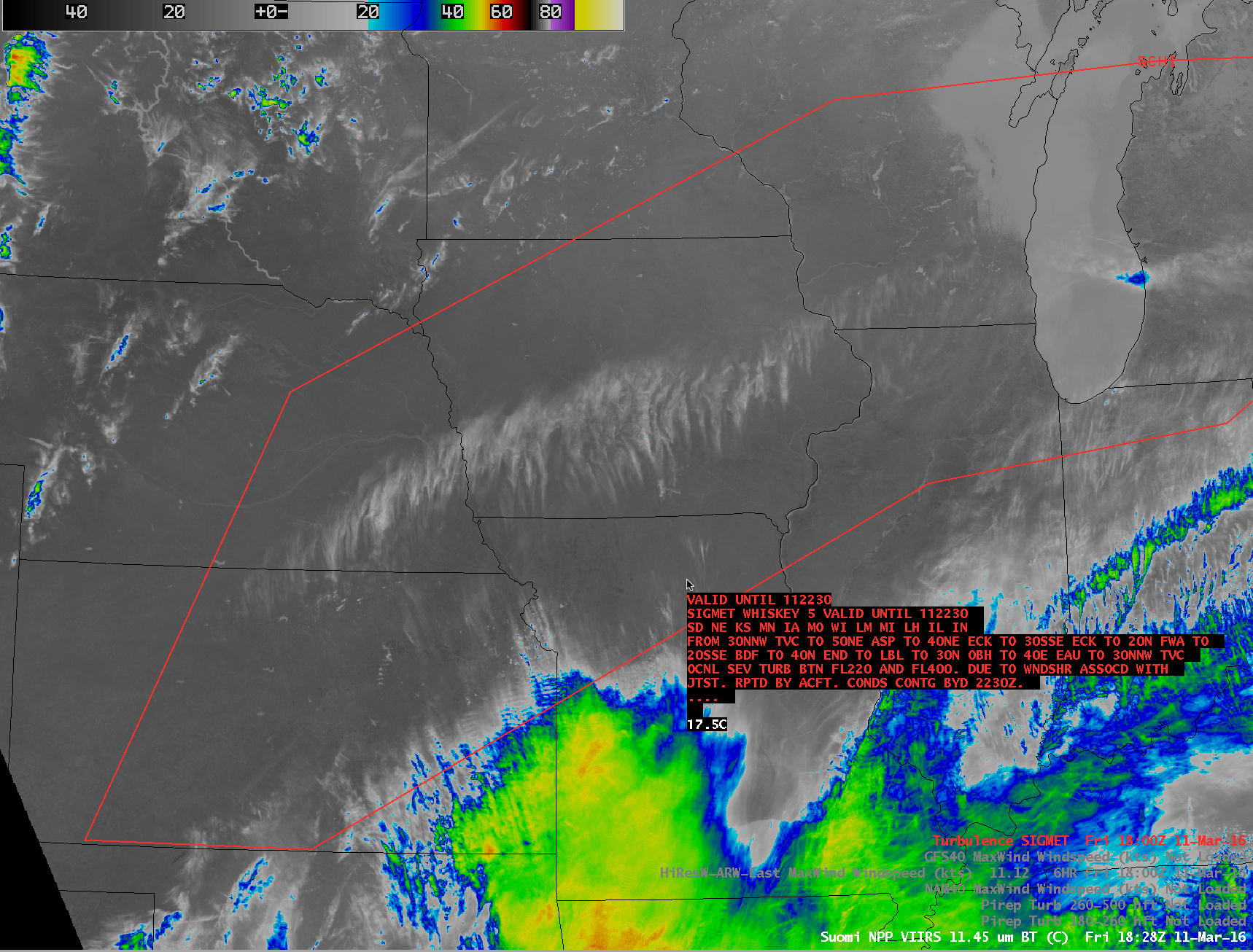
![Terra MODIS "Cirrus" (1.38 µm) image with Turbulence SIGMET, Pilot Reports of turbulence, and GFS Max Wind isotachs [click to enlarge]](https://cimss.ssec.wisc.edu/satellite-blog/wp-content/uploads/sites/5/2016/03/160311_1738utc_modis_cirrus_sigmet_pireps_gfs_maxwinds_anim.gif)
Terra MODIS “Cirrus” (1.38 µm) image with Turbulence SIGMET, Pilot Reports of turbulence, and GFS Max Wind isotachs [click to enlarge]
![Aqua MODIS Visible (0.65 µm), Infrared Window (11.0 µm), and Cirrus (1.38 µm) images, with Pilot Reports of turbulence [click to enlarge]](https://cimss.ssec.wisc.edu/satellite-blog/wp-content/uploads/sites/5/2016/03/160311_1919utc_modis_visible_infrared_cirrus_pireps_anim.gif)
Aqua MODIS Visible (0.65 µm), Infrared Window (11.0 µm), and Cirrus (1.38 µm) images, with Pilot Reports of turbulence [click to enlarge]
@CIMSS_Satellite Looks like a nasty turbulence environment today over the Midwest. Lots of urgent PIREPs & SIGMET pic.twitter.com/pc8PU5xsXf
— Scott Dennstaedt (@AvWxWorkshops) March 11, 2016