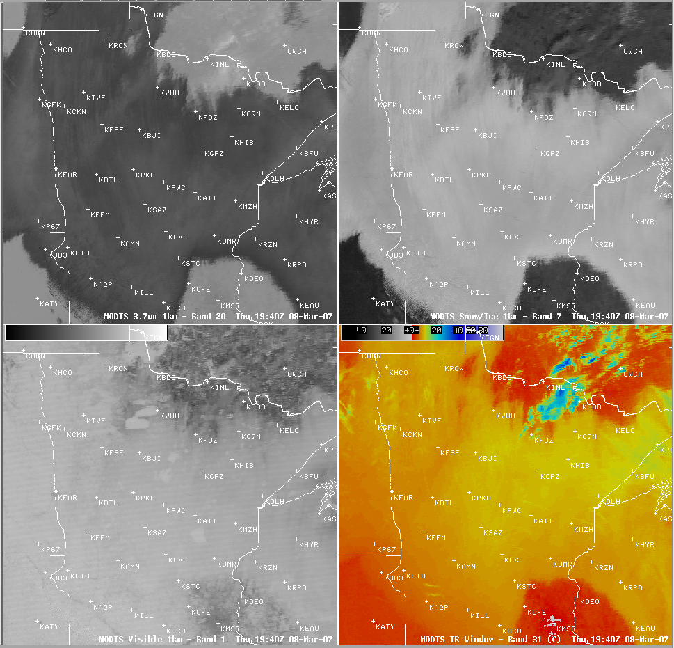
Stratus cloud deck over snow pack
An extensive deck of stratus cloud was evident across much of northern Minnesota and adjacent portions of the Dakotas and Wisconsin during the daytime hours on 08 March 2007. An AWIPS 4-panel display of MODIS imagery (above) shows how different this cloud feature appeared in the various channels. The stratus appeared much darker than the surrounding clear (but snow-covered) ground on the 3.7 µm shortwave IR (Band 20) image (above; upper left panel), due to that channel’s sensitivity to solar radiation reflected off the top of the supercooled droplet cloud layer. On the other hand, this supercooled water droplet cloud feature appeared much brighter than the dark surrounding snow-covered ground on the 2.1 µm near-IR (Band 7) image (above; upper right panel), since snow and ice are strong absorbers at that wavelength. Cloud top temperatures were fairly uniform (around -8 to -10º C) on the 11.0 µm IR Window (Band 31) image (above; lower right panel). However, it is interesting to note that this stratiform cloud deck was semi-transparent on the 0.65 µm visible (Band 1) image (above; lower left panel), allowing several of the larger frozen lakes in northern Minnesota to be seen through the cloud — the frozen lakes (and other surface features such as river valleys and ice in Lake Superior) could also be seen through the stratus cloud deck on GOES-12 visible channel imagery (Java animation).
.
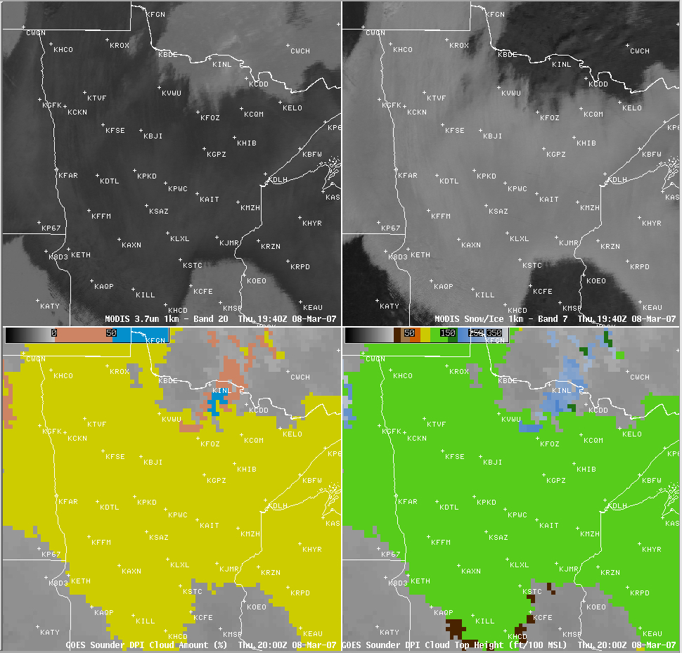
The transparency of the stratus deck was somewhat surprising given the opaque appearance on the other near-IR and IR MODIS channels, and the fact the cloud layer was apparently fairly thick: surface reports across that region indicated cloud bases between 300-800 ft above ground level, and the GOES sounder Effective Cloud Amount product (below; lower left panel) and the Cloud Top Height product (below; lower right panel) indicated overcast (100%) coverage (yellow enhancement) with cloud tops in the 11,000-13,000 ft range (green enhancement). The rawinsonde profile at Minneapolis, Minnesota at 00 UTC on 09 March (a few hours after the MODIS images) indicated that a very strong and deep temperature inversion existed within the 800-900 hPa layer, which was probably where the bulk of the stratiform cloud layer actually existed. The air was not particularly moist above the temperature inversion, but another cloud deck could also have existed near the top of the 625-800 hPa layer — such a higher cloud layer may have been responsible for the cloud top height values of 11,000-13,000 ft seen on the GOES sounder product below.


