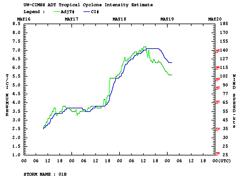
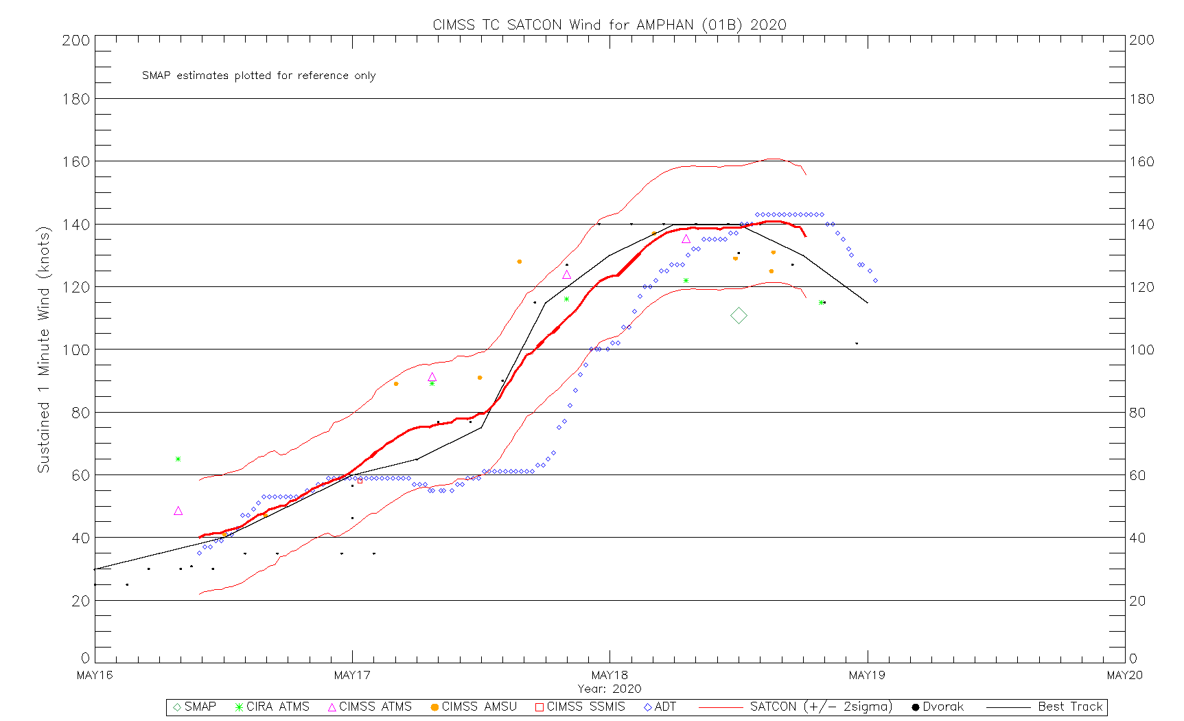
Cyclone Amphan in the Bay of Bengal
![Meteosat-8 Infrared Window (10.8 µm) images [click to play animation | MP4]](https://cimss.ssec.wisc.edu/satellite-blog/images/2020/05/200517_200518_meteosat8_infrared_Amphan_anim.gif)
Meteosat-8 Infrared Window (10.8 µm) images [click to play animation | MP4]
NOAA-20 VIIRS True Color Red-Green-Blue (RGB) and Infrared Window (11.45 µm) images as viewed using RealEarth (below) provided a more detailed view of Amphan shortly before the time of its peak intensity.
![NOAA-20 VIIRS True Color RGB and Infrared Window (11.45 µm) images [click to enlarge]](https://cimss.ssec.wisc.edu/satellite-blog/images/2020/05/200518_07utc_noaa20_viirs_trueColorRGB_infraredWindow_Cyclone_Amphan_anim.gif)
NOAA-20 VIIRS True Color RGB and Infrared Window (11.45 µm) images [click to enlarge]
![Suomi NPP VIIRS Day/Night Band (0.7 µm) and Infrared Window (11.45 µm) images [click to enlarge]](https://cimss.ssec.wisc.edu/satellite-blog/images/2020/05/200518_1938utc_suomiNPP_viirs_dayNightBand_infraredWindow_Cyclone_Amphan_anim.gif)
Suomi NPP VIIRS Day/Night Band (0.7 µm) and Infrared Window (11.45 µm) images (credit: William Straka, CIMSS) [click to enlarge]
![NOAA-20 VIIRS Day/Night Band (0.7 µm) and Infrared Window (11.45 µm) images (credit: William Straka, CIMSS) [click to enlarge]](https://cimss.ssec.wisc.edu/satellite-blog/images/2020/05/200518_2028utc_noaa20_viirs_dayNightBand_infraredWindow_Cyclone_Amphan_anim.gif)
NOAA-20 VIIRS Day/Night Band (0.7 µm) and Infrared Window (11.45 µm) images (credit: William Straka, CIMSS) [click to enlarge]