Typhoon Vongfong makes landfall in the Philippines

Himawari-8 “Clean” Infrared Window (10.4 µm) images [click to play animation | MP4]
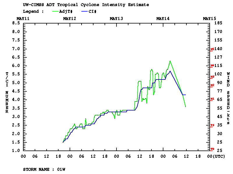
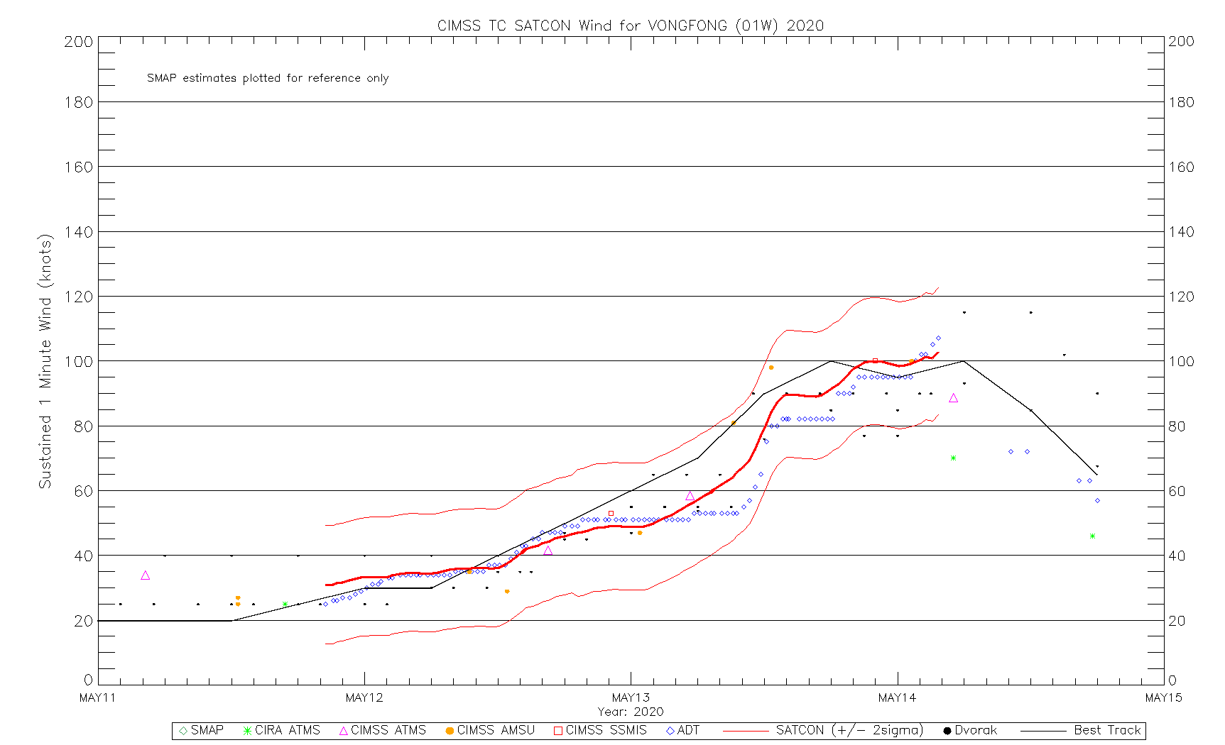
A toggle between NOAA-20 VIIRS Day/Night Band (0.7 µm) and Infrared Window (11.45 µm) images (below) offered a nighttime view of Vongfong at 1703 UTC on 13 May. There was ample illumination from the Moon (in the Waning Gibbous phase, at 61% of Full) to provide a detailed Day/Night Band image of the tropical cyclone when it was at Category 2 intensity.
![NOAA-20 Day/Night Band (0.7 µm) and Infrared Window (11.45 µm) images (credit: William Straka, CIMSS) [click to enlarge]](https://cimss.ssec.wisc.edu/satellite-blog/images/2020/05/200513_1703utc_noaa20_viirs_dayNightBand_infraredWindow_Typhoon_Vongfong_anim.gif)
NOAA-20 VIIRS Day/Night Band (0.7 µm) and Infrared Window (11.45 µm) images (credit: William Straka, CIMSS) [click to enlarge]
![Suomi NPP VIIRS True Color RGB and Infrared Window (11.45 µm) images [click to enlarge]](https://cimss.ssec.wisc.edu/satellite-blog/images/2020/05/200514_04utc_suomiNPP_viirs_trueColorRGB_infrared_Vongfong_anim.gif)
Suomi NPP VIIRS True Color RGB and Infrared Window (11.45 µm) images [click to enlarge]