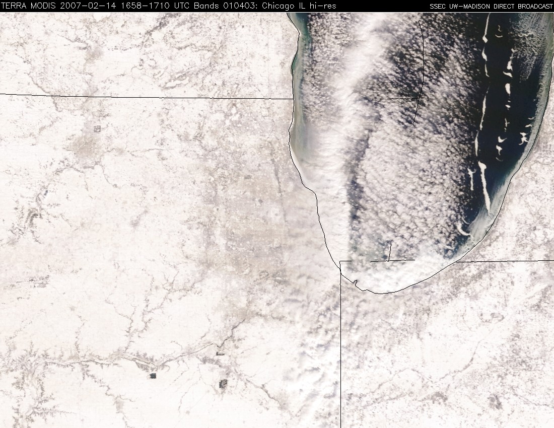
“Ice Floes” in Lake Michigan
GOES-12 visible imagery (above; Java animation) revealed several large “ice floes” that were moving rapidly southwestward across southern Lake Michigan on 14 February 2007. Strong northeasterly winds associated with an intense winter storm in the northeastern US were likely breaking large pieces of “fast ice” from the Michigan shore and causing them to drift toward the southern end of Lake Michigan. A well-defined cloud band can also be seen to the west of the ice floes — this feature produced 1-3 inches of lake-effect snowfall as it moved inland across northeastern Illinois and northwestern Indiana. 250-meter resolution MODIS true color imagery (below; Java animation) shows these ice features with better clarity than the 1-km resolution GOES-12 imagery.


