Another round of severe weather in the Deep South
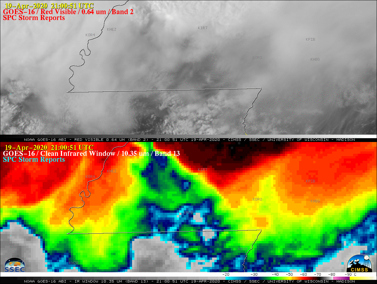
GOES-16 “Red” Visible (0.64 µm, top) and “Clean” Infrared Window (10.35 µm, bottom), with plots of SPC Storm Reports [click to play animation | MP4]
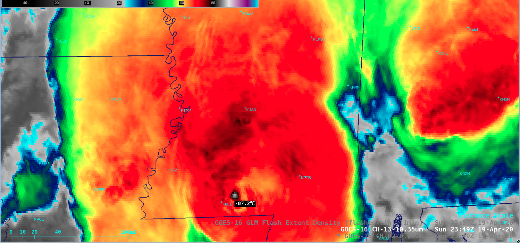
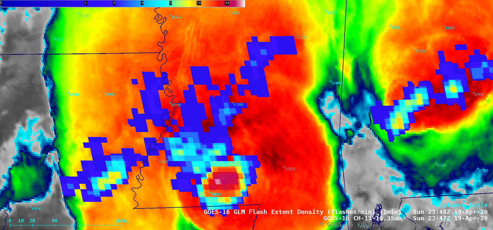
Focusing on the 10-minute period 2340-2350 UTC, a sequence of GOES-16 Visible, Infrared and GLM Flash Extent Density (below) revealed a well-defined overshooting top turret which exhibited a minimum infrared brightness temperature of -87.2ºC at 2349 UTC — and a lightning jump where the FED increased to 44 flashes per minute at 2348 UTC. The long-track tornado began about 20 minutes later, at 0010 UTC on 20 April.
![GOES-16 "Red" Visible (0.64 µm), "Clean" Infrared Window (10.35 µm) and GLM Flash Extent Density [click to play animation | MP4]](https://cimss.ssec.wisc.edu/satellite-blog/images/2020/04/200419_goes16_visible_infrared_glmFlashExtentDensity_MS_OT_anim.gif)
GOES-16 “Red” Visible (0.64 µm), “Clean” Infrared Window (10.35 µm) and GLM Flash Extent Density [click to play animation | MP4]
Corrected graphic with the correct path length. pic.twitter.com/JoSZPdYHe9
— NWS Jackson MS (@NWSJacksonMS) April 21, 2020