Easy Fire in Southern California
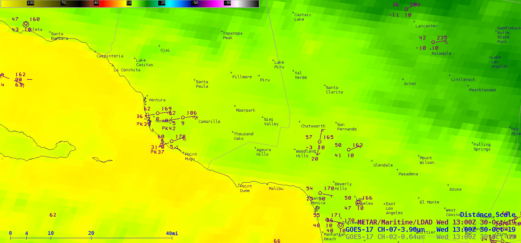
![GOES-17 Shortwave Infrared (3.9 µm) and “Red” Visible (0.64 µm) images [click to play animation | MP4]](https://cimss.ssec.wisc.edu/satellite-blog/wp-content/uploads/sites/5/2019/10/191030_goes17_visible_shortwaveInfrared_SoCal_fires_anim.gif)
GOES-17 Shortwave Infrared (3.9 µm) and “Red” Visible (0.64 µm) images [click to play animation | MP4]
A comparison of 3 consecutive VIIRS Shortwave Infrared (3.74 µm) images from Suomi NPP and NOAA-20 with the corresponding GOES-17 Shortwave Infrared (3.9 µm) images (below) demonstrated the advantage of polar orbiter imagery for providing a more accurate depiction of the size and location of a fire. Note: the color enhancements are different for the Suomi NPP/NOAA-20 vs GOES-17 images, since there are differences between shortwave infrared detectors on the VIIRS and ABI instruments.
![3.74 µm Shortwave Infrared images from Suomi NPP and NOAA-20 compared with the corresponding GOES-17 3.9 µm images [click to enlarge]](https://cimss.ssec.wisc.edu/satellite-blog/wp-content/uploads/sites/5/2019/10/191030_viirs_goes17_shotwaveInfrared_Easy_Fire_CA_anim.gif)
3.74 µm Shortwave Infrared images from Suomi NPP and NOAA-20 compared with the corresponding GOES-17 3.9 µm images [click to enlarge]