Smoke plumes from Saudi Arabian oil facilities
![VIIRS Day/Night Band (0.7 µm) and Visible (0.64 µm) imagery from Suomi NPP and NOAA-20 [click to enlarge]](https://cimss.ssec.wisc.edu/satellite-blog/wp-content/uploads/sites/5/2019/09/190913-190915_suomiNPP_noaa20_viirs_Saudi_Arabia_anim.gif)
VIIRS Day/Night Band (0.7 µm) and Visible (0.64 µm) images from Suomi NPP and NOAA-20 (courtesy of William Straka, CIMSS) [click to enlarge]
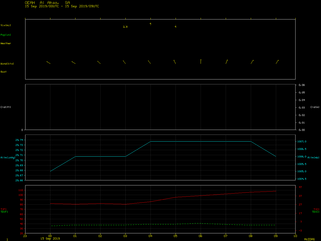
EUMETSAT Meteosat-8 Visible (0.8 µm) images (below) showed the south-southwestward transport of the smoke plumes. Thick smoke drifted over Al Ahsa (OEAH), and at one point restricted to 2.8 miles.
![EUMETSAT Meteosat-8 Visible (0.8 µm) images, with hourly plots of surface reports [click to play animation | MP4]](https://cimss.ssec.wisc.edu/satellite-blog/wp-content/uploads/sites/5/2019/09/190914_meteosat8_visible_Saudi_Arabia_anim.gif)
EUMETSAT Meteosat-8 Visible (0.8 µm) images, with hourly plots of surface reports [click to play animation | MP4]
![True Color RGB images from Terra MODIS and Suomi NPP VIIRS, from 13-15 September [click to enlarge]](https://cimss.ssec.wisc.edu/satellite-blog/wp-content/uploads/sites/5/2019/09/190913_190915_modis_viirs_trueColor_Saudi_Arabia_refinery_fires_anim.gif)
True Color RGB images from Terra MODIS and Suomi NPP VIIRS, from 13-15 September [click to enlarge]
![VIIRS Day/Night Band (0.7 µm) from Suomi NPP and NOAA-20 [click to enlarge]](https://cimss.ssec.wisc.edu/satellite-blog/wp-content/uploads/sites/5/2019/09/190915_suomiNPP_noaa20_viirs_dayNightBand_Saudi_Arabia_refinery_fires_anim.gif)
VIIRS Day/Night Band (0.7 µm) from Suomi NPP and NOAA-20 (courtesy of William Straka, CIMSS) [click to enlarge]
![EUMETSAT Meteosat-8 Visible (0.8 µm) images, with hourly plots of surface reports [click to play animation | MP4]](https://cimss.ssec.wisc.edu/satellite-blog/wp-content/uploads/sites/5/2019/09/190914_190916_meteosat8_visible_Saudi_Arabia_anim.gif)
EUMETSAT Meteosat-8 Visible (0.8 µm) images with hourly plots of surface reports, 14-16 September [click to play animation | MP4]
===== 17 September Update =====
![Landsat-8 False Color image [click to enlarge]](https://cimss.ssec.wisc.edu/satellite-blog/wp-content/uploads/sites/5/2019/09/190917_0712utc_landsat8_falsecolor_Saudi_Arabia_anim.gif)
Landsat-8 False Color RGB image [click to enlarge]