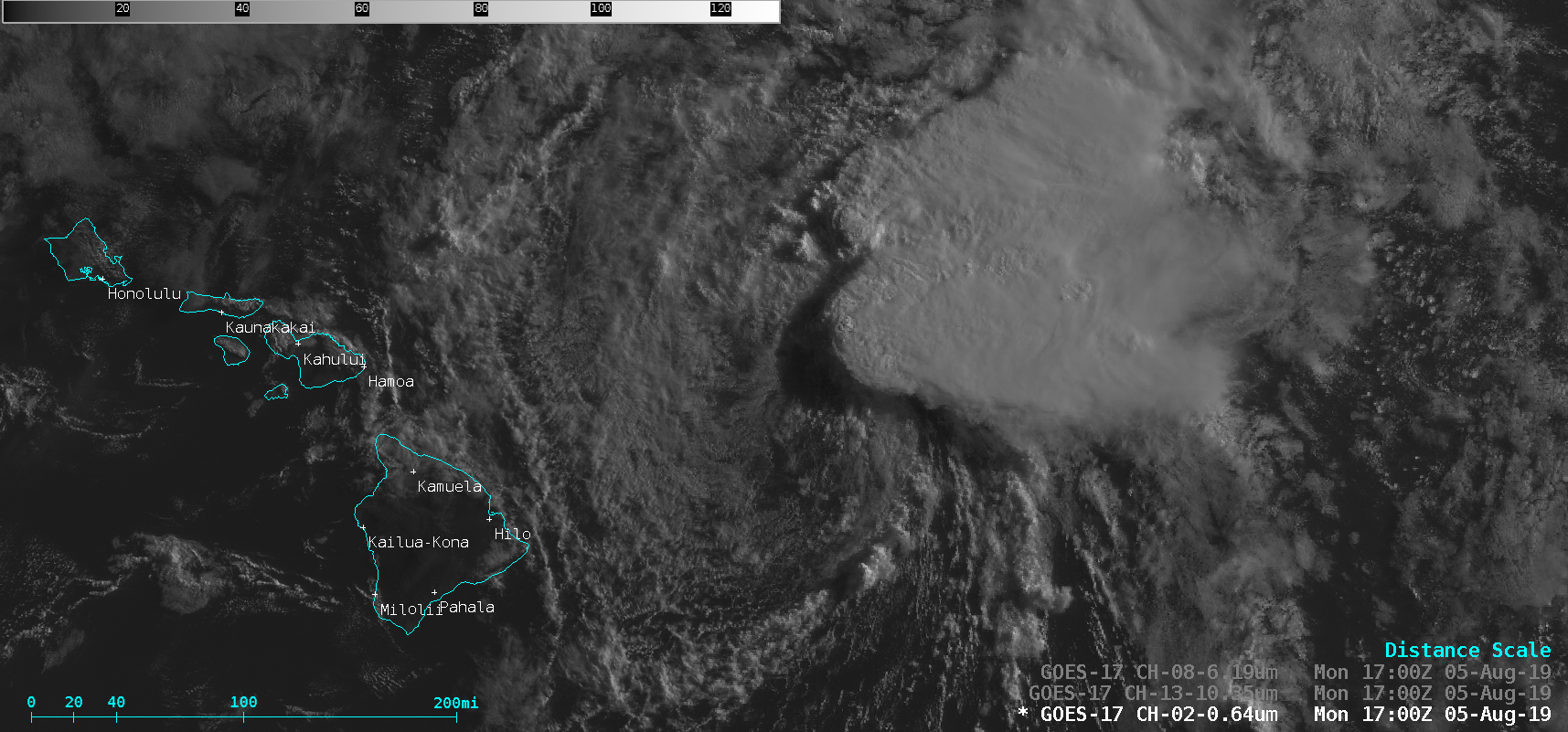
Tropical Depression Flossie near Hawai’i

GOES-17 “Red” Visible (0.64 µm), “Clean” Infrared Window (10.35 µm) and Upper-level Water Vapor (6.2 µm) images [click to play animation | MP4]
GOES-15 Infrared imagery and deep-layer wind shear data from the CIMSS Tropical Cyclones site (below) showed that the tropical cyclone was in an environment of strong shear, which was responsible for the displacement between the exposed LLCC and the convection. In addition to the wind shear, the weakening trend of the system was also due to its motion over cold Sea Surface Temperatures and low Ocean Heat Content.


![GOES-15 Infrared Window (10.7 µm) images, with contours and streamlines of deep-layer wind shear [click to enlarge]](https://cimss.ssec.wisc.edu/satellite-blog/wp-content/uploads/sites/5/2019/08/190805_goes15_infrared_deepLayerShear_TD_Flossie_anim.gif)